 |
|
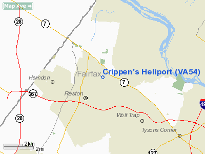
Location & QuickFacts
| FAA Information Effective: | 2008-09-25 |
| Airport Identifier: | VA54 |
| Airport Status: | Operational |
| Longitude/Latitude: | 077-19-35.9420W/38-58-34.3960N
-77.326651/38.976221 (Estimated) |
| Elevation: | 350 ft / 106.68 m (Estimated) |
| Land: | 0 acres |
| From nearest city: | 1 nautical miles NE of Reston, VA |
| Location: | Fairfax County, VA |
| Magnetic Variation: | 10W (1985) |
Owner & Manager
| Ownership: | Privately owned |
| Owner: | S.l. Cripper |
| Address: | 11395 Seneca View Way
Great Falls, VA 22066 |
| Phone number: | 703-430-9555 |
| Manager: | Tom Schaaf, Jr |
| Address: |
|
Airport Operations and Facilities
| Airport Use: | Private |
| Wind indicator: | Yes |
| Segmented Circle: | No |
| Control Tower: | No |
| Sectional chart: | Washington |
| Region: | AEA - Eastern |
| Boundary ARTCC: | ZDC - Washington |
| Tie-in FSS: | DCA - Leesburg |
| FSS Toll Free: | 1-800-WX-BRIEF |
Runway Information
Helipad H1
| Dimension: | 100 x 20 ft / 30.5 x 6.1 m |
| Surface: | CONC, |
| |
Runway H1 |
Runway |
| Traffic Pattern: | Left | Left |
|
Radio Navigation Aids
| ID |
Type |
Name |
Ch |
Freq |
Var |
Dist |
| GTN | NDB | Georgetown | | 323.00 | 09W | 9.9 nm |
| GAI | NDB | Gaithersburg | | 385.00 | 09W | 13.8 nm |
| DC | NDB | Oxonn | | 332.00 | 11W | 18.9 nm |
| VKX | NDB | Potomac | | 241.00 | 10W | 22.1 nm |
| GDX | NDB | Goodwin Lake | | 227.00 | 08W | 23.6 nm |
| BUH | NDB | Anne Arundel | | 260.00 | 10W | 27.2 nm |
| FND | NDB | Ellicott | | 371.00 | 11W | 31.7 nm |
| TZ | NDB | Cogan | | 364.00 | 10W | 35.3 nm |
| CJR | NDB | Culpeper | | 252.00 | 09W | 36.6 nm |
| IUB | NDB | Institute | | 404.00 | 08W | 37.7 nm |
| MSQ | NDB | Nailr | | 351.00 | 10W | 41.5 nm |
| EZF | NDB | Shannon | | 237.00 | 10W | 43.1 nm |
| MTN | NDB | Martin | | 342.00 | 11W | 48.2 nm |
| MTN | TACAN | Martin | 068X | | 11W | 47.7 nm |
| FDK | VOR | Frederick | | 109.00 | 08W | 26.3 nm |
| HGR | VOR | Hagerstown | | 109.80 | 07W | 49.9 nm |
| DCA | VOR/DME | Washington | 047X | 111.00 | 09W | 15.3 nm |
| AML | VORTAC | Armel | 082X | 113.50 | 08W | 7.0 nm |
| ADW | VORTAC | Andrews | 078X | 113.10 | 10W | 23.8 nm |
| OTT | VORTAC | Nottingham | 084X | 113.70 | 10W | 31.7 nm |
| CSN | VORTAC | Casanova | 110X | 116.30 | 06W | 32.3 nm |
| BAL | VORTAC | Baltimore | 098X | 115.10 | 11W | 33.2 nm |
| MRB | VORTAC | Martinsburg | 058X | 112.10 | 07W | 34.6 nm |
| EMI | VORTAC | Westminster | 126X | 117.90 | 08W | 35.1 nm |
| BRV | VORTAC | Brooke | 092X | 114.50 | 09W | 38.5 nm |
| LDN | VORTAC | Linden | 090X | 114.30 | 06W | 41.8 nm |
| DCA | VOT | Washington National | | 109.40 | | 15.8 nm |
| ADW | VOT | Andrews Afb | | 109.60 | | 23.8 nm |
Remarks
- PRVDD VFR USE ONLY; PRIOR TO COMMENCING OPNS; CTC DULLES ATCT MGR TO SEE IF YOU REQUIRE A LTR OF AGREEMENT AND SPECIAL COMMUNICATIONS AND EQUIPMENT.
Images and information placed above are from
http://www.airport-data.com/airport/VA54/
We thank them for the data!
| General Info
|
| Country |
United States
|
| State |
VIRGINIA
|
| FAA ID |
VA54
|
| Latitude |
38-58-34.396N
|
| Longitude |
077-19-35.942W
|
| Elevation |
350 feet
|
| Near City |
RESTON
|
We don't guarantee the information is fresh and accurate. The data may
be wrong or outdated.
For more up-to-date information please refer to other sources.
|
|


