 |
|
Location & QuickFacts
| FAA Information Effective: | 2008-09-25 |
| Airport Identifier: | W81 |
| Airport Status: | Operational |
| Longitude/Latitude: | 078-05-54.0010W/37-10-51.5450N
-78.098334/37.180985 (Estimated) |
| Elevation: | 420 ft / 128.02 m (Surveyed) |
| Land: | 97 acres |
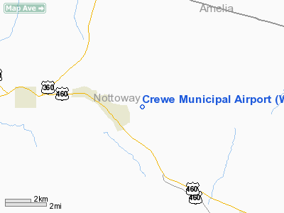
| From nearest city: | 1 nautical miles E of Crewe, VA |
| Location: | Nottoway County, VA |
| Magnetic Variation: | 08W (1985) |
Owner & Manager
| Ownership: | Publicly owned |
| Owner: | Town Of Crewe |
| Address: | 125 E Carolina Ave
Crewe, VA 23930 |
| Phone number: | 434-645-9453 |
| Manager: | W. Wade Walker |
| Address: | 125 E Carolina Ave
Crewe, VA 23930 |
| Phone number: | 434-645-1191
OR 434-645-9003. |
Airport Operations and Facilities
| Airport Use: | Open to public |
| Wind indicator: | Yes |
| Segmented Circle: | No |
| Control Tower: | No |
| Lighting Schedule: | DUSK-DAWN
FOR MIRL RY 15/33 KEY CTAF 5 TIMES ON; 3 TIMES OFF. |
| Beacon Color: | Clear-Green (lighted land airport) |
| Landing fee charge: | No |
| Sectional chart: | Washington |
| Region: | AEA - Eastern |
| Boundary ARTCC: | ZDC - Washington |
| Tie-in FSS: | DCA - Leesburg |
| FSS on Airport: | No |
| FSS Toll Free: | 1-800-WX-BRIEF |
| NOTAMs Facility: | DCA (NOTAM-d service avaliable) |
Airport Communications
| CTAF: | 122.800 |
| Unicom: | 122.800 |
Airport Services
| Fuel available: | 100LL |
| Airframe Repair: | MINOR
FOR AIRFRAME & PWR PLANT RPRS CALL 804-645-9393. |
| Power Plant Repair: | MINOR |
| Bottled Oxygen: | NONE |
| Bulk Oxygen: | NONE |
Runway Information
Runway 15/33
| Dimension: | 3300 x 60 ft / 1005.8 x 18.3 m |
| Surface: | ASPH, Good Condition |
| Weight Limit: | Single wheel: 12000 lbs. |
| Edge Lights: | Medium |
| |
Runway 15 |
Runway 33 |
| Traffic Pattern: | Left | Left |
| Markings: | Basic, Good Condition | Basic, Good Condition |
| Crossing Height: | 17.00 ft | 8.00 ft |
| Displaced threshold: | 87.00 ft | 0.00 ft |
| VASI: | system of panels on left side that may or may not be lighted
NOT LIGHTED. PNIL'S UNAVAILABLE AT NIGHT. | system of panels on left side that may or may not be lighted
NOT LIGHTED. PNIL'S UNAVAILABLE AT NIGHT. |
| Visual Glide Angle: | 5.00° | 3.00° |
| Obstruction: | 5 ft gnd, 200.0 ft from runway, 125 ft right of centerline
APCH RATIO 15:1 TO DSPLCD THLD.
RISING GROUND OFF THE END OF RY 15. | 85 ft tree, 2846.0 ft from runway, 50 ft right of centerline, 31:1 slope to clear |
|
Radio Navigation Aids
| ID |
Type |
Name |
Ch |
Freq |
Var |
Dist |
| BKT | NDB | Blackstone | | 326.00 | 09W | 4.1 nm |
| FVX | NDB | Farmville | | 367.00 | 07W | 19.3 nm |
| PTB | NDB | Petersburg | | 284.00 | 08W | 25.3 nm |
| MBV | NDB | Mecklenburg/dcmsnd | | 356.00 | 08W | 29.4 nm |
| CF | NDB | Pubbs | | 392.00 | 09W | 32.2 nm |
| AEA | NDB | Jones | | 373.00 | 09W | 34.1 nm |
| LJK | NDB | Ashey | | 280.00 | 09W | 46.2 nm |
| ELQ | NDB | Emporia | | 261.00 | 10W | 46.8 nm |
| RZZ | NDB | Rapids | | 407.00 | 08W | 48.3 nm |
| LVL | VORTAC | Lawrenceville | 076X | 112.90 | 08W | 23.7 nm |
| FAK | VORTAC | Flat Rock | 080X | 113.30 | 06W | 24.6 nm |
| RIC | VORTAC | Richmond | 088X | 114.10 | 09W | 41.9 nm |
| HPW | VORTAC | Hopewell | 057X | 112.00 | 06W | 47.8 nm |
Images and information placed above are from
http://www.airport-data.com/airport/W81/
We thank them for the data!
| General Info
|
| Country |
United States
|
| State |
VIRGINIA
|
| FAA ID |
W81
|
| Latitude |
37-10-51.545N
|
| Longitude |
078-05-54.001W
|
| Elevation |
420 feet
|
| Near City |
CREWE
|
We don't guarantee the information is fresh and accurate. The data may
be wrong or outdated.
For more up-to-date information please refer to other sources.
|
|


