 |
|
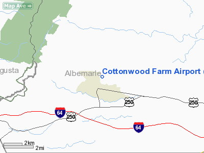
Location & QuickFacts
| FAA Information Effective: | 2008-09-25 |
| Airport Identifier: | 87VA |
| Airport Status: | Operational |
| Longitude/Latitude: | 078-41-44.0000W/38-04-52.0000N
-78.695556/38.081111 (Estimated) |
| Elevation: | 690 ft / 210.31 m (Estimated) |
| Land: | 40 acres |
| From nearest city: | 1 nautical miles N of Crozet, VA |
| Location: | Albemarle County, VA |
| Magnetic Variation: | 08W (1990) |
Owner & Manager
| Ownership: | Privately owned |
| Owner: | Emil J Kutilek |
| Address: | 5691 Cottonwood Farm
Crozet, VA 22932 |
| Phone number: | 434-823-5055 |
| Manager: | Emil J Kutilek |
| Address: | 5691 Cottonwood Farm
Crozet, VA 22932 |
| Phone number: | 434-823-5055 |
Airport Operations and Facilities
| Airport Use: | Private |
| Wind indicator: | Yes |
| Segmented Circle: | No |
| Control Tower: | No |
| Sectional chart: | Washington |
| Region: | AEA - Eastern |
| Boundary ARTCC: | ZDC - Washington |
| Tie-in FSS: | DCA - Leesburg |
| FSS on Airport: | No |
| FSS Toll Free: | 1-800-WX-BRIEF |
Runway Information
Runway 15/33
| Dimension: | 1000 x 50 ft / 304.8 x 15.2 m |
| Surface: | TURF, |
| |
Runway 15 |
Runway 33 |
| Traffic Pattern: | Left | Left |
| Obstruction: | 20 ft pline, 50.0 ft from runway | |
|
Radio Navigation Aids
| ID |
Type |
Name |
Ch |
Freq |
Var |
Dist |
| AZS | NDB | Azalea Park | | 336.00 | 08W | 9.4 nm |
| VBW | NDB | Bridgewater | | 241.00 | 07W | 21.2 nm |
| LUA | NDB | Caverns | | 245.00 | 09W | 38.6 nm |
| IQK | NDB | Louisa | | 382.00 | 09W | 39.8 nm |
| MSQ | NDB | Nailr | | 351.00 | 10W | 43.5 nm |
| FVX | NDB | Farmville | | 367.00 | 07W | 45.4 nm |
| CJR | NDB | Culpeper | | 252.00 | 09W | 47.9 nm |
| MOL | VOR/DME | Montebello | 100X | 115.30 | 05W | 22.3 nm |
| GVE | VORTAC | Gordonsville | 103X | 115.60 | 06W | 26.0 nm |
Remarks
- PROVIDED 30-40 FT TREES EACH SIDE OF RY ARE REMOVED; DAYLIGHT OPERATIONS ONLY; NO IFR OPERATIONS CONDUCTED; ALLTRAFFIC PATTERNS NE SIDE OF ARPT; TAKEOFFS TO SE ONLY & LANDINGS NW ONLY; & ONLY CLASS/AIRCRAFT USE ARPT.
Images and information placed above are from
http://www.airport-data.com/airport/87VA/
We thank them for the data!
| General Info
|
| Country |
United States
|
| State |
VIRGINIA
|
| FAA ID |
87VA
|
| Latitude |
38-04-52.000N
|
| Longitude |
078-41-44.000W
|
| Elevation |
690 feet
|
| Near City |
CROZET
|
We don't guarantee the information is fresh and accurate. The data may
be wrong or outdated.
For more up-to-date information please refer to other sources.
|
|


