 |
|
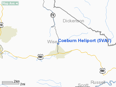
Location & QuickFacts
| FAA Information Effective: | 2008-09-25 |
| Airport Identifier: | 5VA7 |
| Airport Status: | Operational |
| Longitude/Latitude: | 082-28-12.5450W/36-57-35.3700N
-82.470151/36.959825 (Estimated) |
| Elevation: | 2010 ft / 612.65 m (Estimated) |
| Land: | 0 acres |
| From nearest city: | 2 nautical miles N of Coeburn, VA |
| Location: | Wise County, VA |
| Magnetic Variation: | 04W (1985) |
Owner & Manager
| Ownership: | Privately owned |
| Owner: | Virginia Iron Coal & Coke Co. |
| Address: | Po Box Drawer C
Coeburn, VA 24230 |
| Phone number: | 703-395-3316 |
| Manager: | Rod Poindextor |
| Address: | Po Box Drawer C
Coeburn, VA 24230 |
| Phone number: | 703-395-3316 |
Airport Operations and Facilities
| Airport Use: | Private |
| Wind indicator: | Yes |
| Segmented Circle: | No |
| Control Tower: | No |
| Lighting Schedule: | NONE |
| Landing fee charge: | No |
| Sectional chart: | Cincinnati |
| Region: | AEA - Eastern |
| Boundary ARTCC: | ZID - Indianapolis |
| Tie-in FSS: | DCA - Leesburg |
| FSS on Airport: | No |
| FSS Toll Free: | 1-800-WX-BRIEF |
Runway Information
Helipad H1
| Dimension: | 20 x 20 ft / 6.1 x 6.1 m |
| Surface: | CONC, |
| |
Runway H1 |
Runway |
| Traffic Pattern: | Left | Left |
|
Radio Navigation Aids
| ID |
Type |
Name |
Ch |
Freq |
Var |
Dist |
| VJ | NDB | Whine | | 236.00 | 05W | 28.5 nm |
| LQV | NDB | Long Hollow | | 252.00 | 03W | 32.8 nm |
| BO | NDB | Booie | | 221.00 | 04W | 33.8 nm |
| RVN | NDB | Rogersville | | 329.00 | 04W | 36.3 nm |
| EZT | NDB | Elizabethton | | 275.00 | 02W | 39.9 nm |
| JJO | NDB | Mountain City | | 396.00 | 04W | 45.1 nm |
| GZG | VOR/DME | Glade Spring | 039X | 110.20 | 02W | 20.5 nm |
| AZQ | VOR/DME | Hazard | 049X | 111.20 | 04W | 46.0 nm |
| HMV | VORTAC | Holston Mountain | 093X | 114.60 | 04W | 35.5 nm |
Images and information placed above are from
http://www.airport-data.com/airport/5VA7/
We thank them for the data!
| General Info
|
| Country |
United States
|
| State |
VIRGINIA
|
| FAA ID |
5VA7
|
| Latitude |
36-57-35.370N
|
| Longitude |
082-28-12.545W
|
| Elevation |
2010 feet
|
| Near City |
COEBURN
|
We don't guarantee the information is fresh and accurate. The data may
be wrong or outdated.
For more up-to-date information please refer to other sources.
|
|


