 |
|
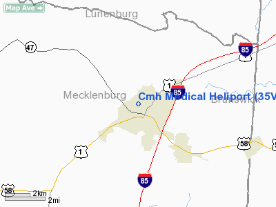
Location & QuickFacts
| FAA Information Effective: | 2008-09-25 |
| Airport Identifier: | 35VA |
| Airport Status: | Operational |
| Longitude/Latitude: | 078-08-03.9880W/36-44-03.5140N
-78.134441/36.734309 (Estimated) |
| Elevation: | 442 ft / 134.72 m (Estimated) |
| Land: | 3 acres |
| From nearest city: | 2 nautical miles NE of South Hill, VA |
| Location: | Mecklenburg County, VA |
| Magnetic Variation: | 08W (1990) |
Owner & Manager
| Ownership: | Privately owned |
| Owner: | Benchmark Bank |
| Address: | 828 N. Mecklenburg Ave.
South Hill, VA 23970 |
| Phone number: | 804-447-4256 |
| Manager: | Steve Kelly |
| Address: | 125 Buena Vista Cr.
South Hill, VA 23970 |
| Phone number: | 804-447-3151 |
Airport Operations and Facilities
| Airport Use: | Private
MEDICAL USE. |
| Segmented Circle: | No |
| Control Tower: | No |
| Sectional chart: | Washington |
| Region: | AEA - Eastern |
| Boundary ARTCC: | ZDC - Washington |
| Tie-in FSS: | DCA - Leesburg |
| FSS Toll Free: | 1-800-WX-BRIEF |
Runway Information
Helipad H1
| Dimension: | 60 x 60 ft / 18.3 x 18.3 m |
| Surface: | ASPH, |
| |
Runway H1 |
Runway |
| Traffic Pattern: | Left | Left |
|
Radio Navigation Aids
| ID |
Type |
Name |
Ch |
Freq |
Var |
Dist |
| MBV | NDB | Mecklenburg/dcmsnd | | 356.00 | 08W | 4.5 nm |
| AEA | NDB | Jones | | 373.00 | 09W | 8.2 nm |
| BKT | NDB | Blackstone | | 326.00 | 09W | 24.0 nm |
| RZZ | NDB | Rapids | | 407.00 | 08W | 27.1 nm |
| ELQ | NDB | Emporia | | 261.00 | 10W | 34.9 nm |
| HXO | NDB | Huntsboro | | 271.00 | 07W | 35.0 nm |
| PTB | NDB | Petersburg | | 284.00 | 08W | 35.9 nm |
| FVX | NDB | Farmville | | 367.00 | 07W | 39.9 nm |
| CF | NDB | Pubbs | | 392.00 | 09W | 48.6 nm |
| LVL | VORTAC | Lawrenceville | 076X | 112.90 | 08W | 12.2 nm |
| SBV | VORTAC | South Boston | 041X | 110.40 | 05W | 42.6 nm |
| FAK | VORTAC | Flat Rock | 080X | 113.30 | 06W | 49.9 nm |
Remarks
- PRVDD TREES TO NW ARE REMOVED & TREES TO SW ARE CLEARED OR TOPPED TO PRVD 8:1 APCH SLOPE.
Images and information placed above are from
http://www.airport-data.com/airport/35VA/
We thank them for the data!
| General Info
|
| Country |
United States
|
| State |
VIRGINIA
|
| FAA ID |
35VA
|
| Latitude |
36-44-03.514N
|
| Longitude |
078-08-03.988W
|
| Elevation |
442 feet
|
| Near City |
SOUTH HILL
|
We don't guarantee the information is fresh and accurate. The data may
be wrong or outdated.
For more up-to-date information please refer to other sources.
|
|


