 |
|
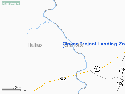
Clover Project Landing Zone Heliport |
Location & QuickFacts
| FAA Information Effective: | 2008-09-25 |
| Airport Identifier: | 7VA6 |
| Airport Status: | Operational |
| Longitude/Latitude: | 078-42-48.0150W/36-52-18.5090N
-78.713338/36.871808 (Estimated) |
| Elevation: | 420 ft / 128.02 m (Estimated) |
| Land: | 0 acres |
| From nearest city: | 2 nautical miles NN of Clover, VA |
| Location: | Halifax County, VA |
| Magnetic Variation: | 08W (1990) |
Owner & Manager
| Ownership: | Privately owned |
| Owner: | Old Dominion Electric Corp. |
| Address: | P O Box 229
Clover, VA 24534 |
| Phone number: | 804-454-7962 |
| Manager: | A E Toomey |
| Address: | P O Box 229
Clover, VA 24534 |
| Phone number: | 804-454-7962 |
Airport Operations and Facilities
| Airport Use: | Private |
| Wind indicator: | Yes |
| Segmented Circle: | No |
| Control Tower: | No |
| Lighting Schedule: | DUSK-DAWN
FOR PERIMETER LGTS CALL 804-454-7962. |
| Sectional chart: | Charlotte |
| Region: | AEA - Eastern |
| Boundary ARTCC: | ZDC - Washington |
| Tie-in FSS: | DCA - Leesburg |
| FSS Toll Free: | 1-800-WX-BRIEF |
Runway Information
Helipad H1
| Dimension: | 40 x 40 ft / 12.2 x 12.2 m |
| Surface: | CONC, |
| |
Runway H1 |
Runway |
| Traffic Pattern: | Left | Left |
|
Radio Navigation Aids
| ID |
Type |
Name |
Ch |
Freq |
Var |
Dist |
| FVX | NDB | Farmville | | 367.00 | 07W | 31.8 nm |
| MBV | NDB | Mecklenburg/dcmsnd | | 356.00 | 08W | 33.4 nm |
| LY | NDB | Bojar | | 385.00 | 08W | 34.6 nm |
| HXO | NDB | Huntsboro | | 271.00 | 07W | 34.6 nm |
| AEA | NDB | Jones | | 373.00 | 09W | 35.4 nm |
| BKT | NDB | Blackstone | | 326.00 | 09W | 35.6 nm |
| HUR | NDB | Person | | 220.00 | 08W | 42.0 nm |
| DAN | VOR | Danville | | 113.10 | 06W | 35.1 nm |
| SBV | VORTAC | South Boston | 041X | 110.40 | 05W | 18.7 nm |
| LYH | VORTAC | Lynchburg | 029X | 109.20 | 05W | 34.0 nm |
| LVL | VORTAC | Lawrenceville | 076X | 112.90 | 08W | 39.1 nm |
Remarks
- PRVDD HELIPORT OPERATED AS A PRIVATE USE HELIPORT; NOT BE OPERATED IN IFR WE CONDITIONS; RED HEMISPHERICAL MARKERS PLACED ON WIRES IN THE 270 DEGREE DIRECTION FROM HELIPORT.
Images and information placed above are from
http://www.airport-data.com/airport/7VA6/
We thank them for the data!
| General Info
|
| Country |
United States
|
| State |
VIRGINIA
|
| FAA ID |
7VA6
|
| Latitude |
36-52-18.509N
|
| Longitude |
078-42-48.015W
|
| Elevation |
420 feet
|
| Near City |
CLOVER
|
We don't guarantee the information is fresh and accurate. The data may
be wrong or outdated.
For more up-to-date information please refer to other sources.
|
|


