 |
|
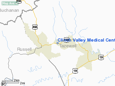
Clinch Valley Medical Center Heliport |
Location & QuickFacts
| FAA Information Effective: | 2008-09-25 |
| Airport Identifier: | 30VA |
| Airport Status: | Operational |
| Longitude/Latitude: | 081-49-15.4220W/37-05-40.4070N
-81.820951/37.094558 (Estimated) |
| Elevation: | 1965 ft / 598.93 m (Estimated) |
| Land: | 0 acres |
| From nearest city: | 2 nautical miles W of Richlands, VA |
| Location: | Tazewell County, VA |
| Magnetic Variation: | 05W (1985) |
Owner & Manager
| Ownership: | Privately owned |
| Owner: | Clinch Valley Medical Center |
| Address: | 2949 West Front Street
Richlands, VA 24641 |
| Phone number: | 703-963-0811 |
| Manager: | President And C.e.o. |
| Address: | 2949 West Front Street
Richlands, VA 24641 |
Airport Operations and Facilities
| Airport Use: | Private
MEDICAL USE. |
| Segmented Circle: | No |
| Control Tower: | No |
| Landing fee charge: | No |
| Sectional chart: | Cincinnati |
| Region: | AEA - Eastern |
| Boundary ARTCC: | ZID - Indianapolis |
| Tie-in FSS: | DCA - Leesburg |
| FSS on Airport: | No |
| FSS Toll Free: | 1-800-WX-BRIEF |
Runway Information
Helipad H1
| Dimension: | 65 x 60 ft / 19.8 x 18.3 m |
| Surface: | ASPH, |
| |
Runway H1 |
Runway |
| Traffic Pattern: | Left | Left |
|
Radio Navigation Aids
| ID |
Type |
Name |
Ch |
Freq |
Var |
Dist |
| VJ | NDB | Whine | | 236.00 | 05W | 22.5 nm |
| MK | NDB | Suzze | | 335.00 | 06W | 29.6 nm |
| JJO | NDB | Mountain City | | 396.00 | 04W | 40.8 nm |
| GTC | NDB | Guyandot | | 293.00 | 03W | 41.5 nm |
| JU | NDB | Ashee | | 410.00 | 07W | 46.4 nm |
| GZG | VOR/DME | Glade Spring | 039X | 110.20 | 02W | 20.4 nm |
| BLF | VORTAC | Bluefield | 037X | 110.00 | 03W | 32.6 nm |
| HMV | VORTAC | Holston Mountain | 093X | 114.60 | 04W | 42.2 nm |
Remarks
- PROVIDED PARKING LOT LIGHT IS REMOVED/MARKED, REMOVE DIRECTIONAL SIGN.
Images and information placed above are from
http://www.airport-data.com/airport/30VA/
We thank them for the data!
| General Info
|
| Country |
United States
|
| State |
VIRGINIA
|
| FAA ID |
30VA
|
| Latitude |
37-05-40.407N
|
| Longitude |
081-49-15.422W
|
| Elevation |
1965 feet
|
| Near City |
RICHLANDS
|
We don't guarantee the information is fresh and accurate. The data may
be wrong or outdated.
For more up-to-date information please refer to other sources.
|
|


