|
|
Chesterfield County Airport |
| Chesterfield County Airport |
| IATA: none – ICAO: KFCI – FAA LID: FCI |
| Summary |
| Airport type |
Public |
| Owner |
Chesterfield County |
| Serves |
Richmond, Virginia |
| Elevation AMSL |
237 ft / 72 m |
| Coordinates |
37°24′24″N 077°31′30″W / 37.40667°N 77.525°W / 37.40667; -77.525 |
| Runways |
| Direction |
Length |
Surface |
| ft |
m |
| 15/33 |
5,500 |
1,676 |
Asphalt |
| Statistics (2006) |
| Aircraft operations |
82,500 |
| Based aircraft |
137 |
| Source: Federal Aviation Administration |
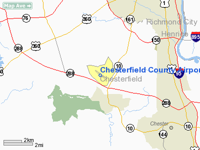
Chesterfield County Airport (ICAO: KFCI, FAA LID: FCI) is a public airport located four miles (6 km) southwest of the central business district of Richmond, a city in Chesterfield County, Virginia, United States. It is owned by Chesterfield County.
Although most U.S. airports use the same three-letter location identifier for the FAA and IATA, Chesterfield County Airport is assigned FCI by the FAA but has no designation from the IATA.
Facilities and aircraft
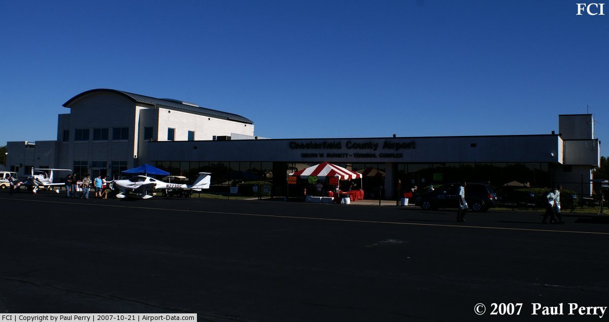
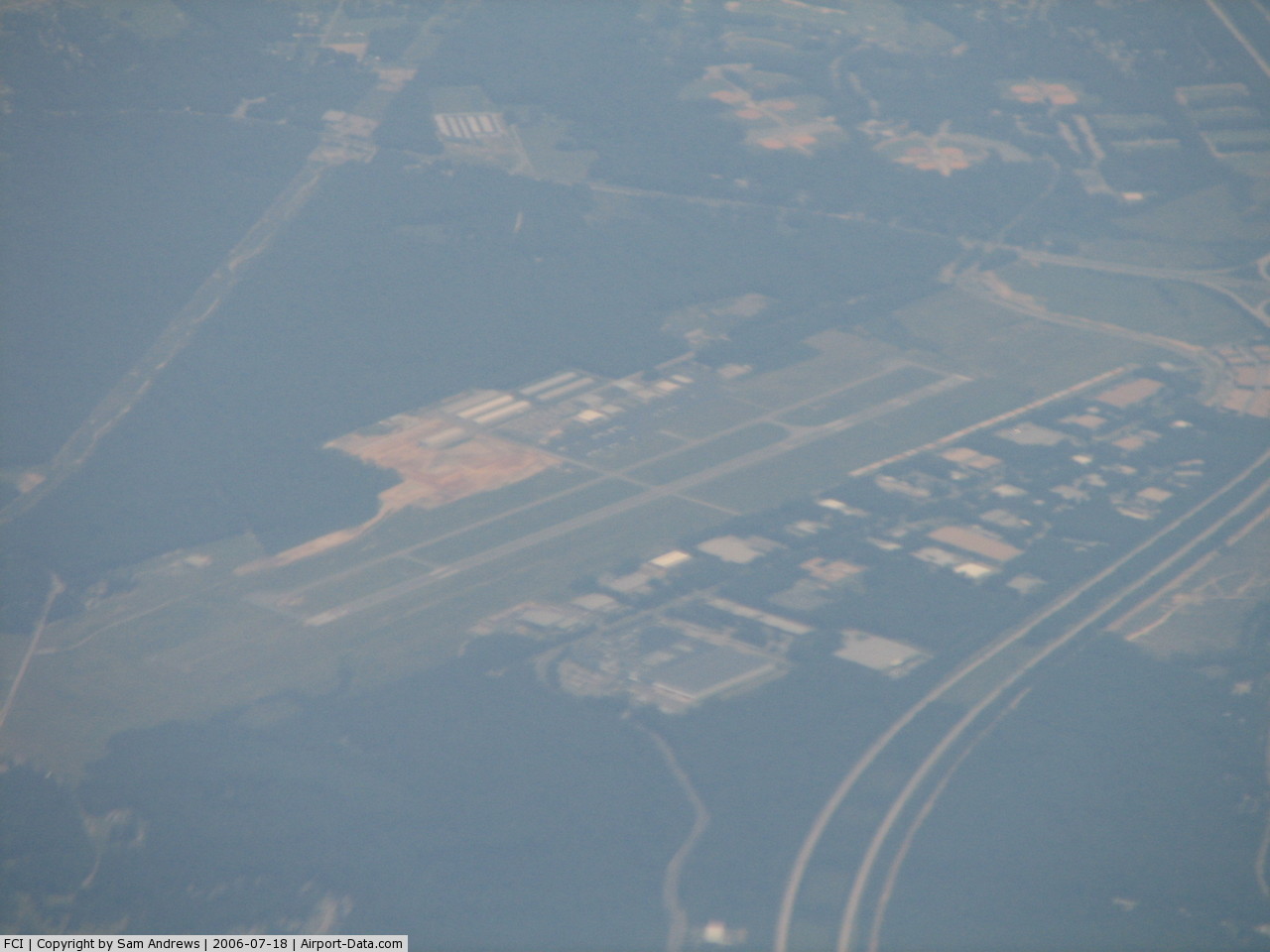
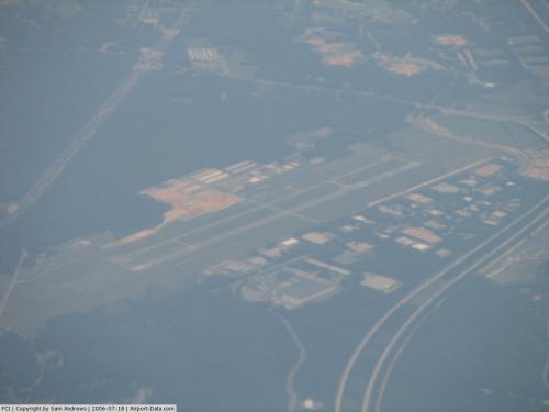
Built in 1973, Chesterfield County Airport covers an area of 593 acres (240 ha) which contains one asphalt paved runway (15/33) measuring 5,500 x 100 ft (1,676 x 30 m). The runway was completely resurfaced in 2007 and repainted in 2008 and is in excellent condition. Chesterfield County Airport is designated by the FAA as an official general aviation reliever airport for the busier Richmond International Airport. A modern terminal building with internet access, Wi-Fi, flight planning room, showers, vending machines, restaurant, and pilot quiet rooms is available.
Dominion Aviation Services is the fixed base operator (FBO) at this field. Fuel, flight training, and aircraft rental are available. Dominion is an FAA certified repair station.
Chesterfield County Airport is the homebase for the Wingnuts Flying Club.
The airport is the second busiest in the Richmond, Virginia region. For the 12-month period ending December 31, 2006, the airport had 82,500 aircraft operations, an average of 226 per day: 99% general aviation, 1% air taxi and <1% military. There are 137 aircraft based at this airport: 75% single engine, 15% multi-engine, 7% jets and 3% helicopters.
The above content comes from Wikipedia and is published under free licenses – click here to read more.
 |
(Click on the photo to enlarge) |
 |
(Click on the photo to enlarge) |
Location & QuickFacts
| FAA Information Effective: | 2008-09-25 |
| Airport Identifier: | FCI |
| Airport Status: | Operational |
| Longitude/Latitude: | 077-31-29.9520W/37-24-23.5350N
-77.524987/37.406537 (Estimated) |
| Elevation: | 237 ft / 72.24 m (Estimated) |
| Land: | 593 acres |
| From nearest city: | 4 nautical miles SW of Richmond, VA |
| Location: | Chesterfield County, VA |
| Magnetic Variation: | 10W (2005) |
Owner & Manager
| Ownership: | Publicly owned |
| Owner: | Chesterfield Co
BOARD OF SUPERVISORS. |
| Address: | Po Box 40
Chesterfield, VA 23832-0040 |
| Phone number: | 804-748-1215 |
| Manager: | Charles Dane |
| Address: | 7511 Airfield Drive
Richmond, VA 23237-2252 |
| Phone number: | 804-743-0771 |
Airport Operations and Facilities
| Airport Use: | Open to public |
| Wind indicator: | Yes |
| Segmented Circle: | Yes |
| Control Tower: | No |
| Lighting Schedule: | DUSK-DAWN
HIRL RY 15/33 PRESET LOW INTST; INCR INTST & ACTVT MALSR RY 33 & REIL RY 15 - CTAF. |
| Beacon Color: | Clear-Green (lighted land airport) |
| Landing fee charge: | No |
| Sectional chart: | Washington |
| Region: | AEA - Eastern |
| Boundary ARTCC: | ZDC - Washington |
| Tie-in FSS: | DCA - Leesburg |
| FSS on Airport: | No |
| FSS Toll Free: | 1-800-WX-BRIEF |
| NOTAMs Facility: | DCA (NOTAM-d service avaliable) |
| Federal Agreements: | NGY |
Airport Communications
| CTAF: | 123.050 |
| Unicom: | 123.050 |
Airport Services
| Fuel available: | 100LLA
FUEL AFT HRS PHONE (804)920-2099 BTN 2200-0700. |
| Airframe Repair: | MAJOR |
| Power Plant Repair: | MAJOR |
| Bottled Oxygen: | HIGH |
Runway Information
Runway 15/33
| Dimension: | 5500 x 100 ft / 1676.4 x 30.5 m |
| Surface: | ASPH, Good Condition |
| Surface Treatment: | Saw-cut or plastic Grooved |
| Weight Limit: | Single wheel: 40000 lbs.
Dual wheel: 60000 lbs. |
| Edge Lights: | High |
| |
Runway 15 |
Runway 33 |
| Longitude: | 077-31-50.8100W | 077-31-08.0100W |
| Latitude: | 37-24-44.3300N | 37-24-02.0000N |
| Elevation: | 236.00 ft | 199.00 ft |
| Alignment: | 127 | 127 |
| ILS Type: | | ILS/DME
|
| Traffic Pattern: | Left | Left |
| Markings: | Non-precision instrument, Fair Condition | Precision instrument, Fair Condition |
| Crossing Height: | 42.00 ft | 53.00 ft |
| VASI: | 4-light PAPI on left side | 4-light PAPI on left side |
| Visual Glide Angle: | 3.00° | 3.00° |
| Approach lights: | | MALSR |
| Runway End Identifier: | Yes
RY 15 REIL OTS INDEFLY. | |
| Obstruction: | 43 ft pole, 1516.0 ft from runway, 635 ft left of centerline, 31:1 slope to clear | 20 ft pole, 1034.0 ft from runway, 620 ft right of centerline, 41:1 slope to clear |
|
Radio Navigation Aids
| ID |
Type |
Name |
Ch |
Freq |
Var |
Dist |
| CF | NDB | Pubbs | | 392.00 | 09W | 5.6 nm |
| PTB | NDB | Petersburg | | 284.00 | 08W | 16.8 nm |
| LJK | NDB | Ashey | | 280.00 | 09W | 22.1 nm |
| BKT | NDB | Blackstone | | 326.00 | 09W | 30.0 nm |
| AKQ | NDB | Wakefield | | 274.00 | 09W | 35.7 nm |
| IQK | NDB | Louisa | | 382.00 | 09W | 40.2 nm |
| APH | NDB | A P Hill | | 396.00 | 10W | 42.0 nm |
| FVX | NDB | Farmville | | 367.00 | 07W | 43.7 nm |
| FAF | NDB | Felker | | 226.00 | 08W | 46.2 nm |
| ELQ | NDB | Emporia | | 261.00 | 10W | 47.6 nm |
| MBV | NDB | Mecklenburg/dcmsnd | | 356.00 | 08W | 49.9 nm |
| RIC | VORTAC | Richmond | 088X | 114.10 | 09W | 11.3 nm |
| FAK | VORTAC | Flat Rock | 080X | 113.30 | 06W | 16.2 nm |
| HPW | VORTAC | Hopewell | 057X | 112.00 | 06W | 20.1 nm |
| HCM | VORTAC | Harcum | 025X | 108.80 | 07W | 38.9 nm |
| LVL | VORTAC | Lawrenceville | 076X | 112.90 | 08W | 39.7 nm |
| GVE | VORTAC | Gordonsville | 103X | 115.60 | 06W | 47.1 nm |
| FKN | VORTAC | Franklin | 043X | 110.60 | 09W | 48.3 nm |
Remarks
- ACFT ON ILS APCH TO RICHMOND INTL CROSSING OVER ARPT.
- 400 FT AGL UNLGTD TOWER 5 NM N ARPT.
- NOISE SENSITIVE AREA NORTH OF ARPT.NO WIND VOLUNTARY USE OF RY 15 PREFERRED.
- DEER & BIRDS ON & INVOF ARPT.
- HELICOPTER PARKING ADJACENT TO TW 'C'
- MED-FLIGHT: IRREGULAR DEPARTURE PATTERN
- PRVDD A TFC PAT IS ESTABLISHED BY THE CHIEF OF THE ATCT.
Images and information placed above are from
http://www.airport-data.com/airport/FCI/
We thank them for the data!
| General Info
|
| Country |
United States
|
| State |
VIRGINIA
|
| FAA ID |
FCI
|
| Latitude |
37-24-23.535N
|
| Longitude |
077-31-29.952W
|
| Elevation |
237 feet
|
| Near City |
RICHMOND
|
We don't guarantee the information is fresh and accurate. The data may
be wrong or outdated.
For more up-to-date information please refer to other sources.
|
|