|
|
| Chesapeake Regional Airport |
| IATA: none – ICAO: KCPK – FAA LID: CPK |
| Summary |
| Airport type |
Public |
| Owner |
Chesapeake Airport Authority |
| Location |
Chesapeake, Virginia |
| Elevation AMSL |
19 ft / 6 m |
| Coordinates |
36°39′56″N 076°19′14″W / 36.66556°N 76.32056°W / 36.66556; -76.32056 |
| Website |
ChesapeakeAirport.com |
| Runways |
| Direction |
Length |
Surface |
| ft |
m |
| 5/23 |
5,500 |
1,676 |
Asphalt |
| Statistics (2007) |
| Aircraft operations |
32,600 |
| Based aircraft |
117 |
| Source: Federal Aviation Administration |
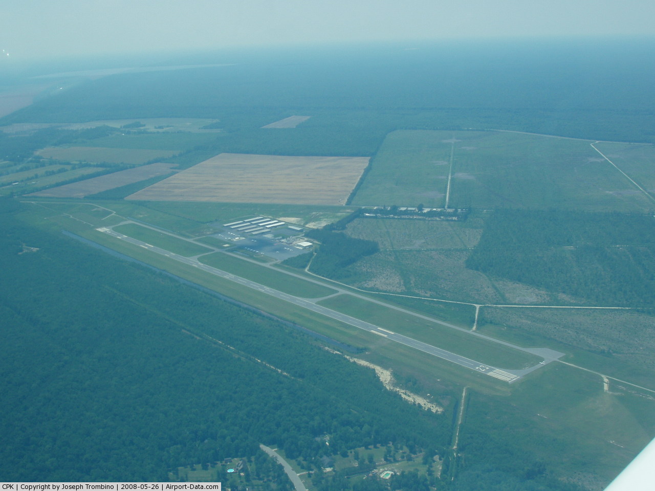
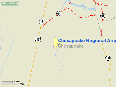
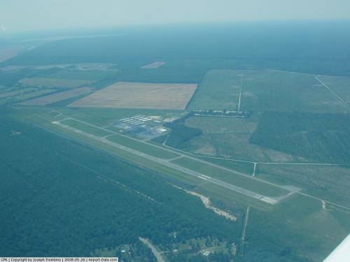
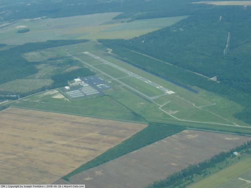
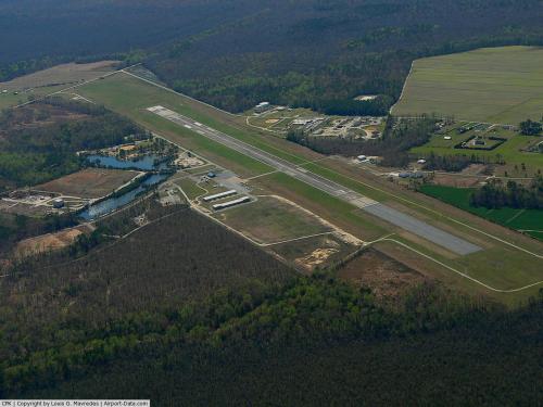
Chesapeake Regional Airport (ICAO: KCPK, FAA LID: CPK) is a public use airport located in the city of Chesapeake, Virginia and serving the Hampton Roads area. The airport is 12 nautical miles (22 km) south of the central business district of Norfolk, Virginia. It is owned by the Chesapeake Airport Authority. Tidewater Flight Center is located on site.
Although most U.S. airports use the same three-letter location identifier for the FAA and IATA, this airport is assigned CPK by the FAA but has no designation from the IATA.
Facilities and aircraft
Chesapeake Regional Airport covers an area of 430 acres (174 ha) at an elevation of 19 feet (6 m) above mean sea level. It has one asphalt paved runway designated 5/23 which measures 5,500 by 100 feet (1,676 x 30 m).
For the 12-month period ending February 28, 2007, the airport had 32,600 aircraft operations, an average of 89 per day: 96% general aviation, 3% air taxi and 1% military. At that time there were 117 aircraft based at this airport: 85% single-engine, 9% multi-engine, 3% ultralight, 2% jet and 1% helicopter.
The above content comes from Wikipedia and is published under free licenses – click here to read more.
 |
(Click on the photo to enlarge) |
 |
(Click on the photo to enlarge) |
 |
(Click on the photo to enlarge) |
Location & QuickFacts
| FAA Information Effective: | 2008-09-25 |
| Airport Identifier: | CPK |
| Airport Status: | Operational |
| Longitude/Latitude: | 076-19-14.3900W/36-39-56.2260N
-76.320664/36.665618 (Estimated) |
| Elevation: | 20 ft / 6.10 m (Surveyed) |
| Land: | 430 acres |
| From nearest city: | 12 nautical miles S of Norfolk, VA |
| Location: | Chesapeake County, VA |
| Magnetic Variation: | 09W (1985) |
Owner & Manager
| Ownership: | Publicly owned |
| Owner: | Chesapeake Airport Authority |
| Address: | 1777 West Road
Chesapeake, VA 23323-6402 |
| Phone number: | 757-432-8110 |
| Manager: | Joseph E. Love |
| Address: | 1777 West Rd
Chesapeake, VA 23323-6402 |
| Phone number: | 757-432-8110 |
Airport Operations and Facilities
| Airport Use: | Open to public |
| Wind indicator: | Yes |
| Segmented Circle: | Yes |
| Control Tower: | No |
| Lighting Schedule: | DUSK-DAWN
ACTVT HIRL RY 05/23, MALSR RY 05 AND REIL RY 23 - CTAF. |
| Beacon Color: | Clear-Green (lighted land airport) |
| Landing fee charge: | No |
| Sectional chart: | Washington |
| Region: | AEA - Eastern |
| Boundary ARTCC: | ZDC - Washington |
| Tie-in FSS: | DCA - Leesburg |
| FSS on Airport: | No |
| FSS Toll Free: | 1-800-WX-BRIEF |
| NOTAMs Facility: | CPK (NOTAM-d service avaliable) |
| Federal Agreements: | NGY |
Airport Communications
| CTAF: | 123.050 |
| Unicom: | 123.050 |
Airport Services
| Fuel available: | 100LLA
FOR FUEL AFT HRS CALL IN ADVANCE 757-421-9000. |
| Airframe Repair: | MAJOR |
| Power Plant Repair: | MAJOR |
Runway Information
Runway 05/23
| Dimension: | 5500 x 100 ft / 1676.4 x 30.5 m |
| Surface: | ASPH, Good Condition |
| Surface Treatment: | Saw-cut or plastic Grooved |
| Weight Limit: | Single wheel: 30000 lbs. |
| Edge Lights: | High |
| |
Runway 05 |
Runway 23 |
| Longitude: | 076-19-34.6580W | 076-18-54.1220W |
| Latitude: | 36-39-34.4820N | 36-40-17.9690N |
| Elevation: | 18.00 ft | 20.00 ft |
| Alignment: | 36 | 127 |
| ILS Type: | ILS/DME
| |
| Traffic Pattern: | Left | Right |
| Markings: | Precision instrument, Fair Condition | Non-precision instrument, Fair Condition |
| Crossing Height: | 42.00 ft | 42.00 ft |
| VASI: | 4-light PAPI on left side | 4-light PAPI on left side |
| Visual Glide Angle: | 3.00° | 3.00° |
| Approach lights: | MALSR | |
| Runway End Identifier: | No | Yes |
| Obstruction: | 15 ft tree, 552.0 ft from runway, 504 ft right of centerline, 23:1 slope to clear
SMALL TREES ALONG THE EAST SIDE OF THE RY APPROX 400 TO 500 FT OFF CNTRLN. | 12 ft tree, 303.0 ft from runway, 373 ft left of centerline, 8:1 slope to clear
SMALL TREES ALONG THE EAST SIDE OF THE RY APPROX 400 TO 500 FT OFF CNTRLN. |
|
Radio Navigation Aids
| ID |
Type |
Name |
Ch |
Freq |
Var |
Dist |
| EY | NDB | Chesi | | 233.00 | 09W | 4.9 nm |
| PVG | NDB | Portsmouth | | 241.00 | 10W | 9.1 nm |
| RK | NDB | Waley | | 249.00 | 10W | 16.3 nm |
| LLW | NDB | Woodville | | 254.00 | 10W | 24.2 nm |
| PJS | NDB | Henry | | 375.00 | 09W | 29.3 nm |
| FAF | NDB | Felker | | 226.00 | 08W | 31.8 nm |
| AKQ | NDB | Wakefield | | 274.00 | 09W | 37.9 nm |
| EDE | NDB | Edenton | | 265.00 | 10W | 40.3 nm |
| ASJ | NDB | Ahoskie | | 415.00 | 10W | 46.8 nm |
| NGU | TACAN | Chambers | 048X | | 10W | 16.6 nm |
| NTU | TACAN | Oceana | 113X | | 10W | 16.7 nm |
| LFI | TACAN | Langley | 070X | | 10W | 25.3 nm |
| ECG | VOR/DME | Elizabeth City | 072X | 112.50 | 07W | 25.5 nm |
| ORF | VORTAC | Norfolk | 116X | 116.90 | 07W | 14.8 nm |
| CVI | VORTAC | Cofield | 093X | 114.60 | 09W | 31.9 nm |
| FKN | VORTAC | Franklin | 043X | 110.60 | 09W | 33.5 nm |
| CCV | VORTAC | Cape Charles | 059X | 112.20 | 10W | 43.8 nm |
Remarks
- DEER ON & INVOF RY.
- GCO AVBL ON FREQ 135.075 THRU ORF CLNC DEL.
- NOISE ABATEMENT PROCEDURES IN EFFECT; CTC AMGR 757-432-8110.
- SPB ASP: PRVDD SAME TFC PAT IS USED FOR RWY & SEALANE; ARPT MGR ESTABS MIN CROSSWIND LNDG CRITERIA & HAS THIS INFO PUBLD LOCAL & IN AIM.
Images and information placed above are from
http://www.airport-data.com/airport/CPK/
We thank them for the data!
| General Info
|
| Country |
United States
|
| State |
VIRGINIA
|
| FAA ID |
CPK
|
| Latitude |
36-39-56.226N
|
| Longitude |
076-19-14.390W
|
| Elevation |
20 feet
|
| Near City |
NORFOLK
|
We don't guarantee the information is fresh and accurate. The data may
be wrong or outdated.
For more up-to-date information please refer to other sources.
|
|