 |
|
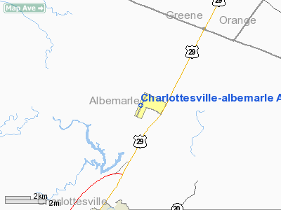
Charlottesville-albemarle Airport |
| Charlottesville-Albemarle Airport |
| IATA: CHO – ICAO: KCHO |
| Summary |
| Airport type |
Public |
| Operator |
Charlottesville-Albemarle Airport Authority |
| Location |
Charlottesville, Virginia |
| Elevation AMSL |
639 ft / 194.8 m |
| Coordinates |
38°08′19.1″N 78°27′10.3″W / 38.138639°N 78.452861°W / 38.138639; -78.452861Coordinates: 38°08′19.1″N 78°27′10.3″W / 38.138639°N 78.452861°W / 38.138639; -78.452861 |
| Website |
[1] |
| Runways |
| Direction |
Length |
Surface |
| ft |
m |
| 3/21 |
6,001 |
1,829 |
Asphalt |
Charlottesville-Albemarle Airport (IATA: CHO, ICAO: KCHO) is a public airport located 8 miles (12 km) north of Charlottesville, in Albemarle County, Virginia, USA. The airport serves the Charlottesville/Albemarle region and surrounding counties with 22 daily non-stop flights to seven major cities on three different airlines. CHO underwent a major construction in Summer 2006, and is currently in the middle of a runway expansion.
The airport has a 60,000 sq ft (6,000 m). terminal with offering on-site rental cars, ground transportation, and food service and gifts from "The Market" Gourmet Deli & Gift Shop. General aviation facilities include an executive terminal offering a full-service by the fixed base operator, Landmark Aviation, flight schools, emergency medical transportation and aircraft charter firms. Airlines and destinations
| Airlines |
Destinations |
| Delta Connection operated by Atlantic Southeast Airlines |
Atlanta |
| Delta Connection operated by Pinnacle Airlines |
Detroit |
| United Express operated by Colgan Air |
Washington-Dulles |
| US Airways Express operated by Piedmont Airlines |
Charlotte, Philadelphia, New York-LaGuardia |
| US Airways Express operated by PSA Airlines |
Charlotte |
| US Airways Express operated by Air Wisconsin |
Charlotte |
Cargo airlines and destinations
- DHL
- operated by Ameriflight (Wilmington, Lynchburg)
The above content comes from Wikipedia and is published under free licenses – click here to read more.
Location & QuickFacts
| FAA Information Effective: | 2008-09-25 |
| Airport Identifier: | CHO |
| Airport Status: | Operational |
| Longitude/Latitude: | 078-27-10.3000W/38-08-19.1000N
-78.452861/38.138639 (Estimated) |
| Elevation: | 639 ft / 194.77 m (Surveyed) |
| Land: | 610 acres |
| From nearest city: | 7 nautical miles N of Charlottesville, VA |
| Location: | Albemarle County, VA |
| Magnetic Variation: | 08W (1985) |
Owner & Manager
| Ownership: | Publicly owned |
| Owner: | Chrltsvl-albmrl Arpt Auth |
| Address: | 100 Bowen Loop, Suite 200
Charlottesville, VA 22911 |
| Phone number: | 434-973-8341 |
| Manager: | Barbara Hutchinson |
| Address: | 100 Bowen Loop, Suite 200
Charlottesville, VA 22911 |
| Phone number: | 434-973-8342 |
Airport Operations and Facilities
| Airport Use: | Open to public |
| Wind indicator: | Yes |
| Segmented Circle: | No |
| Control Tower: | Yes |
| Lighting Schedule: | DUSK-DAWN
WHEN ATCT CLSD HIRL RY 03/21 & TWY LIGHTS PRESET LOW INTST AND REIL RY 21 UNAVBL. TO INCREASE INTST HIRL RY 03/21 & TWY LIGHTS AND ACTVT MALSR RY 03 - CTAF. |
| Beacon Color: | Clear-Green (lighted land airport) |
| Landing fee charge: | Yes
LNDG FEE ONLY FOR ACFT OVER 7000 LBS. |
| Sectional chart: | Washington |
| Region: | AEA - Eastern |
| Boundary ARTCC: | ZDC - Washington |
| Tie-in FSS: | DCA - Leesburg |
| FSS on Airport: | No |
| FSS Toll Free: | 1-800-WX-BRIEF |
| NOTAMs Facility: | CHO (NOTAM-d service avaliable) |
| Certification type/date: | I B S 05/1973
PPR 8 HRS FOR UNSKED ACR OPNS WITH MORE THAN 9 PASSENGER SEATS BTWN 0400-1100Z; CALL APRT MGR 434-981-4152. |
| Federal Agreements: | NGYH |
Airport Communications
| CTAF: | 124.500 |
| Unicom: | 122.950 |
Airport Services
| Fuel available: | 100LLA |
| Airframe Repair: | MAJOR |
| Power Plant Repair: | MAJOR |
| Bottled Oxygen: | NONE |
| Bulk Oxygen: | NONE |
Runway Information
Runway 03/21
| Dimension: | 6001 x 150 ft / 1829.1 x 45.7 m |
| Surface: | ASPH, Good Condition |
| Surface Treatment: | Saw-cut or plastic Grooved |
| Weight Limit: | Single wheel: 100000 lbs.
Dual wheel: 160000 lbs.
Dual tandem wheel: 300000 lbs. |
| Edge Lights: | High |
| |
Runway 03 |
Runway 21 |
| Longitude: | 078-27-24.4596W | 078-26-56.1620W |
| Latitude: | 38-07-51.6017N | 38-08-46.5473N |
| Elevation: | 639.00 ft | 620.00 ft |
| Alignment: | 22 | 127 |
| ILS Type: | ILS
| |
| Traffic Pattern: | Left | Left |
| Markings: | Precision instrument, Good Condition | Non-precision instrument, Good Condition |
| Crossing Height: | 0.00 ft | 50.00 ft |
| VASI: | | 4-box on left side |
| Visual Glide Angle: | 0.00° | 3.00° |
| Approach lights: | MALSR | |
| Runway End Identifier: | | Yes |
|
Radio Navigation Aids
| ID |
Type |
Name |
Ch |
Freq |
Var |
Dist |
| AZS | NDB | Azalea Park | | 336.00 | 08W | 8.3 nm |
| VBW | NDB | Bridgewater | | 241.00 | 07W | 27.6 nm |
| IQK | NDB | Louisa | | 382.00 | 09W | 29.0 nm |
| MSQ | NDB | Nailr | | 351.00 | 10W | 32.1 nm |
| LUA | NDB | Caverns | | 245.00 | 09W | 33.7 nm |
| CJR | NDB | Culpeper | | 252.00 | 09W | 36.6 nm |
| FVX | NDB | Farmville | | 367.00 | 07W | 47.2 nm |
| EZF | NDB | Shannon | | 237.00 | 10W | 47.9 nm |
| MOL | VOR/DME | Montebello | 100X | 115.30 | 05W | 34.1 nm |
| GVE | VORTAC | Gordonsville | 103X | 115.60 | 06W | 16.1 nm |
| CSN | VORTAC | Casanova | 110X | 116.30 | 06W | 41.0 nm |
| LDN | VORTAC | Linden | 090X | 114.30 | 06W | 44.6 nm |
| FAK | VORTAC | Flat Rock | 080X | 113.30 | 06W | 47.2 nm |
Remarks
- DEER & BIRDS ON & INVOF ARPT.
- EXISTED PRIOR TO 1959.
Images and information placed above are from
http://www.airport-data.com/airport/CHO/
We thank them for the data!
| General Info
|
| Country |
United States
|
| State |
VIRGINIA
|
| FAA ID |
CHO
|
| Latitude |
38-08-19.100N
|
| Longitude |
078-27-10.300W
|
| Elevation |
639 feet
|
| Near City |
CHARLOTTESVILLE
|
We don't guarantee the information is fresh and accurate. The data may
be wrong or outdated.
For more up-to-date information please refer to other sources.
|
|


