 |
|
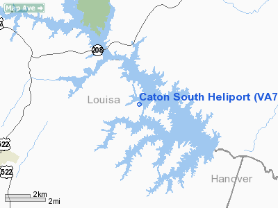
Location & QuickFacts
| FAA Information Effective: | 2008-09-25 |
| Airport Identifier: | VA74 |
| Airport Status: | Operational |
| Longitude/Latitude: | 077-46-52.9720W/38-02-44.4960N
-77.781381/38.045693 (Estimated) |
| Elevation: | 260 ft / 79.25 m (Estimated) |
| Land: | 0 acres |
| From nearest city: | 7 nautical miles NE of Mineral, VA |
| Location: | Louisa County, VA |
| Magnetic Variation: | 08W (1985) |
Owner & Manager
| Ownership: | Privately owned |
| Owner: | John Leo Caton |
| Address: | Rt 2 Box 110
Mineral, VA 23117 |
| Phone number: | 703-494-0732 |
| Address: |
|
Airport Operations and Facilities
| Airport Use: | Private |
| Segmented Circle: | No |
| Control Tower: | No |
| Sectional chart: | Washington |
| Region: | AEA - Eastern |
| Boundary ARTCC: | ZDC - Washington |
| Tie-in FSS: | DCA - Leesburg |
| FSS Toll Free: | 1-800-WX-BRIEF |
Runway Information
Helipad H1
| Dimension: | 75 x 75 ft / 22.9 x 22.9 m |
| Surface: | TURF, |
| |
Runway H1 |
Runway |
| Traffic Pattern: | Left | Left |
|
Radio Navigation Aids
| ID |
Type |
Name |
Ch |
Freq |
Var |
Dist |
| IQK | NDB | Louisa | | 382.00 | 09W | 4.0 nm |
| EZF | NDB | Shannon | | 237.00 | 10W | 20.5 nm |
| APH | NDB | A P Hill | | 396.00 | 10W | 21.7 nm |
| LJK | NDB | Ashey | | 280.00 | 09W | 21.7 nm |
| MSQ | NDB | Nailr | | 351.00 | 10W | 25.3 nm |
| CJR | NDB | Culpeper | | 252.00 | 09W | 29.4 nm |
| AZS | NDB | Azalea Park | | 336.00 | 08W | 34.9 nm |
| CF | NDB | Pubbs | | 392.00 | 09W | 45.6 nm |
| GVE | VORTAC | Gordonsville | 103X | 115.60 | 06W | 17.7 nm |
| BRV | VORTAC | Brooke | 092X | 114.50 | 09W | 26.7 nm |
| FAK | VORTAC | Flat Rock | 080X | 113.30 | 06W | 31.2 nm |
| CSN | VORTAC | Casanova | 110X | 116.30 | 06W | 36.0 nm |
| RIC | VORTAC | Richmond | 088X | 114.10 | 09W | 39.3 nm |
Remarks
- PRVDD VFR USE ONLY & YOU CTC LEESBURG AFSS 703-777-1832 TO OBTAIN INFO REGARDING MTR'S INVOF HELIPAD.
Images and information placed above are from
http://www.airport-data.com/airport/VA74/
We thank them for the data!
| General Info
|
| Country |
United States
|
| State |
VIRGINIA
|
| FAA ID |
VA74
|
| Latitude |
38-02-44.496N
|
| Longitude |
077-46-52.972W
|
| Elevation |
260 feet
|
| Near City |
MINERAL
|
We don't guarantee the information is fresh and accurate. The data may
be wrong or outdated.
For more up-to-date information please refer to other sources.
|
|


