 |
|
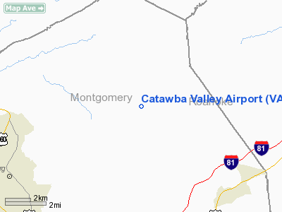
Location & QuickFacts
| FAA Information Effective: | 2008-09-25 |
| Airport Identifier: | VA10 |
| Airport Status: | Operational |
| Longitude/Latitude: | 080-18-05.1700W/37-16-48.4700N
-80.301436/37.280131 (Estimated) |
| Elevation: | 1720 ft / 524.26 m (Estimated) |
| Land: | 0 acres |
| From nearest city: | 7 nautical miles SW of Blacksburg, VA |
| Location: | Montgomery County, VA |
| Magnetic Variation: | 07W (1995) |
Owner & Manager
| Ownership: | Privately owned |
| Owner: | James Mc Pherson |
| Address: | 3046 Catawba Rd
Blacksburg, VA 27060 |
| Phone number: | 540-951-2845 |
| Manager: | James Mc Pherson |
| Address: | 3046 Catawba Rd
Blacksburg, VA 27060 |
| Phone number: | 540-951-2845 |
Airport Operations and Facilities
| Airport Use: | Private |
| Segmented Circle: | No |
| Control Tower: | No |
| Sectional chart: | Cincinnati |
| Region: | AEA - Eastern |
| Boundary ARTCC: | ZDC - Washington |
| Tie-in FSS: | DCA - Leesburg |
| FSS Toll Free: | 1-800-WX-BRIEF |
Runway Information
Runway 05/23
| Dimension: | 1930 x 100 ft / 588.3 x 30.5 m |
| Surface: | TURF, |
| |
Runway 05 |
Runway 23 |
| Traffic Pattern: | Left | Left |
|
Radio Navigation Aids
| ID |
Type |
Name |
Ch |
Freq |
Var |
Dist |
| TEC | NDB | Tech | | 368.00 | 06W | 6.5 nm |
| CNQ | NDB | Callahan | | 379.00 | 05W | 6.9 nm |
| VIT | NDB | Vinton | | 277.00 | 06W | 20.6 nm |
| LW | NDB | Bushi | | 346.00 | 06W | 31.2 nm |
| HLX | NDB | Hillsville | | 269.00 | 06W | 39.9 nm |
| UV | NDB | Bales | | 396.00 | 07W | 45.4 nm |
| ODR | VOR | Woodrum | | 114.90 | 06W | 15.6 nm |
| RNL | VOR | Rainelle | | 116.60 | 04W | 48.2 nm |
| LWB | VOR/DME | Greenbrier | 107Y | 116.05 | 08W | 35.3 nm |
| ROA | VORTAC | Roanoke | 031X | 109.40 | 04W | 11.7 nm |
| PSK | VORTAC | Pulaski | 115X | 116.80 | 06W | 22.8 nm |
| BLF | VORTAC | Bluefield | 037X | 110.00 | 03W | 42.7 nm |
| BKW | VORTAC | Beckley | 124X | 117.70 | 06W | 49.4 nm |
Remarks
- PRVDD DAYLGT OPNS ONLY & IFR OPNS NOT CONDUCTED.
Images and information placed above are from
http://www.airport-data.com/airport/VA10/
We thank them for the data!
| General Info
|
| Country |
United States
|
| State |
VIRGINIA
|
| FAA ID |
VA10
|
| Latitude |
37-16-48.470N
|
| Longitude |
080-18-05.170W
|
| Elevation |
1720 feet
|
| Near City |
BLACKSBURG
|
We don't guarantee the information is fresh and accurate. The data may
be wrong or outdated.
For more up-to-date information please refer to other sources.
|
|


