 |
|
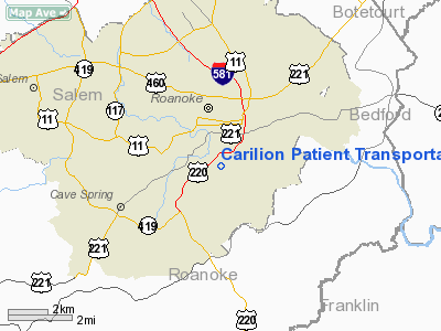
Carilion Patient Transportation Services Heliport |
Location & QuickFacts
| FAA Information Effective: | 2008-09-25 |
| Airport Identifier: | VG47 |
| Airport Status: | Operational |
| Longitude/Latitude: | 079-56-59.1340W/37-15-07.4950N
-79.949759/37.252082 (Estimated) |
| Elevation: | 946 ft / 288.34 m (Estimated) |
| Land: | 1 acres |
| From nearest city: | 0 nautical miles S of Roanoke, VA |
| Location: | Roanoke County, VA |
| Magnetic Variation: | 06W (1985) |
Owner & Manager
| Ownership: | Privately owned |
| Owner: | Carilion Patient Trans Services |
| Address: | 431 Mc Clanahan St
Roanoke, VA 24018 |
| Phone number: | 888-377-7628 |
| Manager: | Paul Davenport |
| Address: | 433 Mc Clanahan St
Roanoke, VA 24018 |
| Phone number: | 540-981-9448 |
Airport Operations and Facilities
| Airport Use: | Private
MEDICAL USE. |
| Wind indicator: | Yes |
| Segmented Circle: | No |
| Control Tower: | No |
| Landing fee charge: | No |
| Sectional chart: | Cincinnati |
| Region: | AEA - Eastern |
| Boundary ARTCC: | ZDC - Washington |
| Tie-in FSS: | DCA - Leesburg |
| FSS on Airport: | No |
| FSS Toll Free: | 1-800-WX-BRIEF |
Runway Information
Helipad H1
| Dimension: | 100 x 70 ft / 30.5 x 21.3 m |
| Surface: | CONC, |
| |
Runway H1 |
Runway |
| Traffic Pattern: | Left | Left |
|
Radio Navigation Aids
| ID |
Type |
Name |
Ch |
Freq |
Var |
Dist |
| OQA | FAN MARKER | Rockingham County | | | | 50.0 nm |
| VIT | NDB | Vinton | | 277.00 | 06W | 4.4 nm |
| CNQ | NDB | Callahan | | 379.00 | 05W | 10.0 nm |
| TEC | NDB | Tech | | 368.00 | 06W | 21.9 nm |
| LY | NDB | Bojar | | 385.00 | 08W | 33.8 nm |
| UV | NDB | Bales | | 396.00 | 07W | 39.8 nm |
| LW | NDB | Bushi | | 346.00 | 06W | 40.3 nm |
| ODR | VOR | Woodrum | | 114.90 | 06W | 4.6 nm |
| LWB | VOR/DME | Greenbrier | 107Y | 116.05 | 08W | 42.4 nm |
| ROA | VORTAC | Roanoke | 031X | 109.40 | 04W | 8.0 nm |
| LYH | VORTAC | Lynchburg | 029X | 109.20 | 05W | 34.1 nm |
| PSK | VORTAC | Pulaski | 115X | 116.80 | 06W | 37.9 nm |
Remarks
- THIS GND PAD LCTD 1/4 NM FM ROOFTOP PAD AT CARILION ROANOKE MEM HOSP.
- RESTRICTED TO MEDICAL EMERGENCIES; OPERATIONAL PROCEDURES COORD WITH ROA ATC.
Images and information placed above are from
http://www.airport-data.com/airport/VG47/
We thank them for the data!
| General Info
|
| Country |
United States
|
| State |
VIRGINIA
|
| FAA ID |
VG47
|
| Latitude |
37-15-07.495N
|
| Longitude |
079-56-59.134W
|
| Elevation |
946 feet
|
| Near City |
ROANOKE
|
We don't guarantee the information is fresh and accurate. The data may
be wrong or outdated.
For more up-to-date information please refer to other sources.
|
|


