 |
|
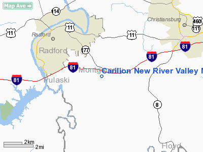
Carilion New River Valley Medical Center Heliport |
Location & QuickFacts
| FAA Information Effective: | 2008-09-25 |
| Airport Identifier: | 68VA |
| Airport Status: | Operational |
| Longitude/Latitude: | 080-30-36.0000W/37-05-28.0000N
-80.510000/37.091111 (Estimated) |
| Elevation: | 3130 ft / 954.02 m (Estimated) |
| Land: | 110 acres |
| From nearest city: | 5 nautical miles N of Radford, VA |
| Location: | Montgomery County, VA |
| Magnetic Variation: | 07W (1995) |
Owner & Manager
| Ownership: | Privately owned |
| Owner: | Carilion Health Systems |
| Address: | Po Box 13367
Roanoke, VA 24033-3367 |
| Phone number: | 540-981-7000 |
| Manager: | Alan Verling-bill Copening |
| Address: | 2900 Tyler Dr/box 5
Radford, VA 24141 |
| Phone number: | 540-731-2000 |
Airport Operations and Facilities
| Airport Use: | Private |
| Wind indicator: | Yes |
| Segmented Circle: | No |
| Control Tower: | No |
| Lighting Schedule: | PHONE REQ
FOR PERIMETER LGTS CALL 540-731-2000. |
| Sectional chart: | Cincinnati |
| Region: | AEA - Eastern |
| Boundary ARTCC: | ZDC - Washington |
| Tie-in FSS: | DCA - Leesburg |
| FSS Toll Free: | 1-800-WX-BRIEF |
Runway Information
Helipad H1
| Dimension: | 48 x 48 ft / 14.6 x 14.6 m |
| Surface: | CONC, Good Condition |
| |
Runway H1 |
Runway |
| Traffic Pattern: | Left | Left |
|
Radio Navigation Aids
| ID |
Type |
Name |
Ch |
Freq |
Var |
Dist |
| TEC | NDB | Tech | | 368.00 | 06W | 8.7 nm |
| CNQ | NDB | Callahan | | 379.00 | 05W | 19.7 nm |
| HLX | NDB | Hillsville | | 269.00 | 06W | 24.8 nm |
| VIT | NDB | Vinton | | 277.00 | 06W | 30.9 nm |
| MK | NDB | Suzze | | 335.00 | 06W | 36.7 nm |
| UV | NDB | Bales | | 396.00 | 07W | 41.5 nm |
| LW | NDB | Bushi | | 346.00 | 06W | 41.6 nm |
| AZW | NDB | Mount Airy | | 223.00 | 07W | 42.7 nm |
| ZEF | NDB | Zephyr | | 326.00 | 05W | 47.9 nm |
| ODR | VOR | Woodrum | | 114.90 | 06W | 29.0 nm |
| LWB | VOR/DME | Greenbrier | 107Y | 116.05 | 08W | 46.8 nm |
| PSK | VORTAC | Pulaski | 115X | 116.80 | 06W | 9.7 nm |
| ROA | VORTAC | Roanoke | 031X | 109.40 | 04W | 25.9 nm |
| BLF | VORTAC | Bluefield | 037X | 110.00 | 03W | 35.2 nm |
Remarks
- PRVDD ACCURATE INGRESS/EGRESS ROUTE, CLEAR 8:1 SLOPE, APPROPRIATE INGRESS/EGRESS MKGS, LGTD WINDSOCK, VEHICULAR TFC AROUND SITE CONTROLLED, & MAXIMUM USE OF HIGHWAY SYSTEM TO MINIMIZE NOISE IN AREA.
Images and information placed above are from
http://www.airport-data.com/airport/68VA/
We thank them for the data!
| General Info
|
| Country |
United States
|
| State |
VIRGINIA
|
| FAA ID |
68VA
|
| Latitude |
37-05-28.000N
|
| Longitude |
080-30-36.000W
|
| Elevation |
3130 feet
|
| Near City |
RADFORD
|
We don't guarantee the information is fresh and accurate. The data may
be wrong or outdated.
For more up-to-date information please refer to other sources.
|
|


