 |
|
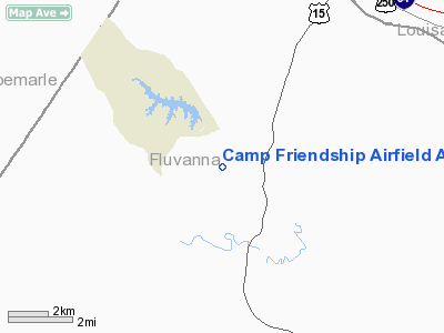
Camp Friendship Airfield Airport |
Location & QuickFacts
| FAA Information Effective: | 2008-09-25 |
| Airport Identifier: | 77VA |
| Airport Status: | Operational |
| Longitude/Latitude: | 078-17-09.0000W/37-53-17.5080N
-78.285833/37.888197 (Estimated) |
| Elevation: | 345 ft / 105.16 m (Estimated) |
| Land: | 8 acres |
| From nearest city: | 2 nautical miles NW of Palmyra, VA |
| Location: | Fluvanna County, VA |
| Magnetic Variation: | 08W (1990) |
Owner & Manager
| Ownership: | Privately owned |
| Owner: | Camp Friendship Inc |
| Address: | Po Box 145
Palmyra, VA 22963 |
| Phone number: | 804-589-8950 |
| Manager: | Charles R Ackenbom Sr |
| Address: | Po Box 145
Palmyra, VA 22963 |
| Phone number: | 804-589-8950 |
Airport Operations and Facilities
| Airport Use: | Private |
| Wind indicator: | Yes |
| Segmented Circle: | No |
| Control Tower: | No |
| Sectional chart: | Washington |
| Region: | AEA - Eastern |
| Boundary ARTCC: | ZDC - Washington |
| Tie-in FSS: | DCA - Leesburg |
| FSS on Airport: | No |
| FSS Toll Free: | 1-800-WX-BRIEF |
Airport Communications
Runway Information
Runway 12/30
| Dimension: | 2400 x 50 ft / 731.5 x 15.2 m |
| Surface: | TURF, |
| |
Runway 12 |
Runway 30 |
| Traffic Pattern: | Left | Left |
|
Radio Navigation Aids
| ID |
Type |
Name |
Ch |
Freq |
Var |
Dist |
| AZS | NDB | Azalea Park | | 336.00 | 08W | 13.2 nm |
| IQK | NDB | Louisa | | 382.00 | 09W | 21.7 nm |
| FVX | NDB | Farmville | | 367.00 | 07W | 33.0 nm |
| MSQ | NDB | Nailr | | 351.00 | 10W | 38.5 nm |
| LJK | NDB | Ashey | | 280.00 | 09W | 38.9 nm |
| VBW | NDB | Bridgewater | | 241.00 | 07W | 42.9 nm |
| CJR | NDB | Culpeper | | 252.00 | 09W | 43.6 nm |
| EZF | NDB | Shannon | | 237.00 | 10W | 45.6 nm |
| APH | NDB | A P Hill | | 396.00 | 10W | 47.1 nm |
| BKT | NDB | Blackstone | | 326.00 | 09W | 47.2 nm |
| LUA | NDB | Caverns | | 245.00 | 09W | 49.6 nm |
| MOL | VOR/DME | Montebello | 100X | 115.30 | 05W | 39.0 nm |
| GVE | VORTAC | Gordonsville | 103X | 115.60 | 06W | 9.8 nm |
| FAK | VORTAC | Flat Rock | 080X | 113.30 | 06W | 30.7 nm |
| CSN | VORTAC | Casanova | 110X | 116.30 | 06W | 49.4 nm |
Remarks
- COORD USE WITH VIRGINIA BEACH NAS; IDENTIFIED TREES ARE REMOVED.
Images and information placed above are from
http://www.airport-data.com/airport/77VA/
We thank them for the data!
| General Info
|
| Country |
United States
|
| State |
VIRGINIA
|
| FAA ID |
77VA
|
| Latitude |
37-53-17.508N
|
| Longitude |
078-17-09.000W
|
| Elevation |
345 feet
|
| Near City |
PALMYRA
|
We don't guarantee the information is fresh and accurate. The data may
be wrong or outdated.
For more up-to-date information please refer to other sources.
|
|


