 |
|
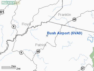
Location & QuickFacts
| FAA Information Effective: | 2008-09-25 |
| Airport Identifier: | 6VA9 |
| Airport Status: | Operational |
| Longitude/Latitude: | 080-14-18.1760W/36-50-33.4840N
-80.238382/36.842634 (Estimated) |
| Elevation: | 1500 ft / 457.20 m (Estimated) |
| Land: | 0 acres |
| From nearest city: | 4 nautical miles NE of Woolwine, VA |
| Location: | Patrick County, VA |
| Magnetic Variation: | 06W (1985) |
Owner & Manager
| Ownership: | Privately owned |
| Owner: | Larry E. Donley |
| Address: | 4461 Woods Gap Rd
Woolwine, VA 24185 |
| Phone number: | 276-930-4311 |
| Manager: | Larry E. Donley |
| Address: | 4461 Woods Gap Rd
Woolwine, VA 24185 |
| Phone number: | 276-930-4311 |
Airport Operations and Facilities
| Airport Use: | Private |
| Wind indicator: | Yes |
| Segmented Circle: | No |
| Control Tower: | No |
| Landing fee charge: | No |
| Sectional chart: | Cincinnati |
| Region: | AEA - Eastern |
| Boundary ARTCC: | ZDC - Washington |
| Tie-in FSS: | DCA - Leesburg |
| FSS on Airport: | No |
| FSS Toll Free: | 1-800-WX-BRIEF |
Runway Information
Runway 15/33
| Dimension: | 2800 x 100 ft / 853.4 x 30.5 m |
| Surface: | TURF, |
| |
Runway 15 |
Runway 33 |
| Traffic Pattern: | Left | Left |
|
Radio Navigation Aids
| ID |
Type |
Name |
Ch |
Freq |
Var |
Dist |
| OQA | FAN MARKER | Rockingham County | | | | 31.8 nm |
| UV | NDB | Bales | | 396.00 | 07W | 21.7 nm |
| TEC | NDB | Tech | | 368.00 | 06W | 23.4 nm |
| CNQ | NDB | Callahan | | 379.00 | 05W | 25.5 nm |
| VIT | NDB | Vinton | | 277.00 | 06W | 27.7 nm |
| HLX | NDB | Hillsville | | 269.00 | 06W | 28.5 nm |
| AZW | NDB | Mount Airy | | 223.00 | 07W | 31.3 nm |
| SIF | NDB | Slammer | | 423.00 | 07W | 35.9 nm |
| ZEF | NDB | Zephyr | | 326.00 | 05W | 39.5 nm |
| MK | NDB | Suzze | | 335.00 | 06W | 48.5 nm |
| ODR | VOR | Woodrum | | 114.90 | 06W | 31.5 nm |
| DAN | VOR | Danville | | 113.10 | 06W | 46.5 nm |
| PSK | VORTAC | Pulaski | 115X | 116.80 | 06W | 27.1 nm |
| ROA | VORTAC | Roanoke | 031X | 109.40 | 04W | 31.2 nm |
| GSO | VORTAC | Greensboro | 109X | 116.20 | 03W | 49.5 nm |
Images and information placed above are from
http://www.airport-data.com/airport/6VA9/
We thank them for the data!
| General Info
|
| Country |
United States
|
| State |
VIRGINIA
|
| FAA ID |
6VA9
|
| Latitude |
36-50-33.484N
|
| Longitude |
080-14-18.176W
|
| Elevation |
1500 feet
|
| Near City |
WOOLWINE
|
We don't guarantee the information is fresh and accurate. The data may
be wrong or outdated.
For more up-to-date information please refer to other sources.
|
|


