 |
|
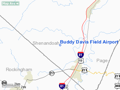
Buddy Davis Field Airport |
Location & QuickFacts
| FAA Information Effective: | 2008-09-25 |
| Airport Identifier: | VA86 |
| Airport Status: | Operational |
| Longitude/Latitude: | 078-42-23.0670W/38-41-21.4190N
-78.706407/38.689283 (Estimated) |
| Elevation: | 1042 ft / 317.60 m (Surveyed) |
| Land: | 0 acres |
| From nearest city: | 3 nautical miles NW of New Market, VA |
| Location: | Shenandoah County, VA |
| Magnetic Variation: | 08W (1985) |
Owner & Manager
| Ownership: | Privately owned |
| Address: |
|
| Manager: | Raymond J. Davis |
| Address: |
New Market, VA 22844 |
| Phone number: | 703-740-3227 |
Airport Operations and Facilities
| Airport Use: | Private |
| Wind indicator: | Yes |
| Segmented Circle: | No |
| Control Tower: | No |
| Landing fee charge: | No |
| Sectional chart: | Washington |
| Region: | AEA - Eastern |
| Boundary ARTCC: | ZDC - Washington |
| Tie-in FSS: | DCA - Leesburg |
| FSS on Airport: | No |
| FSS Toll Free: | 1-800-WX-BRIEF |
Airport Services
| Airframe Repair: | NONE |
| Power Plant Repair: | NONE |
Runway Information
Runway E/W
| Dimension: | 2200 x 130 ft / 670.6 x 39.6 m |
| Surface: | TURF, |
| |
Runway E |
Runway W |
| Traffic Pattern: | Left | Left |
|
Radio Navigation Aids
| ID |
Type |
Name |
Ch |
Freq |
Var |
Dist |
| LUA | NDB | Caverns | | 245.00 | 09W | 11.0 nm |
| VBW | NDB | Bridgewater | | 241.00 | 07W | 22.8 nm |
| TZ | NDB | Cogan | | 364.00 | 10W | 38.2 nm |
| MSQ | NDB | Nailr | | 351.00 | 10W | 40.2 nm |
| CJR | NDB | Culpeper | | 252.00 | 09W | 41.0 nm |
| AZS | NDB | Azalea Park | | 336.00 | 08W | 41.8 nm |
| GDX | NDB | Goodwin Lake | | 227.00 | 08W | 44.0 nm |
| ESL | VOR/DME | Kessel | 045X | 110.80 | 06W | 34.8 nm |
| LDN | VORTAC | Linden | 090X | 114.30 | 06W | 25.5 nm |
| CSN | VORTAC | Casanova | 110X | 116.30 | 06W | 39.6 nm |
| GVE | VORTAC | Gordonsville | 103X | 115.60 | 06W | 48.3 nm |
Remarks
- FILED FOR RECORD PURPOSES.
Images and information placed above are from
http://www.airport-data.com/airport/VA86/
We thank them for the data!
| General Info
|
| Country |
United States
|
| State |
VIRGINIA
|
| FAA ID |
VA86
|
| Latitude |
38-41-21.419N
|
| Longitude |
078-42-23.067W
|
| Elevation |
1042 feet
|
| Near City |
NEW MARKET
|
We don't guarantee the information is fresh and accurate. The data may
be wrong or outdated.
For more up-to-date information please refer to other sources.
|
|


