 |
|
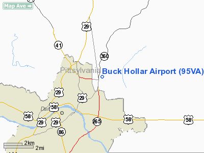
Location & QuickFacts
| FAA Information Effective: | 2008-09-25 |
| Airport Identifier: | 95VA |
| Airport Status: | Operational |
| Longitude/Latitude: | 079-21-21.0790W/36-37-23.4970N
-79.355855/36.623194 (Estimated) |
| Elevation: | 450 ft / 137.16 m (Estimated) |
| Land: | 3 acres |
| From nearest city: | 3 nautical miles NE of Danville, VA |
| Location: | Pittsylvania County, VA |
| Magnetic Variation: | 07W (1990) |
Owner & Manager
| Ownership: | Privately owned |
| Owner: | H Dan Davis |
| Address: | 3204 Old Richmond Rd
Danville, VA 24540 |
| Phone number: | 434-793-0410 |
| Manager: | H Dan Davis |
| Address: | 3204 Old Richmond Rd
Danville, VA 24540 |
| Phone number: | 434-793-0410 |
Airport Operations and Facilities
| Airport Use: | Private |
| Wind indicator: | Yes |
| Segmented Circle: | No |
| Control Tower: | No |
| Sectional chart: | Cincinnati |
| Region: | AEA - Eastern |
| Boundary ARTCC: | ZDC - Washington |
| Tie-in FSS: | DCA - Leesburg |
| FSS on Airport: | No |
| FSS Toll Free: | 1-800-WX-BRIEF |
Runway Information
Runway 17/35
| Dimension: | 1200 x 75 ft / 365.8 x 22.9 m |
| Surface: | TURF, |
| |
Runway 17 |
Runway 35 |
| Traffic Pattern: | Left | Left |
| Obstruction: | 100 ft trees, 200.0 ft from runway | 50 ft trees, 200.0 ft from runway |
|
Radio Navigation Aids
| ID |
Type |
Name |
Ch |
Freq |
Var |
Dist |
| OQA | FAN MARKER | Rockingham County | | | | 25.8 nm |
| SIF | NDB | Slammer | | 423.00 | 07W | 24.4 nm |
| UV | NDB | Bales | | 396.00 | 07W | 27.2 nm |
| HUR | NDB | Person | | 220.00 | 08W | 27.3 nm |
| LY | NDB | Bojar | | 385.00 | 08W | 38.8 nm |
| HB | NDB | Himun | | 361.00 | 08W | 40.3 nm |
| HXO | NDB | Huntsboro | | 271.00 | 07W | 40.6 nm |
| VIT | NDB | Vinton | | 277.00 | 06W | 43.1 nm |
| DAN | VOR | Danville | | 113.10 | 06W | 3.4 nm |
| SBV | VORTAC | South Boston | 041X | 110.40 | 05W | 16.8 nm |
| LYH | VORTAC | Lynchburg | 029X | 109.20 | 05W | 38.4 nm |
| GSO | VORTAC | Greensboro | 109X | 116.20 | 03W | 45.9 nm |
Remarks
- VFR DAYLIGHT USE ONLY; COORDINATION WITH DANVILLE MUNI ARPT; FOLLOW-ON FAA INSPECTION.
Images and information placed above are from
http://www.airport-data.com/airport/95VA/
We thank them for the data!
| General Info
|
| Country |
United States
|
| State |
VIRGINIA
|
| FAA ID |
95VA
|
| Latitude |
36-37-23.497N
|
| Longitude |
079-21-21.079W
|
| Elevation |
450 feet
|
| Near City |
DANVILLE
|
We don't guarantee the information is fresh and accurate. The data may
be wrong or outdated.
For more up-to-date information please refer to other sources.
|
|


