 |
|
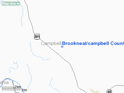
Brookneal/campbell County Airport |
| Brookneal/Campbell County Airport |
| IATA: none – ICAO: none – FAA LID: 0V4 |
| Summary |
| Operator |
Brookneal - Campbell County Airport Authority |
| Location |
Brookneal, Virginia |
| Elevation AMSL |
596 ft / 182 m |
| Coordinates |
37°08′30.20″N 78°00′59.00″W / 37.141722°N 78.01639°W / 37.141722; -78.01639 |
| Runways |
| Direction |
Length |
Surface |
| ft |
m |
| 6/24 |
3,798 |
1,158 |
Asphalt |
The Brookneal/Campbell County Airport (FAA 0V4) is a public airport located 6 miles (9.7 km) southeast of Brookneal, in Campbell County, Virginia, USA. Established in 1978 as a joint effort between Campbell County and the Town of Brookneal, the facility serves primarily general aviation.
The above content comes from Wikipedia and is published under free licenses – click here to read more.
Location & QuickFacts
| FAA Information Effective: | 2008-09-25 |
| Airport Identifier: | 0V4 |
| Airport Status: | Operational |
| Longitude/Latitude: | 079-00-59.0000W/37-08-30.2000N
-79.016389/37.141722 (Estimated) |
| Elevation: | 596 ft / 181.66 m (Estimated) |
| Land: | 295 acres |
| From nearest city: | 6 nautical miles NW of Brookneal, VA |
| Location: | Campbell County, VA |
| Magnetic Variation: | 09W (2000) |
Owner & Manager
| Ownership: | Publicly owned |
| Owner: | Brookneal/campbell Co. Auth |
| Address: | Po Box 342
Brookneal, VA 24528 |
| Phone number: | 434-376-6303 |
| Manager: | Larry Nash |
| Address: | 985 Juniper Cliff Road
Brookneal, VA 24528 |
| Phone number: | 434-376-3381 |
Airport Operations and Facilities
| Airport Use: | Open to public |
| Wind indicator: | Yes |
| Segmented Circle: | Yes |
| Control Tower: | No |
| Lighting Schedule: | DUSK-DAWN
MIRL RY 06/24 PRESET LOW; ACTVT HIGHER INTST - CTAF. |
| Beacon Color: | Clear-Green (lighted land airport) |
| Landing fee charge: | No |
| Sectional chart: | Cincinnati |
| Region: | AEA - Eastern |
| Boundary ARTCC: | ZDC - Washington |
| Tie-in FSS: | DCA - Leesburg |
| FSS on Airport: | No |
| FSS Toll Free: | 1-800-WX-BRIEF |
| NOTAMs Facility: | DCA (NOTAM-d service avaliable) |
| Federal Agreements: | NGY |
Airport Communications
| CTAF: | 122.700 |
| Unicom: | 122.700 |
Airport Services
Runway Information
Runway 06/24
| Dimension: | 3798 x 60 ft / 1157.6 x 18.3 m |
| Surface: | ASPH, |
| Weight Limit: | Single wheel: 12500 lbs. |
| Edge Lights: | Medium |
| |
Runway 06 |
Runway 24 |
| Longitude: | 079-01-17.7655W | 079-00-40.2132W |
| Latitude: | 37-08-18.9825N | 37-08-41.4835N |
| Elevation: | 596.00 ft | 589.00 ft |
| Alignment: | 53 | 127 |
| Traffic Pattern: | Left | Left |
| Markings: | Basic, Good Condition | Nonstandard, Good Condition
NO NON-PRECISION RY MARKINGS |
| Obstruction: | 80 ft tree, 2083.0 ft from runway, 219 ft right of centerline, 24:1 slope to clear | 58 ft tree, 1996.0 ft from runway, 213 ft left of centerline, 32:1 slope to clear |
|
Radio Navigation Aids
| ID |
Type |
Name |
Ch |
Freq |
Var |
Dist |
| LY | NDB | Bojar | | 385.00 | 08W | 13.1 nm |
| FVX | NDB | Farmville | | 367.00 | 07W | 30.4 nm |
| VIT | NDB | Vinton | | 277.00 | 06W | 41.6 nm |
| BKT | NDB | Blackstone | | 326.00 | 09W | 46.6 nm |
| DAN | VOR | Danville | | 113.10 | 06W | 37.7 nm |
| ODR | VOR | Woodrum | | 114.90 | 06W | 47.4 nm |
| MOL | VOR/DME | Montebello | 100X | 115.30 | 05W | 45.8 nm |
| LYH | VORTAC | Lynchburg | 029X | 109.20 | 05W | 12.5 nm |
| SBV | VORTAC | South Boston | 041X | 110.40 | 05W | 28.1 nm |
Remarks
- ULTRALGT ACTIVITY ON & INVOF ARPT.
- DETERMINATION PENDING.
Images and information placed above are from
http://www.airport-data.com/airport/0V4/
We thank them for the data!
| General Info
|
| Country |
United States
|
| State |
VIRGINIA
|
| FAA ID |
0V4
|
| Latitude |
37-08-30.200N
|
| Longitude |
079-00-59.000W
|
| Elevation |
596 feet
|
| Near City |
BROOKNEAL
|
We don't guarantee the information is fresh and accurate. The data may
be wrong or outdated.
For more up-to-date information please refer to other sources.
|
|


