 |
|
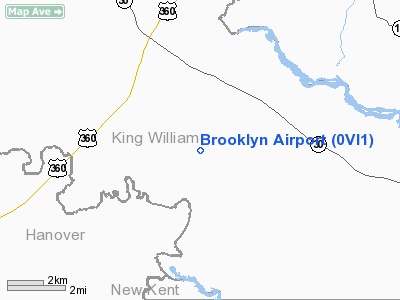
Location & QuickFacts
| FAA Information Effective: | 2008-09-25 |
| Airport Identifier: | 0VI1 |
| Airport Status: | Operational |
| Longitude/Latitude: | 077-06-05.0000W/37-41-20.0000N
-77.101389/37.688889 (Estimated) |
| Elevation: | 145 ft / 44.20 m (Estimated) |
| Land: | 273 acres |
| From nearest city: | 3 nautical miles E of Manquin, VA |
| Location: | King William County, VA |
| Magnetic Variation: | 10W (1995) |
Owner & Manager
| Ownership: | Privately owned |
| Owner: | John E Rouzie Jr |
| Address: | 121 Pineoint Rd
Williamsburg, VA 23185 |
| Phone number: | 757-880-4595 |
| Manager: | John E Rouzie Jr |
| Address: | 121 Pinepoint Rd
Williamsburg, VA 23185 |
| Phone number: | 757-220-1151 |
Airport Operations and Facilities
| Airport Use: | Private |
| Wind indicator: | Yes |
| Segmented Circle: | No |
| Control Tower: | No |
| Sectional chart: | Washington |
| Region: | AEA - Eastern |
| Boundary ARTCC: | ZDC - Washington |
| Tie-in FSS: | DCA - Leesburg |
| FSS Toll Free: | 1-800-WX-BRIEF |
Runway Information
Runway 05/23
| Dimension: | 3000 x 50 ft / 914.4 x 15.2 m |
| Surface: | TURF, |
| |
Runway 05 |
Runway 23 |
| Traffic Pattern: | Right | Left |
| Obstruction: | 50 ft tree, 800.0 ft from runway | 10 ft trees, 50.0 ft from runway |
|
Radio Navigation Aids
| ID |
Type |
Name |
Ch |
Freq |
Var |
Dist |
| LJK | NDB | Ashey | | 280.00 | 09W | 18.7 nm |
| APH | NDB | A P Hill | | 396.00 | 10W | 26.2 nm |
| CF | NDB | Pubbs | | 392.00 | 09W | 27.2 nm |
| EZF | NDB | Shannon | | 237.00 | 10W | 38.5 nm |
| FAF | NDB | Felker | | 226.00 | 08W | 40.3 nm |
| PTB | NDB | Petersburg | | 284.00 | 08W | 40.5 nm |
| IQK | NDB | Louisa | | 382.00 | 09W | 41.1 nm |
| AKQ | NDB | Wakefield | | 274.00 | 09W | 42.7 nm |
| PJS | NDB | Henry | | 375.00 | 09W | 44.3 nm |
| NHK | NDB | Patuxent | | 400.00 | 10W | 48.8 nm |
| RIC | VORTAC | Richmond | 088X | 114.10 | 09W | 15.3 nm |
| HPW | VORTAC | Hopewell | 057X | 112.00 | 06W | 21.7 nm |
| HCM | VORTAC | Harcum | 025X | 108.80 | 07W | 23.5 nm |
| FAK | VORTAC | Flat Rock | 080X | 113.30 | 06W | 35.9 nm |
| BRV | VORTAC | Brooke | 092X | 114.50 | 09W | 40.7 nm |
| PXT | VORTAC | Patuxent | 123X | 117.60 | 10W | 49.0 nm |
Remarks
- PRVDD VFR DAY OPNS ONLY, TREES ALONG RY SIDE REMOVED, LETTER OF AGREEMENT WITH HUNT AIRPORT REGARDING FLIGHT PATTERNS.
Images and information placed above are from
http://www.airport-data.com/airport/0VI1/
We thank them for the data!
| General Info
|
| Country |
United States
|
| State |
VIRGINIA
|
| FAA ID |
0VI1
|
| Latitude |
37-41-25.510N
|
| Longitude |
077-05-18.890W
|
| Elevation |
145 feet
|
| Near City |
MANQUIN
|
We don't guarantee the information is fresh and accurate. The data may
be wrong or outdated.
For more up-to-date information please refer to other sources.
|
|


