 |
|
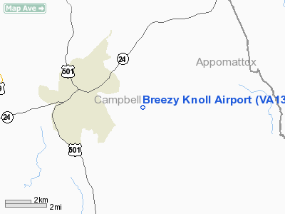
Location & QuickFacts
| FAA Information Effective: | 2008-09-25 |
| Airport Identifier: | VA13 |
| Airport Status: | Operational |
| Longitude/Latitude: | 079-02-34.0710W/37-15-55.5210N
-79.042798/37.265422 (Estimated) |
| Elevation: | 785 ft / 239.27 m (Estimated) |
| Land: | 5 acres |
| From nearest city: | 3 nautical miles SE of Rustburg, VA |
| Location: | Campbell County, VA |
| Magnetic Variation: | 07W (1985) |
Owner & Manager
| Ownership: | Privately owned |
| Owner: | Hubert Van Horn |
| Address: | Rt 2, Box 176
Rustburg, VA 24588 |
| Phone number: | 804-332-6408 |
| Manager: | Hubert Van Horn |
| Address: | Rt 2, Box 176
Rustburg, VA 24588 |
| Phone number: | 804-332-6408 |
Airport Operations and Facilities
| Airport Use: | Private |
| Wind indicator: | Yes |
| Segmented Circle: | No |
| Control Tower: | No |
| Sectional chart: | Detroit |
| Region: | AEA - Eastern |
| Boundary ARTCC: | ZDC - Washington |
| Tie-in FSS: | DCA - Leesburg |
| FSS Toll Free: | 1-800-WX-BRIEF |
Runway Information
Runway 05/23
| Dimension: | 2000 x 60 ft / 609.6 x 18.3 m |
| Surface: | TURF, |
| |
Runway 05 |
Runway 23 |
| Traffic Pattern: | Left | Left |
| Obstruction: | | 50 ft pline, 500.0 ft from runway |
|
Radio Navigation Aids
| ID |
Type |
Name |
Ch |
Freq |
Var |
Dist |
| LY | NDB | Bojar | | 385.00 | 08W | 9.6 nm |
| FVX | NDB | Farmville | | 367.00 | 07W | 29.4 nm |
| VIT | NDB | Vinton | | 277.00 | 06W | 40.3 nm |
| BKT | NDB | Blackstone | | 326.00 | 09W | 48.5 nm |
| DAN | VOR | Danville | | 113.10 | 06W | 44.2 nm |
| ODR | VOR | Woodrum | | 114.90 | 06W | 44.9 nm |
| MOL | VOR/DME | Montebello | 100X | 115.30 | 05W | 38.3 nm |
| LYH | VORTAC | Lynchburg | 029X | 109.20 | 05W | 9.3 nm |
| SBV | VORTAC | South Boston | 041X | 110.40 | 05W | 35.5 nm |
| ROA | VORTAC | Roanoke | 031X | 109.40 | 04W | 49.4 nm |
Images and information placed above are from
http://www.airport-data.com/airport/VA13/
We thank them for the data!
| General Info
|
| Country |
United States
|
| State |
VIRGINIA
|
| FAA ID |
VA13
|
| Latitude |
37-15-55.521N
|
| Longitude |
079-02-34.071W
|
| Elevation |
785 feet
|
| Near City |
RUSTBURG
|
We don't guarantee the information is fresh and accurate. The data may
be wrong or outdated.
For more up-to-date information please refer to other sources.
|
|


