 |
|
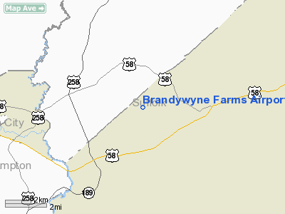
Location & QuickFacts
| FAA Information Effective: | 2008-09-25 |
| Airport Identifier: | 2VA8 |
| Airport Status: | Operational |
| Longitude/Latitude: | 076-49-47.8520W/36-41-01.5420N
-76.829959/36.683762 (Estimated) |
| Elevation: | 66 ft / 20.12 m (Estimated) |
| Land: | 0 acres |
| From nearest city: | 3 nautical miles W of Holland, VA |
| Location: | Suffolk County, VA |
| Magnetic Variation: | 09W (1985) |
Owner & Manager
| Ownership: | Privately owned |
| Owner: | Philip W. Wyne |
| Address: | 7457 Elwood Rd
Suffolk, VA |
| Phone number: | 804-857-6947 |
| Address: |
|
Airport Operations and Facilities
| Airport Use: | Private
PERSONAL USE. |
| Wind indicator: | Yes |
| Segmented Circle: | No |
| Control Tower: | No |
| Sectional chart: | Washington |
| Region: | AEA - Eastern |
| Boundary ARTCC: | ZDC - Washington |
| Tie-in FSS: | DCA - Leesburg |
| FSS on Airport: | No |
| FSS Toll Free: | 1-800-WX-BRIEF |
Runway Information
Runway 09/27
| Dimension: | 1400 x 25 ft / 426.7 x 7.6 m |
| Surface: | TURF, |
| |
Runway 09 |
Runway 27 |
| Traffic Pattern: | Left | Left |
| Displaced threshold: | 0.00 ft | 75.00 ft |
| Obstruction: | 40 ft trees, 100.0 ft from runway | |
|
Radio Navigation Aids
| ID |
Type |
Name |
Ch |
Freq |
Var |
Dist |
| RK | NDB | Waley | | 249.00 | 10W | 10.1 nm |
| PVG | NDB | Portsmouth | | 241.00 | 10W | 19.4 nm |
| AKQ | NDB | Wakefield | | 274.00 | 09W | 19.8 nm |
| EY | NDB | Chesi | | 233.00 | 09W | 22.2 nm |
| ASJ | NDB | Ahoskie | | 415.00 | 10W | 28.5 nm |
| ELQ | NDB | Emporia | | 261.00 | 10W | 29.0 nm |
| FAF | NDB | Felker | | 226.00 | 08W | 29.2 nm |
| PJS | NDB | Henry | | 375.00 | 09W | 31.5 nm |
| LLW | NDB | Woodville | | 254.00 | 10W | 36.1 nm |
| EDE | NDB | Edenton | | 265.00 | 10W | 41.6 nm |
| PTB | NDB | Petersburg | | 284.00 | 08W | 44.7 nm |
| RZZ | NDB | Rapids | | 407.00 | 08W | 44.8 nm |
| CF | NDB | Pubbs | | 392.00 | 09W | 49.2 nm |
| NGU | TACAN | Chambers | 048X | | 10W | 30.7 nm |
| LFI | TACAN | Langley | 070X | | 10W | 33.1 nm |
| NTU | TACAN | Oceana | 113X | | 10W | 39.1 nm |
| ECG | VOR/DME | Elizabeth City | 072X | 112.50 | 07W | 40.7 nm |
| FKN | VORTAC | Franklin | 043X | 110.60 | 09W | 9.0 nm |
| CVI | VORTAC | Cofield | 093X | 114.60 | 09W | 18.8 nm |
| ORF | VORTAC | Norfolk | 116X | 116.90 | 07W | 32.8 nm |
| HPW | VORTAC | Hopewell | 057X | 112.00 | 06W | 41.1 nm |
| HCM | VORTAC | Harcum | 025X | 108.80 | 07W | 46.3 nm |
Remarks
Images and information placed above are from
http://www.airport-data.com/airport/2VA8/
We thank them for the data!
| General Info
|
| Country |
United States
|
| State |
VIRGINIA
|
| FAA ID |
2VA8
|
| Latitude |
36-41-01.542N
|
| Longitude |
076-49-47.852W
|
| Elevation |
66 feet
|
| Near City |
HOLLAND
|
We don't guarantee the information is fresh and accurate. The data may
be wrong or outdated.
For more up-to-date information please refer to other sources.
|
|


