 |
|
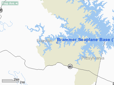
Brammer Seaplane Base Airport |
 |
(Click on the photo to enlarge) |
Location & QuickFacts
| FAA Information Effective: | 2008-09-25 |
| Airport Identifier: | 7VA7 |
| Airport Status: | Operational |
| Longitude/Latitude: | 079-41-59.1080W/37-02-00.5130N
-79.699752/37.033476 (Estimated) |
| Elevation: | 795 ft / 242.32 m (Estimated) |
| Land: | 0 acres |
| From nearest city: | 3 nautical miles NW of Union Hall, VA |
| Location: | Franklin County, VA |
| Magnetic Variation: | 07W (1985) |
Owner & Manager
| Ownership: | Privately owned |
| Owner: | Robert C. Brammer |
| Address: | 2386 Loch Haven Drive
Roanoke, VA 24019 |
| Phone number: | 703-366-8198 |
| Manager: | Robert C. Brammer |
| Address: | 2386 Loch Haven Drive
Roanoke, VA 24019 |
| Phone number: | 703-366-8198 |
Airport Operations and Facilities
| Airport Use: | Private |
| Wind indicator: | Yes |
| Segmented Circle: | No |
| Control Tower: | No |
| Landing fee charge: | No |
| Sectional chart: | Cincinnati |
| Region: | AEA - Eastern |
| Boundary ARTCC: | ZDC - Washington |
| Tie-in FSS: | DCA - Leesburg |
| FSS on Airport: | No |
| FSS Toll Free: | 1-800-WX-BRIEF |
Runway Information
Runway 15/33
| Dimension: | 4000 x 300 ft / 1219.2 x 91.4 m |
| Surface: | WATER, |
| |
Runway 15 |
Runway 33 |
| Traffic Pattern: | Left | Left |
|
Radio Navigation Aids
| ID |
Type |
Name |
Ch |
Freq |
Var |
Dist |
| OQA | FAN MARKER | Rockingham County | | | | 37.0 nm |
| VIT | NDB | Vinton | | 277.00 | 06W | 13.5 nm |
| LY | NDB | Bojar | | 385.00 | 08W | 25.8 nm |
| CNQ | NDB | Callahan | | 379.00 | 05W | 25.9 nm |
| UV | NDB | Bales | | 396.00 | 07W | 28.6 nm |
| TEC | NDB | Tech | | 368.00 | 06W | 35.3 nm |
| SIF | NDB | Slammer | | 423.00 | 07W | 39.3 nm |
| ODR | VOR | Woodrum | | 114.90 | 06W | 22.0 nm |
| DAN | VOR | Danville | | 113.10 | 06W | 32.9 nm |
| ROA | VORTAC | Roanoke | 031X | 109.40 | 04W | 25.7 nm |
| LYH | VORTAC | Lynchburg | 029X | 109.20 | 05W | 25.9 nm |
| SBV | VORTAC | South Boston | 041X | 110.40 | 05W | 39.4 nm |
| PSK | VORTAC | Pulaski | 115X | 116.80 | 06W | 48.7 nm |
Remarks
- PRVDD APROP TFC PATS ARE ESTABD AS RCMDD BY THE ROANOKE ATCT.
Images and information placed above are from
http://www.airport-data.com/airport/7VA7/
We thank them for the data!
| General Info
|
| Country |
United States
|
| State |
VIRGINIA
|
| FAA ID |
7VA7
|
| Latitude |
37-02-00.513N
|
| Longitude |
079-41-59.108W
|
| Elevation |
795 feet
|
| Near City |
UNION HALL
|
We don't guarantee the information is fresh and accurate. The data may
be wrong or outdated.
For more up-to-date information please refer to other sources.
|
|


