 |
|
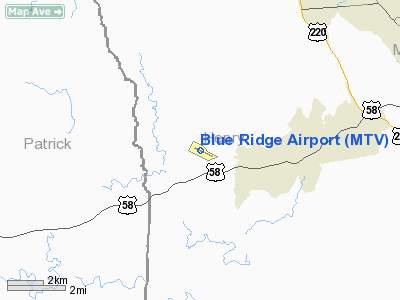
Location & QuickFacts
| FAA Information Effective: | 2008-09-25 |
| Airport Identifier: | MTV |
| Airport Status: | Operational |
| Longitude/Latitude: | 080-01-06.0000W/36-37-50.7000N
-80.018333/36.630750 (Estimated) |
| Elevation: | 941 ft / 286.82 m (Surveyed) |
| Land: | 270 acres |
| From nearest city: | 8 nautical miles SW of Martinsville, VA |
| Location: | Henry County, VA |
| Magnetic Variation: | 07W (1995) |
Owner & Manager
| Ownership: | Publicly owned |
| Owner: | Blue Ridge Arpt Auth |
| Address: | 525 Airport Road
Martinsville, VA 24112 |
| Phone number: | 276-957-2291 |
| Manager: | Jason Davis |
| Address: | 525 Airport Road
Martinsville, VA 24112 |
| Phone number: | 276-957-2291
MANAGER'S CELL: 276-358-0749 |
Airport Operations and Facilities
| Airport Use: | Open to public |
| Wind indicator: | Yes |
| Segmented Circle: | Yes |
| Control Tower: | No |
| Lighting Schedule: | DUSK-DAWN
ACTVT MIRL RY 12/30; PAPI RYS 12 & 30; REIL RYS 12/30 AND ODALS RY 30 - CTAF. |
| Beacon Color: | Clear-Green (lighted land airport) |
| Landing fee charge: | No |
| Sectional chart: | Cincinnati |
| Region: | AEA - Eastern |
| Boundary ARTCC: | ZDC - Washington |
| Responsible ARTCC: | ZTL - Atlanta |
| Tie-in FSS: | DCA - Leesburg |
| FSS on Airport: | No |
| FSS Toll Free: | 1-800-WX-BRIEF |
| NOTAMs Facility: | MTV (NOTAM-d service avaliable) |
| Federal Agreements: | NGY |
Airport Communications
| CTAF: | 122.700 |
| Unicom: | 122.700 |
Airport Services
| Fuel available: | 100LLA |
| Airframe Repair: | MAJOR |
| Power Plant Repair: | MAJOR |
| Bottled Oxygen: | HIGH/LOW |
| Bulk Oxygen: | HIGH/LOW |
Runway Information
Runway 12/30
| Dimension: | 5002 x 100 ft / 1524.6 x 30.5 m |
| Surface: | ASPH, Good Condition |
| Surface Treatment: | Saw-cut or plastic Grooved |
| Weight Limit: | Single wheel: 30000 lbs.
Dual wheel: 45000 lbs. |
| Edge Lights: | Medium |
| |
Runway 12 |
Runway 30 |
| Longitude: | 080-01-33.0620W | 080-00-38.9752W |
| Latitude: | 36-38-02.3955N | 36-37-39.0262N |
| Elevation: | 941.00 ft | 912.00 ft |
| Alignment: | 118 | 127 |
| ILS Type: | | LOC/DME
|
| Traffic Pattern: | Left | Left |
| Markings: | Non-precision instrument, Good Condition | Non-precision instrument, Good Condition |
| Crossing Height: | 40.00 ft | 40.00 ft |
| VASI: | 4-light PAPI on left side | 4-light PAPI on left side |
| Visual Glide Angle: | 3.00° | 3.00° |
| Approach lights: | | ODALS |
| Runway End Identifier: | Yes | Yes |
| Obstruction: | 44 ft tree, 1914.0 ft from runway, 432 ft right of centerline, 38:1 slope to clear | 85 ft trees, 1552.0 ft from runway, 434 ft right of centerline, 15:1 slope to clear |
|
Radio Navigation Aids
| ID |
Type |
Name |
Ch |
Freq |
Var |
Dist |
| OQA | FAN MARKER | Rockingham County | | | | 15.3 nm |
| UV | NDB | Bales | | 396.00 | 07W | 5.5 nm |
| SIF | NDB | Slammer | | 423.00 | 07W | 19.4 nm |
| AZW | NDB | Mount Airy | | 223.00 | 07W | 29.3 nm |
| VIT | NDB | Vinton | | 277.00 | 06W | 35.1 nm |
| CNQ | NDB | Callahan | | 379.00 | 05W | 38.5 nm |
| ZEF | NDB | Zephyr | | 326.00 | 05W | 39.1 nm |
| TEC | NDB | Tech | | 368.00 | 06W | 39.4 nm |
| HLX | NDB | Hillsville | | 269.00 | 06W | 39.5 nm |
| HB | NDB | Himun | | 361.00 | 08W | 44.5 nm |
| DVZ | NDB | Davie | | 354.00 | 06W | 48.1 nm |
| DAN | VOR | Danville | | 113.10 | 06W | 33.1 nm |
| ODR | VOR | Woodrum | | 114.90 | 06W | 41.7 nm |
| GSO | VORTAC | Greensboro | 109X | 116.20 | 03W | 35.2 nm |
| ROA | VORTAC | Roanoke | 031X | 109.40 | 04W | 42.9 nm |
| PSK | VORTAC | Pulaski | 115X | 116.80 | 06W | 43.2 nm |
| SBV | VORTAC | South Boston | 041X | 110.40 | 05W | 48.5 nm |
Remarks
Images and information placed above are from
http://www.airport-data.com/airport/MTV/
We thank them for the data!
| General Info
|
| Country |
United States
|
| State |
VIRGINIA
|
| FAA ID |
MTV
|
| Latitude |
36-37-50.695N
|
| Longitude |
080-01-06.057W
|
| Elevation |
941 feet
|
| Near City |
MARTINSVILLE
|
We don't guarantee the information is fresh and accurate. The data may
be wrong or outdated.
For more up-to-date information please refer to other sources.
|
|


