 |
|
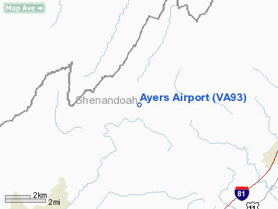
Location & QuickFacts
| FAA Information Effective: | 2008-09-25 |
| Airport Identifier: | VA93 |
| Airport Status: | Operational |
| Longitude/Latitude: | 078-39-17.0550W/38-54-18.3990N
-78.654737/38.905111 (Estimated) |
| Elevation: | 1340 ft / 408.43 m (Estimated) |
| Land: | 0 acres |
| From nearest city: | 2 nautical miles NW of Columbia Furnace, VA |
| Location: | Shenandoah County, VA |
| Magnetic Variation: | 08W (1985) |
Owner & Manager
| Ownership: | Privately owned |
| Owner: | John T. Ayers |
| Address: | Rt 1 Box 345a
Edinburg, VA 22824 |
| Phone number: | 202-606-3600 |
| Address: |
|
| Phone number: | 703-984-8357 |
Airport Operations and Facilities
| Airport Use: | Private |
| Wind indicator: | Yes |
| Segmented Circle: | No |
| Control Tower: | No |
| Sectional chart: | Washington |
| Region: | AEA - Eastern |
| Boundary ARTCC: | ZDC - Washington |
| Tie-in FSS: | DCA - Leesburg |
| FSS on Airport: | No |
| FSS Toll Free: | 1-800-WX-BRIEF |
Runway Information
Runway 01/19
| Dimension: | 2100 x 100 ft / 640.1 x 30.5 m |
| Surface: | TURF, |
| |
Runway 01 |
Runway 19 |
| Traffic Pattern: | Left | Left |
|
Runway 16/34
| Dimension: | 1500 x 60 ft / 457.2 x 18.3 m |
| Surface: | TURF, |
| |
Runway 16 |
Runway 34 |
| Traffic Pattern: | Left | Left |
|
Radio Navigation Aids
| ID |
Type |
Name |
Ch |
Freq |
Var |
Dist |
| LUA | NDB | Caverns | | 245.00 | 09W | 15.0 nm |
| TZ | NDB | Cogan | | 364.00 | 10W | 29.5 nm |
| VBW | NDB | Bridgewater | | 241.00 | 07W | 35.5 nm |
| GDX | NDB | Goodwin Lake | | 227.00 | 08W | 38.6 nm |
| CJR | NDB | Culpeper | | 252.00 | 09W | 43.6 nm |
| MSQ | NDB | Nailr | | 351.00 | 10W | 44.4 nm |
| CBE | NDB | Cumberland | | 317.00 | 07W | 44.9 nm |
| ESL | VOR/DME | Kessel | 045X | 110.80 | 06W | 24.8 nm |
| GRV | VOR/DME | Grantsville | 070X | 112.30 | 06W | 47.6 nm |
| LDN | VORTAC | Linden | 090X | 114.30 | 06W | 21.2 nm |
| CSN | VORTAC | Casanova | 110X | 116.30 | 06W | 40.2 nm |
| MRB | VORTAC | Martinsburg | 058X | 112.10 | 07W | 47.4 nm |
Remarks
- OWNER DESIRES ARPT NOT BE CHARTED.
- PRVDD VFR.
Images and information placed above are from
http://www.airport-data.com/airport/VA93/
We thank them for the data!
| General Info
|
| Country |
United States
|
| State |
VIRGINIA
|
| FAA ID |
VA93
|
| Latitude |
38-54-18.399N
|
| Longitude |
078-39-17.055W
|
| Elevation |
1340 feet
|
| Near City |
COLUMBIA FURNACE
|
We don't guarantee the information is fresh and accurate. The data may
be wrong or outdated.
For more up-to-date information please refer to other sources.
|
|


