 |
|
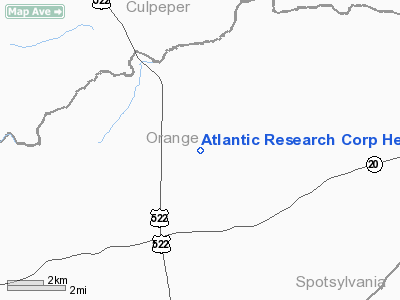
Atlantic Research Corp Heliport |
Location & QuickFacts
| FAA Information Effective: | 2008-09-25 |
| Airport Identifier: | 6VA1 |
| Airport Status: | Operational |
| Longitude/Latitude: | 077-55-52.9860W/38-18-35.4710N
-77.931385/38.309853 (Estimated) |
| Elevation: | 434 ft / 132.28 m (Estimated) |
| Land: | 0 acres |
| From nearest city: | 9 nautical miles E of Orange, VA |
| Location: | Orange County, VA |
| Magnetic Variation: | 09W (1990) |
Owner & Manager
| Ownership: | Privately owned |
| Owner: | Atlantic Research Corporation |
| Address: | 7499 Pine Stake Rd
Culpeper, VA 22701 |
| Phone number: | 703-854-2012 |
| Manager: | Ellis R. Jensen
PLANT MGR. |
| Address: | 7499 Pine Stake Rd
Culpeper, VA 22701 |
| Phone number: | 703-854-2012 |
Airport Operations and Facilities
| Airport Use: | Private |
| Wind indicator: | Yes |
| Segmented Circle: | No |
| Control Tower: | No |
| Lighting Schedule: | PHONE REQ
FOR PERIMETER LGTS CALL PLANT SECURITY ON 703-854-2020. |
| Sectional chart: | Washington |
| Region: | AEA - Eastern |
| Boundary ARTCC: | ZDC - Washington |
| Tie-in FSS: | DCA - Leesburg |
| FSS on Airport: | No |
| FSS Toll Free: | 1-800-WX-BRIEF |
Runway Information
Helipad H1
| Dimension: | 25 x 25 ft / 7.6 x 7.6 m |
| Surface: | CONC, |
| |
Runway H1 |
Runway |
| Traffic Pattern: | Left | Left |
|
Radio Navigation Aids
| ID |
Type |
Name |
Ch |
Freq |
Var |
Dist |
| MSQ | NDB | Nailr | | 351.00 | 10W | 8.8 nm |
| CJR | NDB | Culpeper | | 252.00 | 09W | 13.7 nm |
| IQK | NDB | Louisa | | 382.00 | 09W | 17.7 nm |
| EZF | NDB | Shannon | | 237.00 | 10W | 22.8 nm |
| APH | NDB | A P Hill | | 396.00 | 10W | 31.6 nm |
| AZS | NDB | Azalea Park | | 336.00 | 08W | 33.1 nm |
| LUA | NDB | Caverns | | 245.00 | 09W | 34.6 nm |
| LJK | NDB | Ashey | | 280.00 | 09W | 38.7 nm |
| GDX | NDB | Goodwin Lake | | 227.00 | 08W | 39.0 nm |
| TZ | NDB | Cogan | | 364.00 | 10W | 47.1 nm |
| VBW | NDB | Bridgewater | | 241.00 | 07W | 48.7 nm |
| CSN | VORTAC | Casanova | 110X | 116.30 | 06W | 20.2 nm |
| GVE | VORTAC | Gordonsville | 103X | 115.60 | 06W | 20.7 nm |
| BRV | VORTAC | Brooke | 092X | 114.50 | 09W | 27.3 nm |
| LDN | VORTAC | Linden | 090X | 114.30 | 06W | 35.2 nm |
| AML | VORTAC | Armel | 082X | 113.50 | 08W | 43.4 nm |
| FAK | VORTAC | Flat Rock | 080X | 113.30 | 06W | 47.2 nm |
Remarks
- PRVDD THAT OPERATED UNDER VFR CONDITIONS ONLY.
Images and information placed above are from
http://www.airport-data.com/airport/6VA1/
We thank them for the data!
| General Info
|
| Country |
United States
|
| State |
VIRGINIA
|
| FAA ID |
6VA1
|
| Latitude |
38-18-35.471N
|
| Longitude |
077-55-52.986W
|
| Elevation |
434 feet
|
| Near City |
ORANGE
|
We don't guarantee the information is fresh and accurate. The data may
be wrong or outdated.
For more up-to-date information please refer to other sources.
|
|


