 |
|
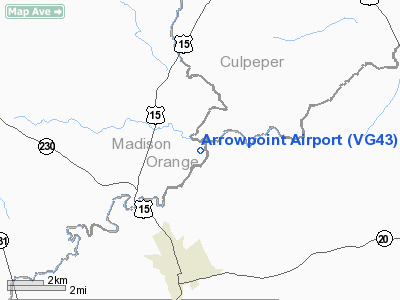
Location & QuickFacts
| FAA Information Effective: | 2008-09-25 |
| Airport Identifier: | VG43 |
| Airport Status: | Operational |
| Longitude/Latitude: | 078-05-56.0000W/38-18-23.0000N
-78.098889/38.306389 (Estimated) |
| Elevation: | 315 ft / 96.01 m () |
| Land: | 12 acres |
| From nearest city: | 8 nautical miles W of Madison, VA |
| Location: | Madison County, VA |
| Magnetic Variation: | 10W (2000) |
Owner & Manager
| Ownership: | Privately owned |
| Owner: | William W Sanford |
| Address: | P.o. Box 117, Rt. 1
Orange, VA 22960 |
| Phone number: | 540-672-5236 |
| Manager: | William W Sanford |
| Address: | P.o. Box 117, Rt. 1
Orange, VA 22960 |
| Phone number: | 540-672-5236 |
Airport Operations and Facilities
| Airport Use: | Private |
| Wind indicator: | Yes |
| Segmented Circle: | No |
| Control Tower: | No |
| Sectional chart: | Washington |
| Region: | AEA - Eastern |
| Boundary ARTCC: | ZDC - Washington |
| Tie-in FSS: | DCA - Leesburg |
| FSS Toll Free: | 1-800-WX-BRIEF |
Runway Information
Runway 13/31
| Dimension: | 1125 x 60 ft / 342.9 x 18.3 m |
| Surface: | TURF, |
| |
Runway 13 |
Runway 31 |
| Traffic Pattern: | Left | Left |
| Obstruction: | 60 ft trees, 700.0 ft from runway | 20 ft bldg, 100.0 ft from runway |
|
Radio Navigation Aids
| ID |
Type |
Name |
Ch |
Freq |
Var |
Dist |
| MSQ | NDB | Nailr | | 351.00 | 10W | 12.7 nm |
| CJR | NDB | Culpeper | | 252.00 | 09W | 17.6 nm |
| IQK | NDB | Louisa | | 382.00 | 09W | 20.6 nm |
| AZS | NDB | Azalea Park | | 336.00 | 08W | 26.6 nm |
| LUA | NDB | Caverns | | 245.00 | 09W | 29.4 nm |
| EZF | NDB | Shannon | | 237.00 | 10W | 30.7 nm |
| APH | NDB | A P Hill | | 396.00 | 10W | 38.8 nm |
| VBW | NDB | Bridgewater | | 241.00 | 07W | 40.8 nm |
| GDX | NDB | Goodwin Lake | | 227.00 | 08W | 40.9 nm |
| LJK | NDB | Ashey | | 280.00 | 09W | 43.4 nm |
| TZ | NDB | Cogan | | 364.00 | 10W | 46.9 nm |
| GVE | VORTAC | Gordonsville | 103X | 115.60 | 06W | 17.8 nm |
| CSN | VORTAC | Casanova | 110X | 116.30 | 06W | 22.9 nm |
| LDN | VORTAC | Linden | 090X | 114.30 | 06W | 33.3 nm |
| BRV | VORTAC | Brooke | 092X | 114.50 | 09W | 35.2 nm |
| AML | VORTAC | Armel | 082X | 113.50 | 08W | 48.0 nm |
| FAK | VORTAC | Flat Rock | 080X | 113.30 | 06W | 48.5 nm |
Remarks
- PRVDD VFR; CLEAR PRIMARY SFC; CLEAR 20:1 APCH/DEP PATH; OPERATE IN MANNER TO MINIMIZE NOISE.
Images and information placed above are from
http://www.airport-data.com/airport/VG43/
We thank them for the data!
| General Info
|
| Country |
United States
|
| State |
VIRGINIA
|
| FAA ID |
VG43
|
| Latitude |
38-18-23.000N
|
| Longitude |
078-05-56.000W
|
| Elevation |
315 feet
|
| Near City |
MADISON
|
We don't guarantee the information is fresh and accurate. The data may
be wrong or outdated.
For more up-to-date information please refer to other sources.
|
|


