 |
|
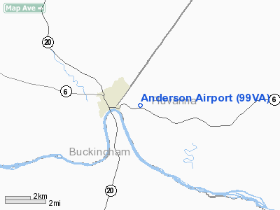
Location & QuickFacts
| FAA Information Effective: | 2008-09-25 |
| Airport Identifier: | 99VA |
| Airport Status: | Operational |
| Longitude/Latitude: | 078-28-00.0000W/37-48-00.0000N
-78.466667/37.800000 (Estimated) |
| Elevation: | 450 ft / 137.16 m (Estimated) |
| Land: | 3 acres |
| From nearest city: | 2 nautical miles NE of Scottsville, VA |
| Location: | Fluvanna County, VA |
| Magnetic Variation: | 09W (1995) |
Owner & Manager
| Ownership: | Privately owned |
| Owner: | Howard H. Anderson |
| Address: | Route 5, P.o. Box 671a
Scottsville, VA 24590 |
| Phone number: | 804-286-2969 |
| Manager: | Howard H. Anderson |
| Address: | Route 5, P.o. Box 671a
Scottsville, VA 24590 |
| Phone number: | 804-286-2969 |
Airport Operations and Facilities
| Airport Use: | Private |
| Wind indicator: | Yes |
| Segmented Circle: | No |
| Control Tower: | No |
| Sectional chart: | Washington |
| Region: | AEA - Eastern |
| Boundary ARTCC: | ZDC - Washington |
| Tie-in FSS: | DCA - Leesburg |
| FSS on Airport: | No |
| FSS Toll Free: | 1-800-WX-BRIEF |
Runway Information
Runway 05/23
| Dimension: | 2400 x 40 ft / 731.5 x 12.2 m |
| Surface: | TURF, Good Condition |
| |
Runway 05 |
Runway 23 |
| Traffic Pattern: | Left | Left |
| Obstruction: | 50 ft trees, 300.0 ft from runway | |
|
Radio Navigation Aids
| ID |
Type |
Name |
Ch |
Freq |
Var |
Dist |
| AZS | NDB | Azalea Park | | 336.00 | 08W | 12.9 nm |
| FVX | NDB | Farmville | | 367.00 | 07W | 26.9 nm |
| IQK | NDB | Louisa | | 382.00 | 09W | 31.7 nm |
| VBW | NDB | Bridgewater | | 241.00 | 07W | 41.3 nm |
| BKT | NDB | Blackstone | | 326.00 | 09W | 45.2 nm |
| LJK | NDB | Ashey | | 280.00 | 09W | 46.9 nm |
| MSQ | NDB | Nailr | | 351.00 | 10W | 47.5 nm |
| LY | NDB | Bojar | | 385.00 | 08W | 49.1 nm |
| MOL | VOR/DME | Montebello | 100X | 115.30 | 05W | 31.0 nm |
| GVE | VORTAC | Gordonsville | 103X | 115.60 | 06W | 19.7 nm |
| FAK | VORTAC | Flat Rock | 080X | 113.30 | 06W | 34.5 nm |
| LYH | VORTAC | Lynchburg | 029X | 109.20 | 05W | 49.2 nm |
Remarks
- PRVDD DALGT OPNS ONLY; NO IFR OPNS; 20:1 APCH; NO COM DEVICES BE USED.
Images and information placed above are from
http://www.airport-data.com/airport/99VA/
We thank them for the data!
| General Info
|
| Country |
United States
|
| State |
VIRGINIA
|
| FAA ID |
99VA
|
| Latitude |
37-48-00.000N
|
| Longitude |
078-28-00.000W
|
| Elevation |
450 feet
|
| Near City |
SCOTTSVILLE
|
We don't guarantee the information is fresh and accurate. The data may
be wrong or outdated.
For more up-to-date information please refer to other sources.
|
|


