 |
|
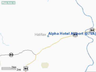
Location & QuickFacts
| FAA Information Effective: | 2008-09-25 |
| Airport Identifier: | 07VA |
| Airport Status: | Operational |
| Longitude/Latitude: | 078-46-59.0240W/36-49-10.5010N
-78.783062/36.819584 (Estimated) |
| Elevation: | 350 ft / 106.68 m (Estimated) |
| Land: | 6 acres |
| From nearest city: | 2 nautical miles W of Clover, VA |
| Location: | Halifax County, VA |
| Magnetic Variation: | 07W (1985) |
Owner & Manager
| Ownership: | Privately owned |
| Owner: | James G. Smiley |
| Address: | Rt 1, Box 26a
Clover, VA 24534 |
| Phone number: | 804-454-6729 |
| Manager: | James G. Smiley |
| Address: | Rt 1, Box 26a
Clover, VA 24534 |
| Phone number: | 804-454-6729 |
Airport Operations and Facilities
| Airport Use: | Private |
| Segmented Circle: | No |
| Control Tower: | No |
| Landing fee charge: | No |
| Sectional chart: | Washington |
| Region: | AEA - Eastern |
| Boundary ARTCC: | ZDC - Washington |
| Tie-in FSS: | DCA - Leesburg |
| FSS on Airport: | No |
| FSS Toll Free: | 1-800-WX-BRIEF |
Runway Information
Runway 16/34
| Dimension: | 1600 x 50 ft / 487.7 x 15.2 m |
| Surface: | TURF, |
| |
Runway 16 |
Runway 34 |
| Traffic Pattern: | Left | Right |
|
Radio Navigation Aids
| ID |
Type |
Name |
Ch |
Freq |
Var |
Dist |
| HXO | NDB | Huntsboro | | 271.00 | 07W | 32.2 nm |
| LY | NDB | Bojar | | 385.00 | 08W | 34.6 nm |
| MBV | NDB | Mecklenburg/dcmsnd | | 356.00 | 08W | 35.8 nm |
| FVX | NDB | Farmville | | 367.00 | 07W | 36.1 nm |
| AEA | NDB | Jones | | 373.00 | 09W | 37.3 nm |
| HUR | NDB | Person | | 220.00 | 08W | 37.8 nm |
| BKT | NDB | Blackstone | | 326.00 | 09W | 40.0 nm |
| DAN | VOR | Danville | | 113.10 | 06W | 30.6 nm |
| SBV | VORTAC | South Boston | 041X | 110.40 | 05W | 14.1 nm |
| LYH | VORTAC | Lynchburg | 029X | 109.20 | 05W | 34.0 nm |
| LVL | VORTAC | Lawrenceville | 076X | 112.90 | 08W | 42.3 nm |
Remarks
- ARPT IS LIMITED TO PRIVATE USE; USERS ARE MADE AWARE THAT AIRPORT IS IN CLOSE PROXIMITY TO MILITARY HIGH SPEED LOW ALTITUDE TRAINING ROUTES.
Images and information placed above are from
http://www.airport-data.com/airport/07VA/
We thank them for the data!
| General Info
|
| Country |
United States
|
| State |
VIRGINIA
|
| FAA ID |
07VA
|
| Latitude |
36-49-10.501N
|
| Longitude |
078-46-59.024W
|
| Elevation |
350 feet
|
| Near City |
CLOVER
|
We don't guarantee the information is fresh and accurate. The data may
be wrong or outdated.
For more up-to-date information please refer to other sources.
|
|


