 |
|
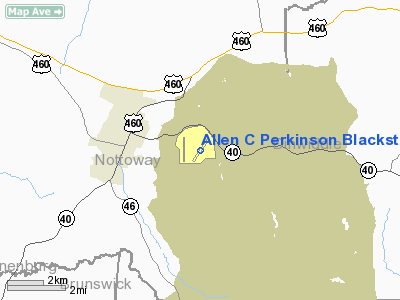
Allen C Perkinson Blackstone Aaf Airport |
Location & QuickFacts
| FAA Information Effective: | 2008-09-25 |
| Airport Identifier: | BKT |
| Airport Status: | Operational |
| Longitude/Latitude: | 077-57-08.9740W/37-04-26.2040N
-77.952493/37.073946 (Estimated) |
| Elevation: | 439 ft / 133.81 m (Estimated) |
| Land: | 600 acres |
| From nearest city: | 2 nautical miles E of Blackstone, VA |
| Location: | Nottoway County, VA |
| Magnetic Variation: | 09W (2000) |
Owner & Manager
| Ownership: | Publicly owned |
| Owner: | Town Of Blackstone & Us Army
C/O LARRY PALMORE. |
| Address: | 100 W Elm St
Blackstone, VA 23824 |
| Phone number: | 434-292-7251 |
| Manager: | Gary Watts |
| Address: | 100 W Elm St
Blackstone, VA 23824 |
| Phone number: | 434-292-2193
ALTERNATE PHONE 434-292-2116. |
Airport Operations and Facilities
| Airport Use: | Open to public |
| Wind indicator: | Yes |
| Segmented Circle: | Yes |
| Control Tower: | Yes |
| Lighting Schedule: | DUSK-DAWN
WHEN ATCT CLSD ACTVT MIRL RY 04/22 - CTAF. |
| Beacon Color: | Clear-Green (lighted land airport) |
| Landing fee charge: | No |
| Sectional chart: | Washington |
| Region: | AEA - Eastern |
| Boundary ARTCC: | ZDC - Washington |
| Tie-in FSS: | DCA - Leesburg |
| FSS on Airport: | No |
| FSS Toll Free: | 1-800-WX-BRIEF |
| NOTAMs Facility: | DCA (NOTAM-d service avaliable) |
| Federal Agreements: | 3 |
Airport Communications
| CTAF: | 122.950 |
| Unicom: | 122.950 |
Airport Services
| Fuel available: | 100LLA |
| Airframe Repair: | NONE |
| Power Plant Repair: | NONE |
| Bottled Oxygen: | NONE |
| Bulk Oxygen: | NONE |
Runway Information
Runway 01/19
| Dimension: | 4032 x 75 ft / 1229.0 x 22.9 m |
| Surface: | CONC, Poor Condition
PAVEMENT CRACKED, SPALLING, AND HAS FOD ENTIRE LENGTH. USED BY STATE POLICE FOR VEHICLE DEFENSIVE DRIVING AT VARIOUS TIMES REQUIRING TEMP CLOSURE OF RY. |
| Pavement Class: | 1 /R/D/W/T |
| |
Runway 01 |
Runway 19 |
| Longitude: | 077-57-46.8720W | 077-57-46.1370W |
| Latitude: | 37-04-09.3470N | 37-04-49.1970N |
| Elevation: | 417.00 ft | 426.00 ft |
| Alignment: | 1 | 127 |
| Traffic Pattern: | Left | Right |
| Markings: | Basic, Poor Condition
RY MARKINGS ARE FADED. | Basic, Poor Condition
RUNWAY MARKINGS ARE FADED. |
| Obstruction: | 67 ft tree, 2293.0 ft from runway, 157 ft left of centerline, 31:1 slope to clear | , 50:1 slope to clear |
|
Runway 04/22
| Dimension: | 4632 x 150 ft / 1411.8 x 45.7 m |
| Surface: | CONC, Good Condition
PAVEMENT CRACKED, SPALLING, AND HAS FOD ENTIRE LENGTH. USED BY STATE POLICE FOR VEHICLE DEFENSIVE DRIVING AT VARIOUS TIMES REQUIRING TEMP CLOSURE OF RY. |
| Pavement Class: | 64 /R/C/W/T |
| Edge Lights: | Medium |
| |
Runway 04 |
Runway 22 |
| Longitude: | 077-57-25.1920W | 077-56-52.7750W |
| Latitude: | 37-04-07.3690N | 37-04-45.0930N |
| Elevation: | 401.00 ft | 438.00 ft |
| Alignment: | 35 | 127 |
| Traffic Pattern: | Left | Left |
| Markings: | Non-precision instrument, Poor Condition
RY MARKINGS ARE FADED. | Non-precision instrument, Poor Condition
RY MARKINGS ARE FADED. |
| Displaced threshold: | 0.00 ft | 700.00 ft |
| Obstruction: | 42 ft tree, 2056.0 ft from runway, 262 ft right of centerline, 44:1 slope to clear | 42 ft tree, 1038.0 ft from runway, 177 ft left of centerline, 19:1 slope to clear
OBSTRUCTION CLEARANCE 36:1 AT DISPLACED THRESHOLD. |
|
Radio Navigation Aids
| ID |
Type |
Name |
Ch |
Freq |
Var |
Dist |
| BKT | NDB | Blackstone | | 326.00 | 09W | 5.5 nm |
| PTB | NDB | Petersburg | | 284.00 | 08W | 18.4 nm |
| MBV | NDB | Mecklenburg/dcmsnd | | 356.00 | 08W | 23.5 nm |
| AEA | NDB | Jones | | 373.00 | 09W | 28.0 nm |
| CF | NDB | Pubbs | | 392.00 | 09W | 28.5 nm |
| FVX | NDB | Farmville | | 367.00 | 07W | 28.7 nm |
| ELQ | NDB | Emporia | | 261.00 | 10W | 37.3 nm |
| RZZ | NDB | Rapids | | 407.00 | 08W | 39.8 nm |
| AKQ | NDB | Wakefield | | 274.00 | 09W | 46.0 nm |
| LJK | NDB | Ashey | | 280.00 | 09W | 47.7 nm |
| LVL | VORTAC | Lawrenceville | 076X | 112.90 | 08W | 15.6 nm |
| FAK | VORTAC | Flat Rock | 080X | 113.30 | 06W | 28.0 nm |
| RIC | VORTAC | Richmond | 088X | 114.10 | 09W | 39.7 nm |
| HPW | VORTAC | Hopewell | 057X | 112.00 | 06W | 42.9 nm |
Remarks
- C-130 AND C-17 PPR FOR LANDING RWY 04/22 CALL 434-292-2193.
- AVOID FLIGHT OVER AMMUNITION SUPPLY POINT.
- MILITARY AIRCRAFT CONTACT RANGE OPERATIONS.
- RESTRICTED 24 HOUR PPR DSN 438-2193 FOR LANDING AT POST HELIPADS.
- RY 04/22 PPR AND RY CONDITION CALL 434-292-2193.
- RY 22 HAS 700 FT RELCTD THLD; RY 04 HAS 700 FT FULL LOAD BEARING OVRN/HIGH SPEED TWY.
- CTC PTS DIV FT PICKETT 804-292-8534 OR 804-292-8506.
- JET AND MIL TRNG WITHIN 20 NM RADIUS.EXTN C130 TFC AND FREQ PRCHT DROPS.
- LDG RY 01 & TKOF RY 19 NOT AUTHORIZED.
- MILITARY OPR CALL C 434-292-2193/2116.
- RWY 04/22 PPR AND RWY CONDITION CALL 434-292-2193.
- RWY 01/19 RESTRICTED TO DAYTIME USE ONLY. EXTENSIVE FOD.
- IN OPERATION PRIOR 1959
Images and information placed above are from
http://www.airport-data.com/airport/BKT/
We thank them for the data!
| General Info
|
| Country |
United States
|
| State |
VIRGINIA
|
| FAA ID |
BKT
|
| Latitude |
37-04-27.100N
|
| Longitude |
077-57-27.100W
|
| Elevation |
439 feet
|
| Near City |
BLACKSTONE
|
We don't guarantee the information is fresh and accurate. The data may
be wrong or outdated.
For more up-to-date information please refer to other sources.
|
|


