 |
|
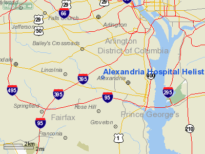
Alexandria Hospital Helistop Heliport |
Location & QuickFacts
| FAA Information Effective: | 2008-09-25 |
| Airport Identifier: | 9VA2 |
| Airport Status: | Operational |
| Longitude/Latitude: | 077-06-14.9230W/38-49-21.4060N
-77.104145/38.822613 (Estimated) |
| Elevation: | 254 ft / 77.42 m (Surveyed) |
| Land: | 0 acres |
| From nearest city: | 0 nautical miles E of Alexandria, VA |
| Location: | Alexandria County, VA |
| Magnetic Variation: | 09W (1985) |
Owner & Manager
| Ownership: | Privately owned |
| Owner: | Alexandria Hospital |
| Address: | 4320 Seminary Road
Alexandria, VA 22304 |
| Phone number: | 703-504-3000 |
| Manager: | Stephen V. Fuoco. Dir Of Eng
SAFETY & SECURITY. |
| Address: | 4320 Seminary Road
Alexandria, VA 22304 |
| Phone number: | 703-504-3402 |
Airport Operations and Facilities
| Airport Use: | Private
MEDICAL USE. |
| Wind indicator: | Yes |
| Segmented Circle: | No |
| Control Tower: | No |
| Lighting Schedule: | PHONE REQ
FOR PERIMETER LGTS CALL 703-504-3066 |
| Landing fee charge: | No |
| Sectional chart: | Washington |
| Region: | AEA - Eastern |
| Boundary ARTCC: | ZDC - Washington |
| Tie-in FSS: | DCA - Leesburg |
| FSS Toll Free: | 1-800-WX-BRIEF |
Runway Information
Helipad H1
| Dimension: | 35 x 35 ft / 10.7 x 10.7 m |
| Surface: | ASPH, |
| |
Runway H1 |
Runway |
| Traffic Pattern: | Left | Left |
|
Radio Navigation Aids
| ID |
Type |
Name |
Ch |
Freq |
Var |
Dist |
| DC | NDB | Oxonn | | 332.00 | 11W | 5.0 nm |
| GTN | NDB | Georgetown | | 323.00 | 09W | 6.5 nm |
| VKX | NDB | Potomac | | 241.00 | 10W | 8.2 nm |
| GAI | NDB | Gaithersburg | | 385.00 | 09W | 21.1 nm |
| BUH | NDB | Anne Arundel | | 260.00 | 10W | 22.5 nm |
| FND | NDB | Ellicott | | 371.00 | 11W | 31.8 nm |
| GDX | NDB | Goodwin Lake | | 227.00 | 08W | 34.9 nm |
| IUB | NDB | Institute | | 404.00 | 08W | 35.8 nm |
| EZF | NDB | Shannon | | 237.00 | 10W | 37.2 nm |
| CJR | NDB | Culpeper | | 252.00 | 09W | 39.5 nm |
| MSQ | NDB | Nailr | | 351.00 | 10W | 43.6 nm |
| MTN | NDB | Martin | | 342.00 | 11W | 44.3 nm |
| APH | NDB | A P Hill | | 396.00 | 10W | 45.4 nm |
| NHK | NDB | Patuxent | | 400.00 | 10W | 46.1 nm |
| TZ | NDB | Cogan | | 364.00 | 10W | 47.8 nm |
| ESN | NDB | Easton | | 212.00 | 10W | 48.5 nm |
| MTN | TACAN | Martin | 068X | | 11W | 44.5 nm |
| FDK | VOR | Frederick | | 109.00 | 08W | 37.6 nm |
| DCA | VOR/DME | Washington | 047X | 111.00 | 09W | 3.9 nm |
| ADW | VORTAC | Andrews | 078X | 113.10 | 10W | 11.2 nm |
| OTT | VORTAC | Nottingham | 084X | 113.70 | 10W | 18.2 nm |
| AML | VORTAC | Armel | 082X | 113.50 | 08W | 18.3 nm |
| BAL | VORTAC | Baltimore | 098X | 115.10 | 11W | 29.4 nm |
| BRV | VORTAC | Brooke | 092X | 114.50 | 09W | 31.5 nm |
| CSN | VORTAC | Casanova | 110X | 116.30 | 06W | 37.3 nm |
| EMI | VORTAC | Westminster | 126X | 117.90 | 08W | 40.8 nm |
| PXT | VORTAC | Patuxent | 123X | 117.60 | 10W | 46.1 nm |
| MRB | VORTAC | Martinsburg | 058X | 112.10 | 07W | 48.5 nm |
| DCA | VOT | Washington National | | 109.40 | | 3.6 nm |
| ADW | VOT | Andrews Afb | | 109.60 | | 10.7 nm |
Remarks
- PRIVATE EMERGENCY HOSPITAL HELISTOP - PPR TO LAND.
- SITE LEVEL WITH SURROUNDING ROAD; VEHICULAR TRAFFIC CLEAR OF AREA DURING OPERS; HOSP BLDG OBSTRUCTION LIGHTED DURING NIGHT OPERS.
Images and information placed above are from
http://www.airport-data.com/airport/9VA2/
We thank them for the data!
| General Info
|
| Country |
United States
|
| State |
VIRGINIA
|
| FAA ID |
9VA2
|
| Latitude |
38-49-21.406N
|
| Longitude |
077-06-14.923W
|
| Elevation |
254 feet
|
| Near City |
ALEXANDRIA
|
We don't guarantee the information is fresh and accurate. The data may
be wrong or outdated.
For more up-to-date information please refer to other sources.
|
|


