 |
|
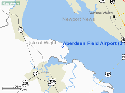
Location & QuickFacts
| FAA Information Effective: | 2008-09-25 |
| Airport Identifier: | 31VA |
| Airport Status: | Operational |
| Longitude/Latitude: | 076-35-18.8330W/37-01-25.5330N
-76.588565/37.023759 (Estimated) |
| Elevation: | 33 ft / 10.06 m (Estimated) |
| Land: | 0 acres |
| From nearest city: | 4 nautical miles SW of Smithfield, VA |
| Location: | Isle Of Wight County, VA |
| Magnetic Variation: | 09W (1985) |
Owner & Manager
| Ownership: | Privately owned |
| Owner: | Smithfield Foods, Inc. |
| Address: | P.o. Box 447
Smithfield, VA 23431 |
| Phone number: | 757-833-6900 |
| Address: |
|
Airport Operations and Facilities
| Airport Use: | Private |
| Wind indicator: | Yes |
| Segmented Circle: | No |
| Control Tower: | No |
| Lighting Schedule: | PHONE REQ
FOR MIRL RWY 02/20 CALL 804-357-4321 |
| Landing fee charge: | No |
| Sectional chart: | Washington |
| Region: | AEA - Eastern |
| Boundary ARTCC: | ZDC - Washington |
| Tie-in FSS: | DCA - Leesburg |
| FSS on Airport: | No |
| FSS Toll Free: | 1-800-WX-BRIEF |
Airport Communications
Runway Information
Runway 02/20
| Dimension: | 5921 x 60 ft / 1804.7 x 18.3 m |
| Surface: | ASPH, |
| Edge Lights: | Medium |
| |
Runway 02 |
Runway 20 |
| Longitude: | 076-35-27.9320W | 076-35-12.0288W |
| Latitude: | 37-00-44.1424N | 37-01-41.2831N |
| Elevation: | 23.00 ft | 29.00 ft |
| Traffic Pattern: | Left | Left |
| Obstruction: | 100 ft trees, 500.0 ft from runway | |
|
Radio Navigation Aids
| ID |
Type |
Name |
Ch |
Freq |
Var |
Dist |
| FAF | NDB | Felker | | 226.00 | 08W | 7.1 nm |
| PJS | NDB | Henry | | 375.00 | 09W | 8.0 nm |
| PVG | NDB | Portsmouth | | 241.00 | 10W | 16.2 nm |
| AKQ | NDB | Wakefield | | 274.00 | 09W | 20.0 nm |
| RK | NDB | Waley | | 249.00 | 10W | 25.7 nm |
| EY | NDB | Chesi | | 233.00 | 09W | 27.4 nm |
| CF | NDB | Pubbs | | 392.00 | 09W | 45.4 nm |
| ELQ | NDB | Emporia | | 261.00 | 10W | 47.1 nm |
| PTB | NDB | Petersburg | | 284.00 | 08W | 47.7 nm |
| LLW | NDB | Woodville | | 254.00 | 10W | 47.8 nm |
| LFI | TACAN | Langley | 070X | | 10W | 11.6 nm |
| NGU | TACAN | Chambers | 048X | | 10W | 15.8 nm |
| NTU | TACAN | Oceana | 113X | | 10W | 29.1 nm |
| ORF | VORTAC | Norfolk | 116X | 116.90 | 07W | 20.3 nm |
| HCM | VORTAC | Harcum | 025X | 108.80 | 07W | 26.2 nm |
| FKN | VORTAC | Franklin | 043X | 110.60 | 09W | 27.6 nm |
| HPW | VORTAC | Hopewell | 057X | 112.00 | 06W | 31.2 nm |
| CCV | VORTAC | Cape Charles | 059X | 112.20 | 10W | 34.3 nm |
| CVI | VORTAC | Cofield | 093X | 114.60 | 09W | 41.4 nm |
| RIC | VORTAC | Richmond | 088X | 114.10 | 09W | 45.3 nm |
Images and information placed above are from
http://www.airport-data.com/airport/31VA/
We thank them for the data!
| General Info
|
| Country |
United States
|
| State |
VIRGINIA
|
| FAA ID |
31VA
|
| Latitude |
37-01-25.533N
|
| Longitude |
076-35-18.833W
|
| Elevation |
33 feet
|
| Near City |
SMITHFIELD
|
We don't guarantee the information is fresh and accurate. The data may
be wrong or outdated.
For more up-to-date information please refer to other sources.
|
|


