 |
|
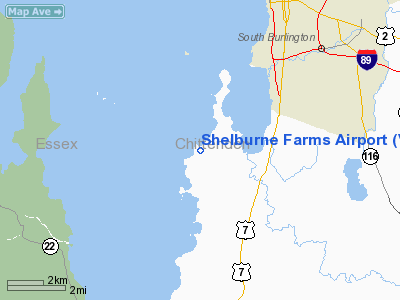
Location & QuickFacts
| FAA Information Effective: | 2008-09-25 |
| Airport Identifier: | VT22 |
| Airport Status: | Operational |
| Longitude/Latitude: | 073-16-01.4570W/44-24-05.1800N
-73.267071/44.401439 (Estimated) |
| Elevation: | 130 ft / 39.62 m (Estimated) |
| Land: | 3 acres |
| From nearest city: | 2 nautical miles W of Shelburne, VT |
| Location: | Chittenden County, VT |
| Magnetic Variation: | 15W (1985) |
Owner & Manager
| Ownership: | Privately owned |
| Owner: | Orchard Point Partnership |
| Address: |
Shelburne, VT 05482 |
| Phone number: | 802-985-3088 |
| Manager: | Gordan A. Sadler |
| Address: | P.o. Box 4038
Burlington, VT 05401 |
| Phone number: | 802-864-0111 |
Airport Operations and Facilities
| Airport Use: | Private |
| Wind indicator: | No |
| Segmented Circle: | No |
| Control Tower: | No |
| Landing fee charge: | No |
| Sectional chart: | Montreal |
| Region: | ANE - New England |
| Boundary ARTCC: | ZBW - Boston |
| Tie-in FSS: | BTV - Burlington |
| FSS on Airport: | No |
| FSS Toll Free: | 1-800-WX-BRIEF |
Airport Services
| Airframe Repair: | NONE |
| Power Plant Repair: | NONE |
Runway Information
Runway N/S
| Dimension: | 1900 x 80 ft / 579.1 x 24.4 m |
| Surface: | TURF, |
| |
Runway N |
Runway S |
| Traffic Pattern: | Left | Left |
|
Radio Navigation Aids
| ID |
Type |
Name |
Ch |
Freq |
Var |
Dist |
| MPV | FAN MARKER | Brook | | | | 26.7 nm |
| R | FAN MARKER | Chitt | | | 14W | 47.7 nm |
| VKN | NDB | Mount Mansfield | | 268.00 | 16W | 24.6 nm |
| JRV | NDB | Morrisville/stowe | | 375.00 | 16W | 31.0 nm |
| DYO | NDB | Smuto | | 221.00 | 15W | 43.9 nm |
| MPV | VOR/DME | Montpelier | 045X | 110.80 | 16W | 40.0 nm |
| SLK | VOR/DME | Saranac Lake | 029X | 109.20 | 14W | 40.3 nm |
| BTV | VORTAC | Burlington | 122X | 117.50 | 15W | 3.6 nm |
| PLB | VORTAC | Plattsburgh | 116X | 116.90 | 15W | 20.3 nm |
| BTV | VOT | Burlington Intl | | 109.00 | | 6.4 nm |
Remarks
Images and information placed above are from
http://www.airport-data.com/airport/VT22/
We thank them for the data!
| General Info
|
| Country |
United States
|
| State |
VERMONT
|
| FAA ID |
VT22
|
| Latitude |
44-24-05.180N
|
| Longitude |
073-16-01.457W
|
| Elevation |
130 feet
|
| Near City |
SHELBURNE
|
We don't guarantee the information is fresh and accurate. The data may
be wrong or outdated.
For more up-to-date information please refer to other sources.
|
|


