 |
|
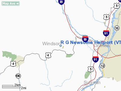
Location & QuickFacts
| FAA Information Effective: | 2008-09-25 |
| Airport Identifier: | VT54 |
| Airport Status: | Operational |
| Longitude/Latitude: | 072-25-20.3340W/43-39-05.2510N
-72.422315/43.651459 (Estimated) |
| Elevation: | 660 ft / 201.17 m (Estimated) |
| Land: | 0 acres |
| From nearest city: | 0 nautical miles N of Quechee, VT |
| Location: | Windsor County, VT |
| Magnetic Variation: | 15W (1985) |
Owner & Manager
| Ownership: | Privately owned |
| Owner: | Robert G. Newsome |
| Address: | 28 Willard Road
Quechee, VT 05059 |
| Address: |
|
Airport Operations and Facilities
| Airport Use: | Private |
| Segmented Circle: | No |
| Control Tower: | No |
| Landing fee charge: | No |
| Sectional chart: | New York |
| Region: | ANE - New England |
| Boundary ARTCC: | ZBW - Boston |
| Tie-in FSS: | BTV - Burlington |
| FSS on Airport: | No |
| FSS Toll Free: | 1-800-WX-BRIEF |
Runway Information
Helipad H1
| Dimension: | 50 x 50 ft / 15.2 x 15.2 m |
| Surface: | TURF, |
| |
Runway H1 |
Runway |
| Traffic Pattern: | Left | Left |
|
Radio Navigation Aids
| ID |
Type |
Name |
Ch |
Freq |
Var |
Dist |
| R | FAN MARKER | Chitt | | | 14W | 24.0 nm |
| MPV | FAN MARKER | Brook | | | | 41.5 nm |
| LCI | FAN MARKER | Laconia | | | | 43.0 nm |
| IVV | NDB | White River | | 379.00 | 16W | 5.8 nm |
| LAH | NDB | Hanover | | 276.00 | 15W | 11.1 nm |
| CNH | NDB | Claremont | | 233.00 | 16W | 17.1 nm |
| DYO | NDB | Smuto | | 221.00 | 15W | 23.5 nm |
| SXD | NDB | Springfield | | 265.00 | 15W | 24.0 nm |
| LC | NDB | Blnap | | 328.00 | 16W | 39.2 nm |
| VKN | NDB | Mount Mansfield | | 268.00 | 16W | 45.7 nm |
| VWD | NDB | Mount Snow | | 224.00 | 15W | 47.6 nm |
| LEB | VOR/DME | Lebanon | 084X | 113.70 | 15W | 9.1 nm |
| RUT | VOR/DME | Rutland | 47X | 111.00 | 15W | 24.2 nm |
| MPV | VOR/DME | Montpelier | 045X | 110.80 | 16W | 26.1 nm |
| CON | VORTAC | Concord | 076X | 112.90 | 15W | 45.2 nm |
Remarks
Images and information placed above are from
http://www.airport-data.com/airport/VT54/
We thank them for the data!
| General Info
|
| Country |
United States
|
| State |
VERMONT
|
| FAA ID |
VT54
|
| Latitude |
43-39-05.251N
|
| Longitude |
072-25-20.334W
|
| Elevation |
660 feet
|
| Near City |
QUECHEE
|
We don't guarantee the information is fresh and accurate. The data may
be wrong or outdated.
For more up-to-date information please refer to other sources.
|
|


