 |
|
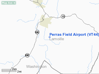
Location & QuickFacts
| FAA Information Effective: | 2008-09-25 |
| Airport Identifier: | VT44 |
| Airport Status: | Operational |
| Longitude/Latitude: | 072-34-53.4110W/44-31-36.1900N
-72.581503/44.526719 (Estimated) |
| Elevation: | 820 ft / 249.94 m (Surveyed) |
| Land: | 0 acres |
| From nearest city: | 3 nautical miles SE of Morrisville, VT |
| Location: | Lamoille County, VT |
| Magnetic Variation: | 16W (1985) |
Owner & Manager
| Ownership: | Privately owned |
| Owner: | Real E. & Lillian L. Perras |
| Address: | 691 Earl Grey Rd
Morrisville, VT 05661 |
| Phone number: | 802-888-7969 |
| Manager: | Real E. Perras |
| Address: | 691 Earl Grey Rd
Morrisville, VT 05661 |
| Phone number: | 802-888-7969 |
Airport Operations and Facilities
| Airport Use: | Private |
| Wind indicator: | Yes |
| Segmented Circle: | No |
| Control Tower: | No |
| Landing fee charge: | No |
| Sectional chart: | Montreal |
| Region: | ANE - New England |
| Boundary ARTCC: | ZBW - Boston |
| Tie-in FSS: | BTV - Burlington |
| FSS on Airport: | No |
| FSS Toll Free: | 1-800-WX-BRIEF |
Airport Communications
Runway Information
Runway 16/34
| Dimension: | 2000 x 50 ft / 609.6 x 15.2 m |
| Surface: | TURF, |
| |
Runway 16 |
Runway 34 |
| Traffic Pattern: | Left | Left |
|
Radio Navigation Aids
| ID |
Type |
Name |
Ch |
Freq |
Var |
Dist |
| MPV | FAN MARKER | Brook | | | | 12.8 nm |
| HIE | FAN MARKER | Witey | | | 17W | 44.7 nm |
| JRV | NDB | Morrisville/stowe | | 375.00 | 16W | 3.1 nm |
| VKN | NDB | Mount Mansfield | | 268.00 | 16W | 9.7 nm |
| LLX | NDB | Lyndonville | | 353.00 | 16W | 23.7 nm |
| EFK | NDB | Newport | | 242.00 | 17W | 30.9 nm |
| GMA | NDB | Mahn | | 386.00 | 17W | 39.7 nm |
| MPV | VOR/DME | Montpelier | 045X | 110.80 | 16W | 27.1 nm |
| BTV | VORTAC | Burlington | 122X | 117.50 | 15W | 26.9 nm |
| PLB | VORTAC | Plattsburgh | 116X | 116.90 | 15W | 41.4 nm |
| BTV | VOT | Burlington Intl | | 109.00 | | 24.6 nm |
Remarks
Images and information placed above are from
http://www.airport-data.com/airport/VT44/
We thank them for the data!
| General Info
|
| Country |
United States
|
| State |
VERMONT
|
| FAA ID |
VT44
|
| Latitude |
44-31-36.190N
|
| Longitude |
072-34-53.411W
|
| Elevation |
820 feet
|
| Near City |
MORRISVILLE
|
We don't guarantee the information is fresh and accurate. The data may
be wrong or outdated.
For more up-to-date information please refer to other sources.
|
|


