 |
|
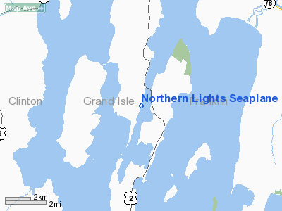
Northern Lights Seaplane Base (2VT2) |
Location & QuickFacts
| FAA Information Effective: | 2008-09-25 |
| Airport Identifier: | 2VT2 |
| Airport Status: | Operational |
| Longitude/Latitude: | 073-16-54.0000W/44-52-22.0000N
-73.281667/44.872778 (Estimated) |
| Elevation: | 95 ft / 28.96 m (Estimated) |
| Land: | 0 acres |
| From nearest city: | 6 nautical miles S of Alburg, VT |
| Location: | Grand Isle County, VT |
| Magnetic Variation: | () |
Owner & Manager
| Ownership: | Privately owned |
| Owner: | Scot Prescott |
| Address: | 502 Rt 2
South Hero, VT 05486 |
| Phone number: | 802-372-3300 |
| Manager: | Scot Prescott |
| Address: | 502 Rt 2
South Hero, VT 05486 |
| Phone number: | 802-796-3011 |
Airport Operations and Facilities
| Airport Use: | Private |
| Control Tower: | No |
| Sectional chart: | Montreal |
| Region: | ANE - New England |
| Boundary ARTCC: | ZBW - Boston |
| Tie-in FSS: | BTV - Burlington |
| FSS Toll Free: | 1-800-WX-BRIEF |
Runway Information
Runway 04W/22W
| Dimension: | 10000 x 100 ft / 3048.0 x 30.5 m |
| Surface: | WATER, |
| |
Runway 04W |
Runway 22W |
| Traffic Pattern: | Left | Left |
|
Radio Navigation Aids
| ID |
Type |
Name |
Ch |
Freq |
Var |
Dist |
| MPV | FAN MARKER | Brook | | | | 42.6 nm |
| JRV | NDB | Morrisville/stowe | | 375.00 | 16W | 34.5 nm |
| VKN | NDB | Mount Mansfield | | 268.00 | 16W | 38.6 nm |
| JL | NDB | Cote St Luc | | 370.00 | 16W | 39.0 nm |
| U | NDB | Uniform | | 201.00 | 15W | 40.7 nm |
| H | NDB | Hotel | | 407.00 | 16W | 41.6 nm |
| NDB | Mike | | 348.00 | 15W | 42.2 nm |
| UL | NDB | Montreal | | 248.00 | 16W | 42.7 nm |
| L | NDB | Lima | | 284.00 | 16W | 43.3 nm |
| EFK | NDB | Newport | | 242.00 | 17W | 47.3 nm |
| SLK | VOR/DME | Saranac Lake | 029X | 109.20 | 14W | 49.2 nm |
| PLB | VORTAC | Plattsburgh | 116X | 116.90 | 15W | 15.3 nm |
| YJN | VORTAC | St Jean | 105X | 115.80 | 16W | 23.1 nm |
| BTV | VORTAC | Burlington | 122X | 117.50 | 15W | 28.9 nm |
| BTV | VOT | Burlington Intl | | 109.00 | | 25.1 nm |
Remarks
- 80 FT BRIDGE WITH PLINES 4000 FT N OF SPB.
- PRVDD YOU RESOLVE TFC PAT CONFLICTS WITH ROUSE'S POINT ARPT AND FRANKLIN COUNTY STATE ARPT; VFR OPNS, PVT SEAPLANES ONLY; AND INGRESS/EGRESS ROUTES ARE DESIGNED TO MINIMIZE NOISE IMPACT.
Images and information placed above are from
http://www.airport-data.com/airport/2VT2/
We thank them for the data!
We don't guarantee the information is fresh and accurate. The data may
be wrong or outdated.
For more up-to-date information please refer to other sources.
|
|


