 |
|
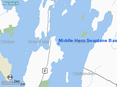
Middle Hero Seaplane Base |
Location & QuickFacts
| FAA Information Effective: | 2008-09-25 |
| Airport Identifier: | 29VT |
| Airport Status: | Operational |
| Longitude/Latitude: | 073-16-00.0000W/44-45-23.0000N
-73.266667/44.756389 (Estimated) |
| Elevation: | 105 ft / 32.00 m (Estimated) |
| Land: | 0 acres |
| From nearest city: | 3 nautical miles NN of Grand Isle, VT |
| Location: | Grand Isle County, VT |
| Magnetic Variation: | () |
Owner & Manager
| Ownership: | Privately owned |
| Owner: | Douglas Smith |
| Address: | 237 East Shore North
Grand Isle, VT 05458 |
| Phone number: | 802-372-4040 |
| Manager: | Douglas Smith |
| Address: | 237 East Shore North
Grand Isle, VT 05458 |
| Phone number: | 802-372-4040 |
Airport Operations and Facilities
| Airport Use: | Private |
| Control Tower: | No |
| Sectional chart: | Montreal |
| Region: | ANE - New England |
| Boundary ARTCC: | ZBW - Boston |
| Tie-in FSS: | BTV - Burlington |
| FSS Toll Free: | 1-800-WX-BRIEF |
Runway Information
Runway 02W/20W
| Dimension: | 10000 x 2000 ft / 3048.0 x 609.6 m |
| Surface: | WATER, |
| |
Runway 02W |
Runway 20W |
| Traffic Pattern: | Left | Left |
|
Runway 15W/33W
| Dimension: | 10000 x 2000 ft / 3048.0 x 609.6 m |
| Surface: | WATER, |
| |
Runway 15W |
Runway 33W |
| Traffic Pattern: | Left | Left |
|
Radio Navigation Aids
| ID |
Type |
Name |
Ch |
Freq |
Var |
Dist |
| MPV | FAN MARKER | Brook | | | | 37.0 nm |
| JRV | NDB | Morrisville/stowe | | 375.00 | 16W | 30.9 nm |
| VKN | NDB | Mount Mansfield | | 268.00 | 16W | 33.1 nm |
| JL | NDB | Cote St Luc | | 370.00 | 16W | 45.8 nm |
| U | NDB | Uniform | | 201.00 | 15W | 47.1 nm |
| EFK | NDB | Newport | | 242.00 | 17W | 47.9 nm |
| H | NDB | Hotel | | 407.00 | 16W | 48.7 nm |
| UL | NDB | Montreal | | 248.00 | 16W | 49.0 nm |
| NDB | Mike | | 348.00 | 15W | 49.0 nm |
| SLK | VOR/DME | Saranac Lake | 029X | 109.20 | 14W | 46.0 nm |
| PLB | VORTAC | Plattsburgh | 116X | 116.90 | 15W | 11.7 nm |
| BTV | VORTAC | Burlington | 122X | 117.50 | 15W | 21.9 nm |
| YJN | VORTAC | St Jean | 105X | 115.80 | 16W | 30.1 nm |
| BTV | VOT | Burlington Intl | | 109.00 | | 18.1 nm |
Remarks
- 100 FT DRAWBRIDGE 1 NM WEST OF SEAPLANE BASE.
- PRVDD VFR OPNS, PRIVATE USE, INSTALL A WIND SOCK, AND ALL USERS ARE NOTIFIED ONCE COMPLY WITH THESE RESTRICTIONS.
Images and information placed above are from
http://www.airport-data.com/airport/29VT/
We thank them for the data!
We don't guarantee the information is fresh and accurate. The data may
be wrong or outdated.
For more up-to-date information please refer to other sources.
|
|


