 |
|
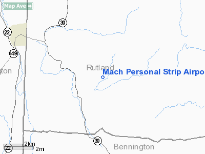
Mach Personal Strip Airport |
Location & QuickFacts
| FAA Information Effective: | 2008-09-25 |
| Airport Identifier: | VT20 |
| Airport Status: | Operational |
| Longitude/Latitude: | 073-08-53.3830W/43-22-00.2620N
-73.148162/43.366739 (Estimated) |
| Elevation: | 854 ft / 260.30 m (Surveyed) |
| Land: | 0 acres |
| From nearest city: | 2 nautical miles NE of Pawlet, VT |
| Location: | Rutland County, VT |
| Magnetic Variation: | 15W (1985) |
Owner & Manager
| Ownership: | Privately owned |
| Owner: | Gilbert F. Mach |
| Address: | Box 13
Pawlet, VT 05761 |
| Phone number: | 802-325-3403 |
| Manager: | Gilbert F. Mach |
| Address: | Box 13
Pawlet, VT 05761 |
| Phone number: | 802-325-3403 |
Airport Operations and Facilities
| Airport Use: | Private |
| Wind indicator: | Yes |
| Segmented Circle: | No |
| Control Tower: | No |
| Landing fee charge: | No |
| Sectional chart: | New York |
| Region: | ANE - New England |
| Boundary ARTCC: | ZBW - Boston |
| Tie-in FSS: | BTV - Burlington |
| FSS on Airport: | No |
| FSS Toll Free: | 1-800-WX-BRIEF |
Airport Services
| Airframe Repair: | NONE |
| Power Plant Repair: | NONE |
Runway Information
Runway NE/SW
| Dimension: | 1750 x 75 ft / 533.4 x 22.9 m |
| Surface: | TURF, |
| |
Runway NE |
Runway SW |
| Traffic Pattern: | Left | Left |
| Obstruction: | 20 ft pline hwy | |
|
Radio Navigation Aids
| ID |
Type |
Name |
Ch |
Freq |
Var |
Dist |
| R | FAN MARKER | Chitt | | | 14W | 17.9 nm |
| DYO | NDB | Smuto | | 221.00 | 15W | 22.0 nm |
| SXD | NDB | Springfield | | 265.00 | 15W | 25.3 nm |
| VWD | NDB | Mount Snow | | 224.00 | 15W | 29.2 nm |
| IVV | NDB | White River | | 379.00 | 16W | 32.0 nm |
| CNH | NDB | Claremont | | 233.00 | 16W | 34.0 nm |
| HEU | NDB | Hunter | | 356.00 | 14W | 46.3 nm |
| LAH | NDB | Hanover | | 276.00 | 15W | 46.9 nm |
| RUT | VOR/DME | Rutland | 47X | 111.00 | 15W | 12.9 nm |
| CAM | VOR/DME | Cambridge | 097X | 115.00 | 14W | 24.0 nm |
| LEB | VOR/DME | Lebanon | 084X | 113.70 | 15W | 44.7 nm |
| GFL | VORTAC | Glens Falls | 039X | 110.20 | 14W | 20.3 nm |
| ALB | VORTAC | Albany | 100X | 115.30 | 13W | 47.1 nm |
| ALB | VOT | Albany County | | 108.20 | | 47.8 nm |
Remarks
Images and information placed above are from
http://www.airport-data.com/airport/VT20/
We thank them for the data!
| General Info
|
| Country |
United States
|
| State |
VERMONT
|
| FAA ID |
VT20
|
| Latitude |
43-22-00.262N
|
| Longitude |
073-08-53.383W
|
| Elevation |
854 feet
|
| Near City |
PAWLET
|
We don't guarantee the information is fresh and accurate. The data may
be wrong or outdated.
For more up-to-date information please refer to other sources.
|
|


