 |
|
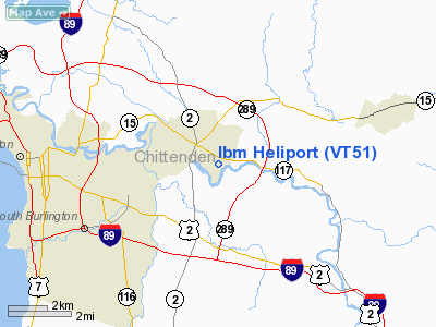
Location & QuickFacts
| FAA Information Effective: | 2008-09-25 |
| Airport Identifier: | VT51 |
| Airport Status: | Operational |
| Longitude/Latitude: | 073-05-47.4550W/44-28-54.1800N
-73.096515/44.481717 (Estimated) |
| Elevation: | 385 ft / 117.35 m (Estimated) |
| Land: | 0 acres |
| From nearest city: | 0 nautical miles N of Essex Junction, VT |
| Location: | Chittenden County, VT |
| Magnetic Variation: | 16W (1985) |
Owner & Manager
| Ownership: | Privately owned |
| Owner: | Ibm Corporation |
| Address: |
Essex Junction, VT 05452 |
| Phone number: | 802-769-0111 |
| Manager: | Wendy B. Pelletier |
| Address: | D726/615-1
Essex Junction, VT 05452 |
| Phone number: | 802-871-4962 |
Airport Operations and Facilities
| Airport Use: | Private |
| Wind indicator: | Yes |
| Segmented Circle: | No |
| Control Tower: | No |
| Landing fee charge: | No |
| Sectional chart: | Montreal |
| Region: | ANE - New England |
| Boundary ARTCC: | ZBW - Boston |
| Tie-in FSS: | BTV - Burlington |
| FSS on Airport: | No |
| FSS Toll Free: | 1-800-WX-BRIEF |
Runway Information
Helipad H1
| Dimension: | 90 x 90 ft / 27.4 x 27.4 m |
| Surface: | CONC, |
| |
Runway H1 |
Runway |
| Traffic Pattern: | Left | Left |
|
Radio Navigation Aids
| ID |
Type |
Name |
Ch |
Freq |
Var |
Dist |
| MPV | FAN MARKER | Brook | | | | 21.2 nm |
| VKN | NDB | Mount Mansfield | | 268.00 | 16W | 18.2 nm |
| JRV | NDB | Morrisville/stowe | | 375.00 | 16W | 22.6 nm |
| LLX | NDB | Lyndonville | | 353.00 | 16W | 45.8 nm |
| DYO | NDB | Smuto | | 221.00 | 15W | 47.0 nm |
| EFK | NDB | Newport | | 242.00 | 17W | 48.4 nm |
| MPV | VOR/DME | Montpelier | 045X | 110.80 | 16W | 36.6 nm |
| SLK | VOR/DME | Saranac Lake | 029X | 109.20 | 14W | 47.9 nm |
| BTV | VORTAC | Burlington | 122X | 117.50 | 15W | 6.3 nm |
| PLB | VORTAC | Plattsburgh | 116X | 116.90 | 15W | 22.0 nm |
| YJN | VORTAC | St Jean | 105X | 115.80 | 16W | 47.5 nm |
| BTV | VOT | Burlington Intl | | 109.00 | | 2.4 nm |
Images and information placed above are from
http://www.airport-data.com/airport/VT51/
We thank them for the data!
| General Info
|
| Country |
United States
|
| State |
VERMONT
|
| FAA ID |
VT51
|
| Latitude |
44-28-54.180N
|
| Longitude |
073-05-47.455W
|
| Elevation |
385 feet
|
| Near City |
ESSEX JUNCTION
|
We don't guarantee the information is fresh and accurate. The data may
be wrong or outdated.
For more up-to-date information please refer to other sources.
|
|


