 |
|
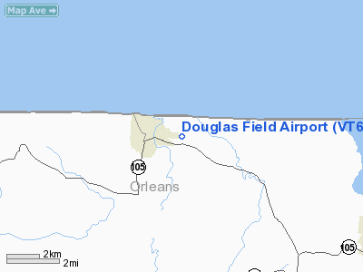
Location & QuickFacts
| FAA Information Effective: | 2008-09-25 |
| Airport Identifier: | VT63 |
| Airport Status: | Operational |
| Longitude/Latitude: | 072-22-44.3900W/44-59-43.1600N
-72.378997/44.995322 (Estimated) |
| Elevation: | 650 ft / 198.12 m (Estimated) |
| Land: | 0 acres |
| From nearest city: | 1 nautical miles E of North Troy, VT |
| Location: | Orleans County, VT |
| Magnetic Variation: | 16W (1995) |
Owner & Manager
| Ownership: | Privately owned |
| Owner: | George B Douglas |
| Address: | 604 Bear Mountain Rd
North Troy, VT 05859 |
| Phone number: | 802-988-2967 |
| Manager: | George B Douglas |
| Address: | 604 Bear Mountain Rd
North Troy, VT 05859 |
| Phone number: | 802-988-2967 |
Airport Operations and Facilities
| Airport Use: | Private |
| Segmented Circle: | No |
| Control Tower: | No |
| Sectional chart: | Montreal |
| Region: | ANE - New England |
| Boundary ARTCC: | ZBW - Boston |
| Tie-in FSS: | BTV - Burlington |
| FSS on Airport: | No |
| FSS Toll Free: | 1-800-WX-BRIEF |
Runway Information
Runway 14/32
| Dimension: | 1200 x 60 ft / 365.8 x 18.3 m |
| Surface: | TURF, |
| |
Runway 14 |
Runway 32 |
| Traffic Pattern: | Left | Left |
|
Radio Navigation Aids
| ID |
Type |
Name |
Ch |
Freq |
Var |
Dist |
| MPV | FAN MARKER | Brook | | | | 42.3 nm |
| EFK | NDB | Newport | | 242.00 | 17W | 8.9 nm |
| JRV | NDB | Morrisville/stowe | | 375.00 | 16W | 26.6 nm |
| LLX | NDB | Lyndonville | | 353.00 | 16W | 33.1 nm |
| SC | NDB | Sherbrooke | | 362.00 | 17W | 38.2 nm |
| VKN | NDB | Mount Mansfield | | 268.00 | 16W | 39.0 nm |
| GMA | NDB | Mahn | | 386.00 | 17W | 48.2 nm |
| YSC | VORTAC | Sherbrooke | 079X | 113.20 | 17W | 31.6 nm |
| YJN | VORTAC | St Jean | 105X | 115.80 | 16W | 42.9 nm |
| BTV | VORTAC | Burlington | 122X | 117.50 | 15W | 49.7 nm |
| BTV | VOT | Burlington Intl | | 109.00 | | 45.7 nm |
Remarks
- PRVDD VFR OPNS; AND ALL OPNS CONDUCTED E OF THE ELEMENTARY SCHOOL IN NORTH TROY.
Images and information placed above are from
http://www.airport-data.com/airport/VT63/
We thank them for the data!
| General Info
|
| Country |
United States
|
| State |
VERMONT
|
| FAA ID |
VT63
|
| Latitude |
44-59-43.160N
|
| Longitude |
072-22-44.390W
|
| Elevation |
650 feet
|
| Near City |
NORTH TROY
|
We don't guarantee the information is fresh and accurate. The data may
be wrong or outdated.
For more up-to-date information please refer to other sources.
|
|


