 |
|
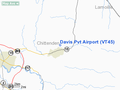
Location & QuickFacts
| FAA Information Effective: | 2008-09-25 |
| Airport Identifier: | VT45 |
| Airport Status: | Operational |
| Longitude/Latitude: | 072-58-45.4570W/44-31-02.1820N
-72.979294/44.517273 (Estimated) |
| Elevation: | 640 ft / 195.07 m (Estimated) |
| Land: | 0 acres |
| From nearest city: | 1 nautical miles NE of Jericho, VT |
| Location: | Chittenden County, VT |
| Magnetic Variation: | 16W (1985) |
Owner & Manager
| Ownership: | Privately owned |
| Owner: | Gary L. Davis |
| Address: | Rr 2, Box 1035
Underhill, VT 05489 |
| Phone number: | 802-899-2357 |
| Manager: | Gary L. Davis |
| Address: | Rr 2, Box 1035
Underhill, VT 05489 |
| Phone number: | 802-899-2357 |
Airport Operations and Facilities
| Airport Use: | Private |
| Wind indicator: | No |
| Segmented Circle: | No |
| Control Tower: | No |
| Landing fee charge: | No |
| Sectional chart: | Montreal |
| Region: | ANE - New England |
| Boundary ARTCC: | ZBW - Boston |
| Tie-in FSS: | BTV - Burlington |
| FSS on Airport: | No |
| FSS Toll Free: | 1-800-WX-BRIEF |
Runway Information
Runway NE/SW
| Dimension: | 1500 x 500 ft / 457.2 x 152.4 m |
| Surface: | TURF, |
| |
Runway NE |
Runway SW |
| Traffic Pattern: | Left | Left |
|
Radio Navigation Aids
| ID |
Type |
Name |
Ch |
Freq |
Var |
Dist |
| MPV | FAN MARKER | Brook | | | | 18.2 nm |
| VKN | NDB | Mount Mansfield | | 268.00 | 16W | 14.6 nm |
| JRV | NDB | Morrisville/stowe | | 375.00 | 16W | 17.2 nm |
| LLX | NDB | Lyndonville | | 353.00 | 16W | 40.7 nm |
| EFK | NDB | Newport | | 242.00 | 17W | 43.1 nm |
| DYO | NDB | Smuto | | 221.00 | 15W | 48.8 nm |
| MPV | VOR/DME | Montpelier | 045X | 110.80 | 16W | 34.5 nm |
| BTV | VORTAC | Burlington | 122X | 117.50 | 15W | 11.3 nm |
| PLB | VORTAC | Plattsburgh | 116X | 116.90 | 15W | 25.3 nm |
| YJN | VORTAC | St Jean | 105X | 115.80 | 16W | 46.7 nm |
| BTV | VOT | Burlington Intl | | 109.00 | | 7.9 nm |
Remarks
Images and information placed above are from
http://www.airport-data.com/airport/VT45/
We thank them for the data!
| General Info
|
| Country |
United States
|
| State |
VERMONT
|
| FAA ID |
VT45
|
| Latitude |
44-31-02.182N
|
| Longitude |
072-58-45.457W
|
| Elevation |
640 feet
|
| Near City |
JERICHO
|
We don't guarantee the information is fresh and accurate. The data may
be wrong or outdated.
For more up-to-date information please refer to other sources.
|
|


