 |
|
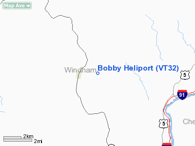
Location & QuickFacts
| FAA Information Effective: | 2008-09-25 |
| Airport Identifier: | VT32 |
| Airport Status: | Operational |
| Longitude/Latitude: | 072-37-41.3300W/42-59-20.2890N
-72.628147/42.988969 (Estimated) |
| Elevation: | 420 ft / 128.02 m (Estimated) |
| Land: | 0 acres |
| From nearest city: | 3 nautical miles SE of Brookline, VT |
| Location: | Windham County, VT |
| Magnetic Variation: | 15W (1985) |
Owner & Manager
| Ownership: | Privately owned |
| Owner: | Herbert D Howe |
| Address: | 125 White Oak Run
Dartmouth, MA 02747 |
| Phone number: | 508-636-4376 |
| Manager: | Herbert D Howe |
| Address: | 125 White Oak Run
Dartmouth, MA 02747 |
| Phone number: | 508-636-4376 |
Airport Operations and Facilities
| Airport Use: | Private
PERSONAL USE. |
| Segmented Circle: | No |
| Control Tower: | No |
| Sectional chart: | New York |
| Region: | ANE - New England |
| Boundary ARTCC: | ZBW - Boston |
| Tie-in FSS: | BTV - Burlington |
| FSS Toll Free: | 1-800-WX-BRIEF |
Runway Information
Helipad H1
| Dimension: | 75 x 50 ft / 22.9 x 15.2 m |
| Surface: | TURF, |
| |
Runway H1 |
Runway |
| Traffic Pattern: | Left | Left |
|
Radio Navigation Aids
| ID |
Type |
Name |
Ch |
Freq |
Var |
Dist |
| PSF | FAN MARKER | Abyss | | | 13W | 41.2 nm |
| R | FAN MARKER | Chitt | | | 14W | 41.8 nm |
| VWD | NDB | Mount Snow | | 224.00 | 15W | 11.0 nm |
| SXD | NDB | Springfield | | 265.00 | 15W | 17.0 nm |
| CNH | NDB | Claremont | | 233.00 | 16W | 25.5 nm |
| ORE | NDB | Orange | | 205.00 | 15W | 29.4 nm |
| IVV | NDB | White River | | 379.00 | 16W | 35.1 nm |
| DXT | NDB | Dalton | | 370.00 | 15W | 39.3 nm |
| DYO | NDB | Smuto | | 221.00 | 15W | 45.5 nm |
| AS | NDB | Chern | | 359.00 | 16W | 46.3 nm |
| FIT | NDB | Fitchburg | | 365.00 | 15W | 46.6 nm |
| LAH | NDB | Hanover | | 276.00 | 15W | 47.2 nm |
| CAM | VOR/DME | Cambridge | 097X | 115.00 | 14W | 31.5 nm |
| RUT | VOR/DME | Rutland | 47X | 111.00 | 15W | 35.3 nm |
| CTR | VOR/DME | Chester | 098X | 115.10 | 13W | 44.3 nm |
| LEB | VOR/DME | Lebanon | 084X | 113.70 | 15W | 45.2 nm |
| EEN | VORTAC | Keene | 031X | 109.40 | 14W | 18.9 nm |
| GDM | VORTAC | Gardner | 043X | 110.60 | 14W | 36.6 nm |
| CEF | VORTAC | Westover | 87X | 114.00 | 14W | 47.8 nm |
| GFL | VORTAC | Glens Falls | 039X | 110.20 | 14W | 48.1 nm |
| CON | VORTAC | Concord | 076X | 112.90 | 15W | 48.2 nm |
| BAF | VORTAC | Barnes | 077X | 113.00 | 14W | 49.9 nm |
Remarks
Images and information placed above are from
http://www.airport-data.com/airport/VT32/
We thank them for the data!
| General Info
|
| Country |
United States
|
| State |
VERMONT
|
| FAA ID |
VT32
|
| Latitude |
42-59-20.289N
|
| Longitude |
072-37-41.330W
|
| Elevation |
420 feet
|
| Near City |
BROOKLINE
|
We don't guarantee the information is fresh and accurate. The data may
be wrong or outdated.
For more up-to-date information please refer to other sources.
|
|


