 |
|
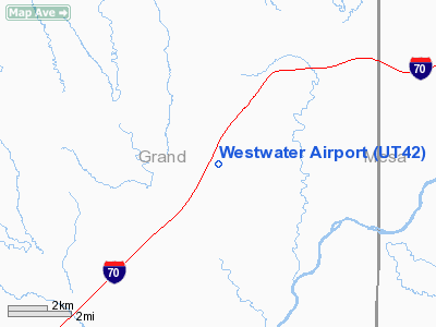
Location & QuickFacts
| FAA Information Effective: | 2008-09-25 |
| Airport Identifier: | UT42 |
| Airport Status: | Operational |
| Longitude/Latitude: | 109-08-42.0000W/39-08-48.0000N
-109.145000/39.146667 (Estimated) |
| Elevation: | 4660 ft / 1420.37 m (Estimated) |
| Land: | 8 acres |
| From nearest city: | 14 nautical miles NE of Cisco, UT |
| Location: | Grand County, UT |
| Magnetic Variation: | 13E (1990) |
Owner & Manager
| Ownership: | Privately owned |
| Owner: | Jim Jacobs |
| Address: | 215 Cottonwood Ln
Aspen, CO 81611 |
| Phone number: | 303-920-2530 |
| Manager: | Jim Jacobs |
| Address: | 215 Cottonwood Ln
Aspen, CO 81611 |
| Phone number: | 303-920-2530 |
Airport Operations and Facilities
| Airport Use: | Private |
| Wind indicator: | Yes |
| Segmented Circle: | No |
| Control Tower: | No |
| Sectional chart: | Denver |
| Region: | ANM - Northwest Mountain |
| Boundary ARTCC: | ZDV - Denver |
| Tie-in FSS: | CDC - Cedar City |
| FSS Toll Free: | 1-800-WX-BRIEF |
Runway Information
Runway 18/36
| Dimension: | 2400 x 40 ft / 731.5 x 12.2 m |
| Surface: | GRAVEL, |
| |
Runway 18 |
Runway 36 |
| Traffic Pattern: | Left | Left |
|
Radio Navigation Aids
| ID |
Type |
Name |
Ch |
Freq |
Var |
Dist |
| OAB | VOR/DME | Moab | 035X | 109.80 | 15E | 36.7 nm |
| JNC | VORTAC | Grand Junction | 071X | 112.40 | 15E | 17.3 nm |
Images and information placed above are from
http://www.airport-data.com/airport/UT42/
We thank them for the data!
| General Info
|
| Country |
United States
|
| State |
UTAH
|
| FAA ID |
UT42
|
| Latitude |
39-08-48.000N
|
| Longitude |
109-08-42.000W
|
| Elevation |
4660 feet
|
| Near City |
CISCO
|
We don't guarantee the information is fresh and accurate. The data may
be wrong or outdated.
For more up-to-date information please refer to other sources.
|
|


