 |
|
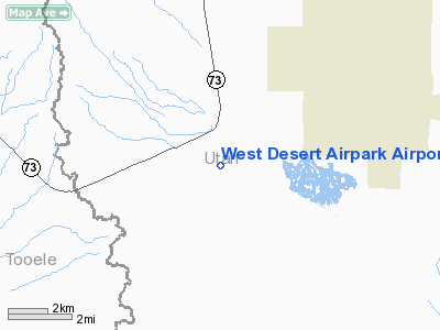
West Desert Airpark Airport |
Location & QuickFacts
| FAA Information Effective: | 2008-09-25 |
| Airport Identifier: | UT99 |
| Airport Status: | Operational |
| Longitude/Latitude: | 112-05-34.9200W/40-14-33.3600N
-112.093033/40.242600 (Estimated) |
| Elevation: | 4902 ft / 1494.13 m (Estimated) |
| Land: | 40 acres |
| From nearest city: | 2 nautical miles N of Cedar Valley, UT |
| Location: | Utah County, UT |
| Magnetic Variation: | () |
Owner & Manager
| Ownership: | Privately owned |
| Owner: | Mark D. Pringle |
| Address: | 614 N 18150 West
Fairfield, UT 84013 |
| Phone number: | 801-766-0160 |
| Manager: | Mark D. Pringle |
| Address: | 614 N 29260 West
Fairfield, UT 84013 |
| Phone number: | 801-652-5480 |
Airport Operations and Facilities
| Airport Use: | Private |
| Wind indicator: | Yes |
| Segmented Circle: | No |
| Control Tower: | No |
| Sectional chart: | Salt Lake City |
| Region: | ANM - Northwest Mountain |
| Boundary ARTCC: | ZLC - Salt Lake City |
| Tie-in FSS: | CDC - Cedar City |
| FSS Toll Free: | 1-800-WX-BRIEF |
Runway Information
Runway 17/35
| Dimension: | 2600 x 40 ft / 792.5 x 12.2 m |
| Surface: | GRVL, Good Condition |
| |
Runway 17 |
Runway 35 |
| Traffic Pattern: | Left | Left |
|
Radio Navigation Aids
| ID |
Type |
Name |
Ch |
Freq |
Var |
Dist |
| TVY | NDB | Tooele | | 371.00 | 13E | 25.0 nm |
| DPG | NDB | Dugway | | 284.00 | 15E | 38.9 nm |
| MIJ | TACAN | Michael | 079X | | 15E | 38.2 nm |
| PVU | VOR/DME | Provo | 021X | 108.40 | 15E | 17.1 nm |
| FFU | VORTAC | Fairfield | 113X | 116.60 | 16E | 7.3 nm |
| TCH | VORTAC | Wasatch | 115X | 116.80 | 16E | 36.9 nm |
| SLC | VOT | Salt Lake City | | 111.00 | | 23.2 nm |
Images and information placed above are from
http://www.airport-data.com/airport/UT99/
We thank them for the data!
|
|


