 |
|
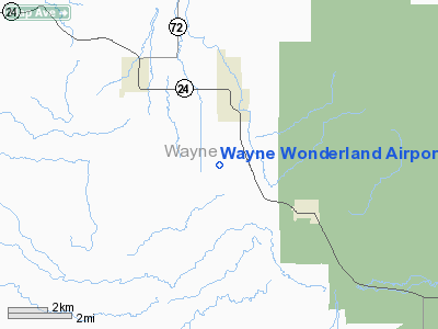
Location & QuickFacts
| FAA Information Effective: | 2008-09-25 |
| Airport Identifier: | 38U |
| Airport Status: | Operational |
| Longitude/Latitude: | 111-35-45.6590W/38-21-44.9270N
-111.596016/38.362480 (Estimated) |
| Elevation: | 7023 ft / 2140.61 m (Surveyed) |
| Land: | 186 acres |
| From nearest city: | 3 nautical miles SE of Loa, UT |
| Location: | Wayne County, UT |
| Magnetic Variation: | 14E (1985) |
Owner & Manager
| Ownership: | Publicly owned |
| Owner: | Wayne County |
| Address: | 18 S Main
Loa, UT 84747 |
| Phone number: | 435-836-2765 |
| Manager: | Clenn Okerlund |
| Address: | 162 S. 100 W.
Lyman, UT 84749 |
| Phone number: | 435-836-2826 |
Airport Operations and Facilities
| Airport Use: | Open to public |
| Wind indicator: | Yes |
| Segmented Circle: | Yes |
| Control Tower: | No |
| Lighting Schedule: | DUSK-DAWN
ACTVT MIRL RY 13/31 - CTAF. |
| Beacon Color: | Clear-Green (lighted land airport) |
| Landing fee charge: | No |
| Sectional chart: | Las Vegas |
| Region: | ANM - Northwest Mountain |
| Boundary ARTCC: | ZLC - Salt Lake City |
| Tie-in FSS: | CDC - Cedar City |
| FSS on Airport: | No |
| FSS Toll Free: | 1-800-WX-BRIEF |
| NOTAMs Facility: | CDC (NOTAM-d service avaliable) |
| Federal Agreements: | NGSY |
Airport Communications
Airport Services
| Fuel available: | 100LL
FOR FUEL CALL AMGR 435-836-2826/691-1045. |
| Airframe Repair: | NONE |
| Power Plant Repair: | NONE |
| Bottled Oxygen: | NONE |
| Bulk Oxygen: | NONE |
Runway Information
Runway 13/31
| Dimension: | 5900 x 75 ft / 1798.3 x 22.9 m |
| Surface: | ASPH, Fair Condition |
| Weight Limit: | Single wheel: 16000 lbs. |
| Edge Lights: | Medium |
| |
Runway 13 |
Runway 31 |
| Traffic Pattern: | Left | Left |
| Markings: | Basic, Fair Condition | Basic, Fair Condition |
| Obstruction: | 5 ft fence, 348.0 ft from runway, 29:1 slope to clear | 12 ft road, 390.0 ft from runway, 15:1 slope to clear |
|
Radio Navigation Aids
| ID |
Type |
Name |
Ch |
Freq |
Var |
Dist |
| HVE | VORTAC | Hanksville | 106X | 115.90 | 15E | 42.4 nm |
Images and information placed above are from
http://www.airport-data.com/airport/38U/
We thank them for the data!
| General Info
|
| Country |
United States
|
| State |
UTAH
|
| FAA ID |
38U
|
| Latitude |
38-21-44.927N
|
| Longitude |
111-35-45.659W
|
| Elevation |
7023 feet
|
| Near City |
LOA
|
We don't guarantee the information is fresh and accurate. The data may
be wrong or outdated.
For more up-to-date information please refer to other sources.
|
|


