 |
|
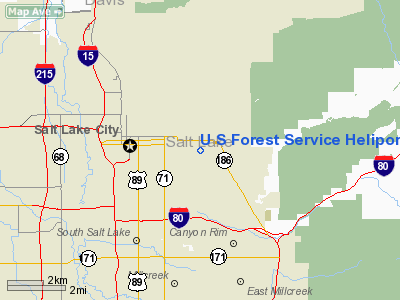
U S Forest Service Heliport |
Location & QuickFacts
| FAA Information Effective: | 2008-09-25 |
| Airport Identifier: | UT18 |
| Airport Status: | Operational |
| Longitude/Latitude: | 111-50-50.7660W/40-45-11.8060N
-111.847435/40.753279 (Estimated) |
| Elevation: | 4800 ft / 1463.04 m (Estimated) |
| Land: | 0 acres |
| From nearest city: | 0 nautical miles E of Salt Lake City, UT |
| Location: | Salt Lake County, UT |
| Magnetic Variation: | 15E (1985) |
Owner & Manager
| Ownership: | Publicly owned |
| Owner: | U S Forest Service |
| Address: | 755 Guardsman Way
Salt Lake City, UT 84108 |
| Phone number: | 801-582-1970 |
| Manager: | Frank E. Wiggins |
| Address: | 755 Guardsman Way
Salt Lake City, UT 84108 |
| Phone number: | 801-582-1970 |
Airport Operations and Facilities
| Airport Use: | Private |
| Wind indicator: | Yes |
| Segmented Circle: | No |
| Control Tower: | No |
| Landing fee charge: | No |
| Sectional chart: | Salt Lake City |
| Region: | ANM - Northwest Mountain |
| Boundary ARTCC: | ZLC - Salt Lake City |
| Tie-in FSS: | CDC - Cedar City |
| FSS on Airport: | No |
| FSS Toll Free: | 1-800-WX-BRIEF |
Runway Information
Helipad H1
| Dimension: | 40 x 40 ft / 12.2 x 12.2 m |
| Surface: | CONC, |
| |
Runway H1 |
Runway |
| Traffic Pattern: | Left | Left |
|
Helipad H2
| Dimension: | 40 x 40 ft / 12.2 x 12.2 m |
| Surface: | CONC, |
| |
Runway H2 |
Runway |
| Traffic Pattern: | Left | Left |
|
Helipad H3
| Dimension: | 40 x 40 ft / 12.2 x 12.2 m |
| Surface: | CONC, |
| |
Runway H3 |
Runway |
| Traffic Pattern: | Left | Left |
|
Radio Navigation Aids
| ID |
Type |
Name |
Ch |
Freq |
Var |
Dist |
| TVY | NDB | Tooele | | 371.00 | 13E | 24.4 nm |
| BMC | NDB | Brigham City | | 294.00 | 16E | 47.0 nm |
| HIF | TACAN | Hill | 049X | | 14E | 22.7 nm |
| PVU | VOR/DME | Provo | 021X | 108.40 | 15E | 32.9 nm |
| EVW | VOR/DME | Evanston | 33X | 109.60 | 13E | 47.9 nm |
| TCH | VORTAC | Wasatch | 115X | 116.80 | 16E | 8.5 nm |
| FFU | VORTAC | Fairfield | 113X | 116.60 | 16E | 29.1 nm |
| OGD | VORTAC | Ogden | 104X | 115.70 | 14E | 30.5 nm |
| SLC | VOT | Salt Lake City | | 111.00 | | 10.3 nm |
Remarks
- APCH DIRECTION/MAG/ 45-17-23. DEPARTURE DIRECTION/MAG/ 23-35-07.
- APPROACH FROM AND DEPARTURE TO S. PROHIBITED.
Images and information placed above are from
http://www.airport-data.com/airport/UT18/
We thank them for the data!
| General Info
|
| Country |
United States
|
| State |
UTAH
|
| FAA ID |
UT18
|
| Latitude |
40-45-11.806N
|
| Longitude |
111-50-50.766W
|
| Elevation |
4800 feet
|
| Near City |
SALT LAKE CITY
|
We don't guarantee the information is fresh and accurate. The data may
be wrong or outdated.
For more up-to-date information please refer to other sources.
|
|


