 |
|
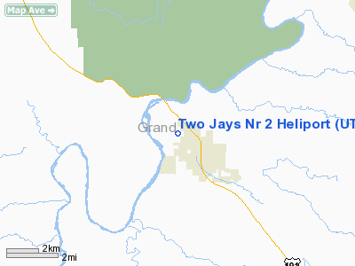
Location & QuickFacts
| FAA Information Effective: | 2008-09-25 |
| Airport Identifier: | UT72 |
| Airport Status: | Operational |
| Longitude/Latitude: | 109-34-02.4220W/38-35-04.9350N
-109.567339/38.584704 (Estimated) |
| Elevation: | 4200 ft / 1280.16 m (Estimated) |
| Land: | 27 acres |
| From nearest city: | 2 nautical miles N of Moab, UT |
| Location: | Grand County, UT |
| Magnetic Variation: | 13E (1990) |
Owner & Manager
| Ownership: | Privately owned |
| Owner: | Two Jays Helicopters Inc |
| Address: | Po Box 155
Moab, UT 84532 |
| Phone number: | 801-259-8900 |
| Manager: | Barbara A Jacklin
JERRY L NOLAND. |
| Address: | Po Box 155
Moab, UT 84532 |
| Phone number: | 801-259-8900 |
Airport Operations and Facilities
| Airport Use: | Private |
| Segmented Circle: | No |
| Control Tower: | No |
| Sectional chart: | Denver |
| Region: | ANM - Northwest Mountain |
| Boundary ARTCC: | ZDV - Denver |
| Tie-in FSS: | CDC - Cedar City |
| FSS Toll Free: | 1-800-WX-BRIEF |
Runway Information
Helipad H1
| Dimension: | 500 x 200 ft / 152.4 x 61.0 m |
| Surface: | TURF, |
| |
Runway H1 |
Runway |
| Traffic Pattern: | Left | Left |
|
Radio Navigation Aids
| ID |
Type |
Name |
Ch |
Freq |
Var |
Dist |
| OAB | VOR/DME | Moab | 035X | 109.80 | 15E | 13.4 nm |
| JNC | VORTAC | Grand Junction | 071X | 112.40 | 15E | 46.2 nm |
Remarks
- APCH & DEP SE & NW; RADIO DURING TKOF & LANDING; LANDING AREA BE MAINTAINED.
Images and information placed above are from
http://www.airport-data.com/airport/UT72/
We thank them for the data!
| General Info
|
| Country |
United States
|
| State |
UTAH
|
| FAA ID |
UT72
|
| Latitude |
38-35-04.935N
|
| Longitude |
109-34-02.422W
|
| Elevation |
4200 feet
|
| Near City |
MOAB
|
We don't guarantee the information is fresh and accurate. The data may
be wrong or outdated.
For more up-to-date information please refer to other sources.
|
|


