 |
|
Location & QuickFacts
| FAA Information Effective: | 2008-09-25 |
| Airport Identifier: | 1UT9 |
| Airport Status: | Operational |
| Longitude/Latitude: | 111-53-40.7700W/40-45-17.8060N
-111.894658/40.754946 (Estimated) |
| Elevation: | 4367 ft / 1331.06 m (Estimated) |
| Land: | 0 acres |
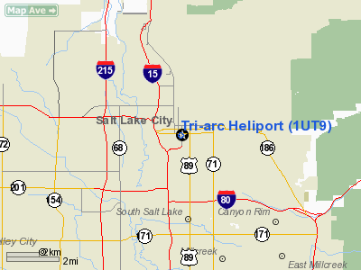
| From nearest city: | 6 nautical miles NW of Salt Lake City, UT |
| Location: | Salt Lake County, UT |
| Magnetic Variation: | 15E (1985) |
Owner & Manager
| Ownership: | Privately owned |
| Owner: | Tri-arc Hotel Associates |
| Address: | 161 W 6th South
Salt Lake City, UT 84101 |
| Phone number: | 801-521-7373 |
| Manager: | Roger Hansen |
| Address: | 161 W 600 South
Salt Lake City, UT 84101 |
| Phone number: | 801-521-7373 |
Airport Operations and Facilities
| Airport Use: | Private |
| Wind indicator: | Yes |
| Segmented Circle: | No |
| Control Tower: | No |
| Lighting Schedule: | DUSK-DAWN |
| Landing fee charge: | No |
| Sectional chart: | Salt Lake City |
| Region: | ANM - Northwest Mountain |
| Boundary ARTCC: | ZLC - Salt Lake City |
| Tie-in FSS: | CDC - Cedar City |
| FSS on Airport: | No |
| FSS Toll Free: | 1-800-WX-BRIEF |
Airport Services
| Airframe Repair: | NONE |
| Power Plant Repair: | NONE |
| Bottled Oxygen: | NONE |
| Bulk Oxygen: | NONE |
Runway Information
Helipad H1
| Dimension: | 52 x 51 ft / 15.8 x 15.5 m |
| Surface: | CONC, |
| Edge Lights: | Medium |
| |
Runway H1 |
Runway |
| Traffic Pattern: | Left | Left |
|
Radio Navigation Aids
| ID |
Type |
Name |
Ch |
Freq |
Var |
Dist |
| TVY | NDB | Tooele | | 371.00 | 13E | 22.4 nm |
| BMC | NDB | Brigham City | | 294.00 | 16E | 46.5 nm |
| HIF | TACAN | Hill | 049X | | 14E | 22.2 nm |
| PVU | VOR/DME | Provo | 021X | 108.40 | 15E | 33.4 nm |
| EVW | VOR/DME | Evanston | 33X | 109.60 | 13E | 49.5 nm |
| TCH | VORTAC | Wasatch | 115X | 116.80 | 16E | 7.0 nm |
| FFU | VORTAC | Fairfield | 113X | 116.60 | 16E | 28.9 nm |
| OGD | VORTAC | Ogden | 104X | 115.70 | 14E | 29.7 nm |
| SLC | VOT | Salt Lake City | | 111.00 | | 9.2 nm |
Images and information placed above are from
http://www.airport-data.com/airport/1UT9/
We thank them for the data!
| General Info
|
| Country |
United States
|
| State |
UTAH
|
| FAA ID |
1UT9
|
| Latitude |
40-45-17.806N
|
| Longitude |
111-53-40.770W
|
| Elevation |
4367 feet
|
| Near City |
SALT LAKE CITY
|
We don't guarantee the information is fresh and accurate. The data may
be wrong or outdated.
For more up-to-date information please refer to other sources.
|
|


