 |
|
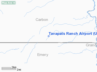
Location & QuickFacts
| FAA Information Effective: | 2008-09-25 |
| Airport Identifier: | UT09 |
| Airport Status: | Operational |
| Longitude/Latitude: | 110-09-02.5480W/39-28-59.8810N
-110.150708/39.483300 (Estimated) |
| Elevation: | 9200 ft / 2804.16 m (Estimated) |
| Land: | 2 acres |
| From nearest city: | 35 nautical miles N of Green River, UT |
| Location: | Carbon County, UT |
| Magnetic Variation: | 14E (1985) |
Owner & Manager
| Ownership: | Privately owned |
| Owner: | Don Wilcox |
| Address: | P.o. Box 139
Green River, UT 84525 |
| Phone number: | 801-564-3463 |
| Address: |
|
Airport Operations and Facilities
| Airport Use: | Private |
| Wind indicator: | Yes |
| Segmented Circle: | No |
| Control Tower: | No |
| Sectional chart: | Denver |
| Region: | ANM - Northwest Mountain |
| Boundary ARTCC: | ZDV - Denver |
| Tie-in FSS: | CDC - Cedar City |
| FSS on Airport: | No |
| FSS Toll Free: | 1-800-WX-BRIEF |
Runway Information
Runway 04/22
| Dimension: | 2500 x 34 ft / 762.0 x 10.4 m |
| Surface: | TURF, |
| |
Runway 04 |
Runway 22 |
| Traffic Pattern: | Left | Left |
|
Radio Navigation Aids
| ID |
Type |
Name |
Ch |
Freq |
Var |
Dist |
| PUC | VOR/DME | Carbon | 102X | 115.50 | 14E | 28.9 nm |
| OAB | VOR/DME | Moab | 035X | 109.80 | 15E | 47.5 nm |
| MTU | VORTAC | Myton | 074X | 112.70 | 14E | 40.0 nm |
Images and information placed above are from
http://www.airport-data.com/airport/UT09/
We thank them for the data!
| General Info
|
| Country |
United States
|
| State |
UTAH
|
| FAA ID |
UT09
|
| Latitude |
39-28-59.881N
|
| Longitude |
110-09-02.548W
|
| Elevation |
9200 feet
|
| Near City |
GREEN RIVER
|
We don't guarantee the information is fresh and accurate. The data may
be wrong or outdated.
For more up-to-date information please refer to other sources.
|
|


