 |
|
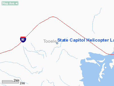
State Capitol Helicopter Landing Site Heliport |
Location & QuickFacts
| FAA Information Effective: | 2008-09-25 |
| Airport Identifier: | UT45 |
| Airport Status: | Operational |
| Longitude/Latitude: | 112-53-12.9090W/40-46-36.7690N
-112.886919/40.776880 (Estimated) |
| Elevation: | 4350 ft / 1325.88 m (Estimated) |
| Land: | 2 acres |
| From nearest city: | 5 nautical miles NE of Salt Lake City, UT |
| Location: | Salt Lake County, UT |
| Magnetic Variation: | 15E (1985) |
Owner & Manager
| Ownership: | Publicly owned |
| Owner: | State Of Utah |
| Address: | Capital Preservation Board
Salt Lake City, UT 84114 |
| Phone number: | 801-538-3074 |
| Manager: | David H. Hart, Aia |
| Address: | 120 State Capital
Salt Lake City, UT 84114 |
| Phone number: | 801-538-3074 |
Airport Operations and Facilities
| Airport Use: | Private |
| Wind indicator: | No |
| Segmented Circle: | No |
| Control Tower: | No |
| Landing fee charge: | No |
| Sectional chart: | Salt Lake City |
| Region: | ANM - Northwest Mountain |
| Boundary ARTCC: | ZLC - Salt Lake City |
| Tie-in FSS: | CDC - Cedar City |
| FSS on Airport: | No |
| FSS Toll Free: | 1-800-WX-BRIEF |
Runway Information
Helipad H1
| Dimension: | 100 x 100 ft / 30.5 x 30.5 m |
| Surface: | TURF, |
| |
Runway H1 |
Runway |
| Traffic Pattern: | Left | Left |
|
Radio Navigation Aids
| ID |
Type |
Name |
Ch |
Freq |
Var |
Dist |
| TVY | NDB | Tooele | | 371.00 | 13E | 26.5 nm |
| DPG | NDB | Dugway | | 284.00 | 15E | 35.8 nm |
| MIJ | TACAN | Michael | 079X | | 15E | 35.2 nm |
| HIF | TACAN | Hill | 049X | | 14E | 46.7 nm |
| BVL | VORTAC | Bonneville | 070X | 112.30 | 17E | 39.8 nm |
| TCH | VORTAC | Wasatch | 115X | 116.80 | 16E | 41.4 nm |
| OGD | VORTAC | Ogden | 104X | 115.70 | 14E | 44.8 nm |
| SLC | VOT | Salt Lake City | | 111.00 | | 41.8 nm |
Remarks
- USE RESTRICTED TO UTAH NATIONAL GUARD.
Images and information placed above are from
http://www.airport-data.com/airport/UT45/
We thank them for the data!
| General Info
|
| Country |
United States
|
| State |
UTAH
|
| FAA ID |
UT45
|
| Latitude |
40-46-36.769N
|
| Longitude |
112-53-12.909W
|
| Elevation |
4350 feet
|
| Near City |
SALT LAKE CITY
|
We don't guarantee the information is fresh and accurate. The data may
be wrong or outdated.
For more up-to-date information please refer to other sources.
|
|


